Synchronize offline edits with a feature service.
Use case
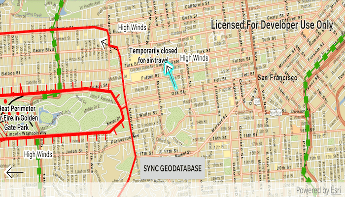
A survey worker who works in an area without an internet connection could take a geodatabase of survey features offline at their office, make edits and add new features to the offline geodatabase in the field, and sync the updates with the online feature service after returning to the office.
How to use the sample
Pan and zoom into the desired area, making sure the area you want to take offline is within the current extent of the map view. Tap on the "Generate Geodatabase" button to take the area offline. When complete, the map will update with a red outline around the offline area. To edit features, tap to select a feature, and tap again anywhere else on the map to move the selected feature to the tapped location. To sync the edits with the feature service, click the "Sync geodatabase" button.
How it works
- Create a
GeodatabaseSyncTaskfrom a URL to a feature service. - Use
createDefaultGenerateGeodatabaseParametersAsync()on the geodatabase sync task to createGenerateGeodatabaseParameters, passing in anEnvelopeextent as the parameter. - Create a
GenerateGeodatabaseJobfrom theGeodatabaseSyncTaskusinggenerateGeodatabaseAsync(...)passing in parameters and a path to the local geodatabase. - Start the job and get the result
Geodatabase. - Load the geodatabase and get its feature tables. Create feature layers from the feature tables and add them to the map's operational layers collection.
- Create
SyncGeodatabaseParametersand set the sync direction. - Create a
SyncGeodatabaseJobfromGeodatabaseSyncTaskusing.syncGeodatabaseAsync(...)passing in the parameters and geodatabase as arguments. - Start the sync job to synchronize the edits with
syncGeodatabase.start().
Relevant API
- FeatureLayer
- FeatureTable
- GenerateGeodatabaseJob
- GenerateGeodatabaseParameters
- GeodatabaseSyncTask
- SyncGeodatabaseJob
- SyncGeodatabaseParameters
- SyncLayerOption
Offline Data
- Download the data from ArcGIS Online.
- Open your command prompt and navigate to the folder where you extracted the contents of the data from step 1.
- Push the data into the scoped storage of the sample app:
adb push SanFrancisco.tpkx /Android/data/com.esri.arcgisruntime.sample.editandsyncfeatures/files/SanFrancisco.tpkx
Tags
feature service, geodatabase, offline, synchronize
Sample Code
/*
* Copyright 2020 Esri
*
* Licensed under the Apache License, Version 2.0 (the "License");
* you may not use this file except in compliance with the License.
* You may obtain a copy of the License at
*
* http://www.apache.org/licenses/LICENSE-2.0
*
* Unless required by applicable law or agreed to in writing, software
* distributed under the License is distributed on an "AS IS" BASIS,
* WITHOUT WARRANTIES OR CONDITIONS OF ANY KIND, either express or implied.
* See the License for the specific language governing permissions and
* limitations under the License.
*
*/
package com.esri.arcgisruntime.sample.editandsyncfeatures
import android.graphics.Color
import android.os.Bundle
import android.util.Log
import android.view.MotionEvent
import android.widget.Button
import android.widget.Toast
import androidx.appcompat.app.AlertDialog
import androidx.appcompat.app.AppCompatActivity
import com.esri.arcgisruntime.concurrent.Job
import com.esri.arcgisruntime.data.Feature
import com.esri.arcgisruntime.data.Geodatabase
import com.esri.arcgisruntime.data.TileCache
import com.esri.arcgisruntime.geometry.Point
import com.esri.arcgisruntime.layers.ArcGISTiledLayer
import com.esri.arcgisruntime.layers.FeatureLayer
import com.esri.arcgisruntime.loadable.LoadStatus
import com.esri.arcgisruntime.mapping.ArcGISMap
import com.esri.arcgisruntime.mapping.Basemap
import com.esri.arcgisruntime.mapping.view.DefaultMapViewOnTouchListener
import com.esri.arcgisruntime.mapping.view.Graphic
import com.esri.arcgisruntime.mapping.view.GraphicsOverlay
import com.esri.arcgisruntime.mapping.view.MapView
import com.esri.arcgisruntime.sample.editandsyncfeatures.databinding.ActivityMainBinding
import com.esri.arcgisruntime.sample.editandsyncfeatures.databinding.EditAndSyncDialogLayoutBinding
import com.esri.arcgisruntime.symbology.SimpleLineSymbol
import com.esri.arcgisruntime.tasks.geodatabase.*
import java.util.*
import kotlin.math.roundToInt
class MainActivity : AppCompatActivity() {
private val TAG: String? = MainActivity::class.simpleName
private var currentEditState: EditState = EditState.NOT_READY
private val graphicsOverlay by lazy { GraphicsOverlay() }
private val geodatabaseSyncTask by lazy { GeodatabaseSyncTask("https://sampleserver6.arcgisonline.com/arcgis/rest/services/Sync/WildfireSync/FeatureServer") }
private var geodatabase: Geodatabase? = null
private val selectedFeatures by lazy { ArrayList<Feature>() }
private val activityMainBinding by lazy {
ActivityMainBinding.inflate(layoutInflater)
}
private val mapView: MapView by lazy {
activityMainBinding.mapView
}
private val syncButton: Button by lazy {
activityMainBinding.syncButton
}
override fun onCreate(savedInstanceState: Bundle?) {
super.onCreate(savedInstanceState)
setContentView(activityMainBinding.root)
// use local tile package for the base map
val sanFranciscoTileCache =
TileCache(getExternalFilesDir(null).toString() + "/SanFrancisco.tpkx")
val tiledLayer = ArcGISTiledLayer(sanFranciscoTileCache)
val map = ArcGISMap(Basemap(tiledLayer))
mapView.apply {
// set the map to the map view
this.map = map
// add a graphics overlay to the map view
graphicsOverlays.add(graphicsOverlay)
// add listener to handle motion events, which only responds once a geodatabase is loaded
onTouchListener = object : DefaultMapViewOnTouchListener(this@MainActivity, mapView) {
override fun onSingleTapConfirmed(e: MotionEvent): Boolean {
when (currentEditState) {
EditState.READY -> selectFeaturesAt(
android.graphics.Point(e.x.toInt(), e.y.toInt()),
10.0
)
EditState.EDITING -> moveSelectedFeatureTo(mapPointFrom(e))
EditState.NOT_READY -> Toast.makeText(
this@MainActivity,
"Can't edit yet. The geodatabase hasn't been generated!",
Toast.LENGTH_LONG
).show()
}
return true
}
}
}
// add listener to handle generate/sync geodatabase button
syncButton.setOnClickListener {
when (currentEditState) {
EditState.NOT_READY -> generateGeodatabase()
EditState.READY -> syncGeodatabase()
EditState.EDITING -> Log.e(TAG, "Unexpected edit state!")
}
}
}
/**
* Creates a GenerateGeodatabaseJob and runs it.
*/
private fun generateGeodatabase() {
// create a geodatabase sync task and load it
geodatabaseSyncTask.loadAsync()
geodatabaseSyncTask.addDoneLoadingListener {
// draw a box around the extent
mapView.apply {
// clear any previous operational layers and graphics
map.operationalLayers.clear()
graphicsOverlays[0].graphics.clear()
// show the extent used as a graphic
graphicsOverlays[0].graphics.add(
Graphic(
visibleArea.extent,
SimpleLineSymbol(SimpleLineSymbol.Style.SOLID, Color.RED, 5f)
)
)
}
// create parameters for the job with the return attachments option set to false
val parameters = geodatabaseSyncTask
.createDefaultGenerateGeodatabaseParametersAsync(mapView.visibleArea.extent).get()
.apply { isReturnAttachments = false }
// create the generate geodatabase job
val generateGeodatabaseJob =
geodatabaseSyncTask.generateGeodatabase(
parameters,
externalCacheDir?.path + "/wildfire.geodatabase"
)
// show the job's progress in a dialog
val progressDialogLayoutBinding = EditAndSyncDialogLayoutBinding.inflate(layoutInflater)
val generateGeodatabaseDialog = createProgressDialog(generateGeodatabaseJob)
generateGeodatabaseDialog.setView(progressDialogLayoutBinding.root)
generateGeodatabaseDialog.show()
// define progress and done behaviours and start the job
generateGeodatabaseJob.apply {
// update progress
addProgressChangedListener {
progressDialogLayoutBinding.progressBar.progress = this.progress
progressDialogLayoutBinding.progressTextView.text = "${this.progress}%"
}
// get geodatabase when done
addJobDoneListener {
// close the progress dialog
generateGeodatabaseDialog.dismiss()
// load the geodatabase and display its feature tables on the map
loadGeodatabase(generateGeodatabaseJob)
// set edit state to ready
currentEditState = EditState.READY
}
}.start()
}
}
/**
* Loads the geodatabase from a GenerateGeodatabaseJob and displays its feature layers on the map.
*
* @param generateGeodatabaseJob the job which generated this geodatabase
*/
private fun loadGeodatabase(generateGeodatabaseJob: GenerateGeodatabaseJob) {
// return if the job failed
if (generateGeodatabaseJob.status != Job.Status.SUCCEEDED) {
val error =
generateGeodatabaseJob.error?.message ?: "Unknown error generating geodatabase"
Log.e(TAG, error)
Toast.makeText(this, error, Toast.LENGTH_LONG).show()
return
}
// if the job succeeded, load the resulting geodatabase
geodatabase = generateGeodatabaseJob.result
geodatabase?.let { geodatabase ->
geodatabase.loadAsync()
geodatabase.addDoneLoadingListener {
// return if the geodatabase failed to load
if (geodatabase.loadStatus != LoadStatus.LOADED) {
val error = "Error loading geodatabase: " + geodatabase.loadError?.message
Log.e(TAG, error)
Toast.makeText(this, error, Toast.LENGTH_LONG).show()
return@addDoneLoadingListener
}
// add all of the geodatabase feature tables to the map as feature layers
val featureLayers =
geodatabase.geodatabaseFeatureTables.map { featureTable ->
FeatureLayer(
featureTable
)
}
mapView.map.operationalLayers.addAll(featureLayers)
syncButton.isEnabled = false
}
}
}
/**
* Syncs changes made on either the local or web service geodatabase with each other.
*/
private fun syncGeodatabase() {
// create parameters for the sync task
val syncGeodatabaseParameters = SyncGeodatabaseParameters()
syncGeodatabaseParameters.syncDirection =
SyncGeodatabaseParameters.SyncDirection.BIDIRECTIONAL
syncGeodatabaseParameters.isRollbackOnFailure = false
geodatabase?.let { geodatabase ->
// get the layer ID for each feature table in the geodatabase, then add to the sync job
geodatabase.geodatabaseFeatureTables.forEach { geodatabaseFeatureTable ->
val serviceLayerId = geodatabaseFeatureTable.serviceLayerId
val syncLayerOption = SyncLayerOption(serviceLayerId)
syncGeodatabaseParameters.layerOptions.add(syncLayerOption)
}
val syncGeodatabaseJob: SyncGeodatabaseJob = geodatabaseSyncTask
.syncGeodatabase(syncGeodatabaseParameters, geodatabase)
syncGeodatabaseJob.start()
val progressDialogLayoutBinding = EditAndSyncDialogLayoutBinding.inflate(layoutInflater)
val syncDialog = createProgressDialog(syncGeodatabaseJob)
syncDialog.setView(progressDialogLayoutBinding.root)
syncDialog.show()
syncGeodatabaseJob.apply {
addProgressChangedListener {
progressDialogLayoutBinding.progressBar.progress = this.progress
progressDialogLayoutBinding.progressTextView.text = "${this.progress}%"
}
addJobDoneListener {
if (syncGeodatabaseJob.status == Job.Status.SUCCEEDED) {
// close the progress dialog
syncDialog.dismiss()
syncButton.isEnabled = false
currentEditState = EditState.READY
Toast.makeText(this@MainActivity, "Sync complete", Toast.LENGTH_SHORT)
.show()
} else {
Log.e(TAG, "Database did not sync correctly!")
Toast.makeText(
this@MainActivity,
"Database did not sync correctly!",
Toast.LENGTH_LONG
)
.show()
}
}
}
}
}
/**
* Create a progress dialog box for tracking the generate geodatabase job.
*
* @param job to be tracked
* @return an AlertDialog set with the dialog layout view
*/
private fun createProgressDialog(job: Job): AlertDialog {
val builder = AlertDialog.Builder(this@MainActivity).apply {
when (job) {
is GenerateGeodatabaseJob -> setTitle("Generating geodatabase")
is SyncGeodatabaseJob -> setTitle("Syncing geodatabase")
}
// provide a cancel button on the dialog
setNegativeButton("Cancel") { _, _ -> job.cancelAsync() }
setCancelable(false)
val dialogLayoutBinding = EditAndSyncDialogLayoutBinding.inflate(layoutInflater)
setView(dialogLayoutBinding.root)
}
return builder.create()
}
/**
* Queries the features at the tapped point within a certain tolerance.
*
* @param point contains an ArcGIS map point
* @param tolerance distance from point within which features will be selected
*/
private fun selectFeaturesAt(point: android.graphics.Point, tolerance: Double) {
mapView.map.operationalLayers.filterIsInstance<FeatureLayer>().forEach { featureLayer ->
val identifyLayerResultFuture =
mapView.identifyLayerAsync(featureLayer, point, tolerance, false)
identifyLayerResultFuture.addDoneListener {
val identifyLayerResult = identifyLayerResultFuture.get()
val identifiedFeatures = identifyLayerResult.elements.filterIsInstance<Feature>()
featureLayer.selectFeatures(identifiedFeatures)
selectedFeatures.addAll(identifiedFeatures)
// set current edit state to editing
currentEditState = EditState.EDITING
}
}
}
/**
* Moves selected features to the given point.
*
* @param point contains an ArcGIS map point
*/
private fun moveSelectedFeatureTo(point: Point) {
selectedFeatures.forEach { feature ->
feature.geometry = point
feature.featureTable.updateFeatureAsync(feature)
}
// clear the list of selected features
selectedFeatures.clear()
// clear selection indicator on the map view
mapView.map.operationalLayers.filterIsInstance<FeatureLayer>().forEach {
it.clearSelection()
}
currentEditState = EditState.READY
syncButton.text = getString(R.string.sync_geodatabase)
syncButton.isEnabled = true
}
/**
* Converts motion event to an ArcGIS map point.
*
* @param motionEvent containing coordinates of an Android screen point
* @return a corresponding map point in the place
*/
private fun mapPointFrom(motionEvent: MotionEvent): Point {
// get the screen point
val screenPoint =
android.graphics.Point(motionEvent.x.roundToInt(), motionEvent.y.roundToInt())
// return the point that was clicked in map coordinates
return mapView.screenToLocation(screenPoint)
}
override fun onPause() {
mapView.pause()
super.onPause()
}
override fun onResume() {
super.onResume()
mapView.resume()
}
override fun onDestroy() {
mapView.dispose()
super.onDestroy()
}
// enumeration to track editing of points
internal enum class EditState {
NOT_READY, // Geodatabase has not yet been generated
EDITING, // A feature is in the process of being moved
READY // The geodatabase is ready for synchronization or further edits
}
}