Limit the features displayed on a map with a definition expression.
Use case
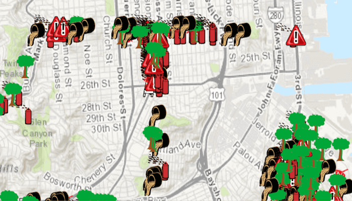
Set a definition expression to filter out the features to be displayed. You might filter a dataset of tree quality selecting for only those trees which require maintenance or are damaged.
How to use the sample
Tap the 'Apply Expression' button to limit the features requested from the feature layer to those specified by the SQL query definition expression. Tap the 'Reset' button to remove the definition expression on the feature layer, which returns all the records.
How it works
- Create a
ServiceFeatureTablefrom a URL. - Create a
FeatureLayerfrom the service feature table. - Set the definition expression of the features on your feature layer using the
setDefinitionExpression().
Relevant API
- FeatureLayer
- FeatureLayer.setDefinitionExpression
- ServiceFeatureTable
About the data
This map displays point features related to crime incidents that have been reported by city residents.
Tags
definition expression, filter, limit data, query, restrict data, SQL, where clause
Sample Code
MainActivity.kt
/*
* Copyright 2020 Esri
*
* Licensed under the Apache License, Version 2.0 (the "License");
* you may not use this file except in compliance with the License.
* You may obtain a copy of the License at
*
* http://www.apache.org/licenses/LICENSE-2.0
*
* Unless required by applicable law or agreed to in writing, software
* distributed under the License is distributed on an "AS IS" BASIS,
* WITHOUT WARRANTIES OR CONDITIONS OF ANY KIND, either express or implied.
* See the License for the specific language governing permissions and
* limitations under the License.
*
*/
package com.esri.arcgisruntime.sample.featurelayerdefinitionexpression
import android.os.Bundle
import android.widget.Button
import androidx.appcompat.app.AppCompatActivity
import com.esri.arcgisruntime.ArcGISRuntimeEnvironment
import com.esri.arcgisruntime.data.ServiceFeatureTable
import com.esri.arcgisruntime.geometry.Point
import com.esri.arcgisruntime.geometry.SpatialReferences
import com.esri.arcgisruntime.layers.FeatureLayer
import com.esri.arcgisruntime.mapping.ArcGISMap
import com.esri.arcgisruntime.mapping.BasemapStyle
import com.esri.arcgisruntime.mapping.view.MapView
import com.esri.arcgisruntime.sample.featurelayerdefinitionexpression.databinding.ActivityMainBinding
class MainActivity : AppCompatActivity() {
// set flag for applying expression to feature layer
private var applyExpression: Boolean = true
private val activityMainBinding by lazy {
ActivityMainBinding.inflate(layoutInflater)
}
private val mapView: MapView by lazy {
activityMainBinding.mapView
}
private val applyExpressionButton: Button by lazy {
activityMainBinding.applyExpressionButton
}
override fun onCreate(savedInstanceState: Bundle?) {
super.onCreate(savedInstanceState)
setContentView(activityMainBinding.root)
// authentication with an API key or named user is required to access basemaps and other
// location services
ArcGISRuntimeEnvironment.setApiKey(BuildConfig.API_KEY)
// create a service feature table from a URL
val serviceFeatureTable = ServiceFeatureTable(getString(R.string.sample_service_url))
// create a feature layer using the service feature table
val featureLayer = FeatureLayer(serviceFeatureTable)
// create a map with a topographic base map
val map = ArcGISMap(BasemapStyle.ARCGIS_TOPOGRAPHIC).apply {
// add the feature layer to the map
operationalLayers.add(featureLayer)
}
mapView.apply {
// set the map to be displayed in the layout's map view
this.map = map
// set a viewpoint on the map view to center on San Francisco
setViewpointCenterAsync(
Point(-13630845.0, 4544861.0, SpatialReferences.getWebMercator()), 200000.0
)
}
// set button listener
applyExpressionButton.setOnClickListener {
if (applyExpression) {
// set the definition expression to nothing (empty string, null also works)
featureLayer.definitionExpression = ""
// change the text to apply
applyExpressionButton.text = getString(R.string.action_def_exp)
applyExpression = false
} else {
// apply a definition expression on the feature layer
// if this is called before the layer is loaded, it will be applied to the loaded layer
featureLayer.definitionExpression = "req_Type = 'Tree Maintenance or Damage'"
// change the text to reset
applyExpressionButton.text = getString(R.string.action_reset)
applyExpression = true
}
}
// click to set initial state
applyExpressionButton.performClick()
}
override fun onResume() {
super.onResume()
mapView.resume()
}
override fun onPause() {
mapView.pause()
super.onPause()
}
override fun onDestroy() {
mapView.dispose()
super.onDestroy()
}
}