Create and use a raster layer made from a local raster file.
Use case
Rasters can be digital aerial photographs, imagery from satellites, digital pictures, or even scanned maps. An end-user will frequently need to import raster files acquired through various data-collection methods into their map to view and analyze the data.
How to use the sample
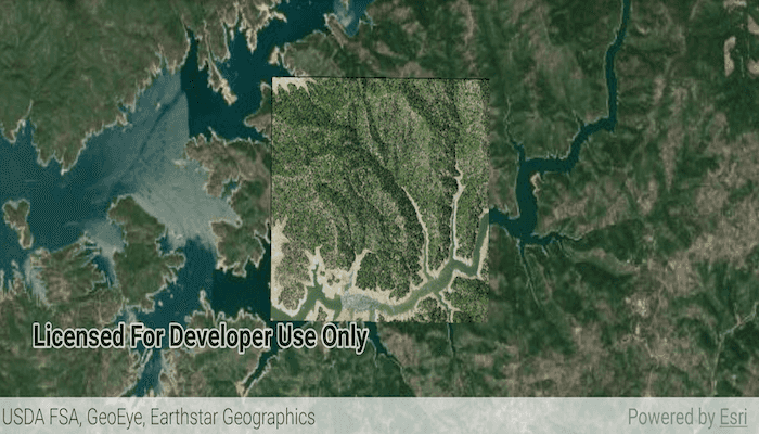
When the sample starts, a raster will be loaded from a file and displayed in the map view.
How it works
- Create a
Rasterfrom a raster file. - Create a
RasterLayerfrom the raster. - Add it as an operational layer with
map.operationalLayers.add(rasterLayer).
Relevant API
- Raster
- RasterLayer
Additional information
See the topic What is raster data? in the ArcMap documentation for more information about raster images.
Offline Data
- Download the data from ArcGIS Online.
- Extract the contents of the downloaded zip file to disk.
- Open your command prompt and navigate to the folder where you extracted the contents of the data from step 1.
- Push the data into the scoped storage of the sample app:
adb push raster-file /Android/data/com.esri.arcgisruntime.sample.rasterlayerfile/files/raster-file
Tags
data, image, import, layer, raster, visualization
Sample Code
MainActivity.kt
/* Copyright 2020 Esri
*
* Licensed under the Apache License, Version 2.0 (the "License");
* you may not use this file except in compliance with the License.
* You may obtain a copy of the License at
*
* http://www.apache.org/licenses/LICENSE-2.0
*
* Unless required by applicable law or agreed to in writing, software
* distributed under the License is distributed on an "AS IS" BASIS,
* WITHOUT WARRANTIES OR CONDITIONS OF ANY KIND, either express or implied.
* See the License for the specific language governing permissions and
* limitations under the License.
*
*/
package com.esri.arcgisruntime.sample.rasterlayerfile
import android.os.Bundle
import android.util.Log
import android.widget.Toast
import androidx.appcompat.app.AppCompatActivity
import com.esri.arcgisruntime.ArcGISRuntimeEnvironment
import com.esri.arcgisruntime.layers.RasterLayer
import com.esri.arcgisruntime.loadable.LoadStatus
import com.esri.arcgisruntime.mapping.ArcGISMap
import com.esri.arcgisruntime.mapping.BasemapStyle
import com.esri.arcgisruntime.mapping.view.MapView
import com.esri.arcgisruntime.raster.Raster
import com.esri.arcgisruntime.sample.rasterlayerfile.databinding.ActivityMainBinding
class MainActivity : AppCompatActivity() {
private val TAG = MainActivity::class.java.simpleName
private val activityMainBinding by lazy {
ActivityMainBinding.inflate(layoutInflater)
}
private val mapView: MapView by lazy {
activityMainBinding.mapView
}
override fun onCreate(savedInstanceState: Bundle?) {
super.onCreate(savedInstanceState)
setContentView(activityMainBinding.root)
// authentication with an API key or named user is required to access basemaps and other
// location services
ArcGISRuntimeEnvironment.setApiKey(BuildConfig.API_KEY)
// create a map with imagery basemap
val map = ArcGISMap(BasemapStyle.ARCGIS_IMAGERY)
// add the map to a map view
mapView.map = map
// create a raster from a local raster filepath
val raster = Raster(getExternalFilesDir(null)?.path + getString(R.string.raster_file_path))
// create a raster layer
val rasterLayer = RasterLayer(raster)
// add the raster as an operational layer
map.operationalLayers.add(rasterLayer)
// set viewpoint on the raster
rasterLayer.addDoneLoadingListener {
if (rasterLayer.loadStatus == LoadStatus.LOADED) {
mapView.setViewpointGeometryAsync(
rasterLayer.fullExtent,
50.0
)
} else {
Log.e(TAG, "Error loading raster layer: ${rasterLayer.loadError.message}")
Toast.makeText(this, "Failed to load raster file from storage", Toast.LENGTH_LONG)
.show()
}
}
}
override fun onPause() {
mapView.pause()
super.onPause()
}
override fun onResume() {
super.onResume()
mapView.resume()
}
override fun onDestroy() {
mapView.dispose()
super.onDestroy()
}
}