Show a predefined popup from a web map.
Use case
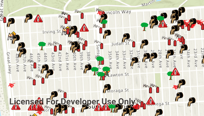
Many web maps contain predefined popups which are used to display the attributes associated with each feature layer in the map, such as hiking trails, land values, or unemployment rates. You can display text, attachments, images, charts, and web links. Rather than creating new popups to display information, you can easily access and display the predefined popups.
How to use the sample
Tap on the features to prompt a popup that displays information about the feature.
How it works
- Create and load an
ArcGISMapusing a URL. - Set the map to a
MapViewand add anonTouchListener. - Use the
MapView.identifyLayerAsync()method to identify the top-most feature. - Attach the
PopupfromidentifyLayerResultsFuture.get()to thePopupViewModel - Present the view controller.
Relevant API
- IdentifyLayerResult
- ArcGISMap
- PopupViewModel
About the data
This sample uses a feature layer that displays reported incidents in San Francisco.
Tags
feature, feature layer, popup, web map
Sample Code
/* Copyright 2021 Esri
*
* Licensed under the Apache License, Version 2.0 (the "License");
* you may not use this file except in compliance with the License.
* You may obtain a copy of the License at
*
* http://www.apache.org/licenses/LICENSE-2.0
*
* Unless required by applicable law or agreed to in writing, software
* distributed under the License is distributed on an "AS IS" BASIS,
* WITHOUT WARRANTIES OR CONDITIONS OF ANY KIND, either express or implied.
* See the License for the specific language governing permissions and
* limitations under the License.
*
*/
package com.esri.arcgisruntime.sample.showpopup
import android.os.Bundle
import android.util.Log
import android.view.MotionEvent
import android.view.View
import android.widget.ProgressBar
import android.widget.Toast
import androidx.activity.viewModels
import androidx.appcompat.app.AppCompatActivity
import androidx.databinding.DataBindingUtil
import com.esri.arcgisruntime.ArcGISRuntimeEnvironment
import com.esri.arcgisruntime.data.Feature
import com.esri.arcgisruntime.geometry.GeometryType
import com.esri.arcgisruntime.layers.FeatureLayer
import com.esri.arcgisruntime.mapping.ArcGISMap
import com.esri.arcgisruntime.mapping.view.DefaultMapViewOnTouchListener
import com.esri.arcgisruntime.mapping.view.MapView
import com.esri.arcgisruntime.portal.Portal
import com.esri.arcgisruntime.portal.PortalItem
import com.esri.arcgisruntime.sample.showpopup.databinding.ActivityMainBinding
import com.esri.arcgisruntime.toolkit.popup.PopupViewModel
import com.esri.arcgisruntime.toolkit.util.observeEvent
import com.google.android.material.bottomsheet.BottomSheetBehavior
import kotlin.math.roundToInt
class MainActivity : AppCompatActivity() {
private val TAG: String = MainActivity::class.java.simpleName
private lateinit var bottomSheetBehavior: BottomSheetBehavior<View>
private lateinit var mapView: MapView
private lateinit var progressBar: ProgressBar
private lateinit var map: ArcGISMap
private val popupViewModel: PopupViewModel by viewModels()
/**
* getter function to retrieve the first available feature layer
* [featureLayer] updates with every map click
*/
private val featureLayer: FeatureLayer?
get() {
return map.operationalLayers?.filterIsInstance<FeatureLayer>()?.first {
(it.featureTable?.geometryType == GeometryType.POINT)
.and(it.isVisible)
.and(it.isPopupEnabled && it.popupDefinition != null)
}
}
override fun onCreate(savedInstanceState: Bundle?) {
super.onCreate(savedInstanceState)
// authentication with an API key or named user is required to access basemaps and other
// location services
ArcGISRuntimeEnvironment.setApiKey(BuildConfig.API_KEY)
val binding: ActivityMainBinding =
DataBindingUtil.setContentView(this, R.layout.activity_main)
binding.lifecycleOwner = this
val portal = Portal("https://arcgisruntime.maps.arcgis.com/")
val portalItem = PortalItem(portal, "fb788308ea2e4d8682b9c05ef641f273")
map = ArcGISMap(portalItem)
// set up binding and UI behaviour
mapView = binding.mapView
mapView.map = map
progressBar = binding.progressBar
bottomSheetBehavior = BottomSheetBehavior.from(binding.bottomSheetContainer)
bottomSheetBehavior.state = BottomSheetBehavior.STATE_HIDDEN
// reset the IdentifyResult on a sheet close
bottomSheetBehavior.addBottomSheetCallback(object :
BottomSheetBehavior.BottomSheetCallback() {
override fun onStateChanged(bottomSheet: View, newState: Int) {
if (newState == BottomSheetBehavior.STATE_HIDDEN) {
// Clear the selected features from the feature layer
resetIdentifyResult()
}
}
override fun onSlide(bottomSheet: View, slideOffset: Float) {
}
})
popupViewModel.dismissPopupEvent.observeEvent(this) {
bottomSheetBehavior.state = BottomSheetBehavior.STATE_HIDDEN
// Clear the selected features from the feature layer
resetIdentifyResult()
}
// set the progressBar visibility
progressBar.visibility = View.GONE
mapView.onTouchListener =
object : DefaultMapViewOnTouchListener(this, mapView) {
override fun onSingleTapConfirmed(event: MotionEvent): Boolean {
// set the progressBar visibility
progressBar.visibility = View.VISIBLE
bottomSheetBehavior.state = BottomSheetBehavior.STATE_HIDDEN
val screenPoint = android.graphics.Point(
event.x.roundToInt(),
event.y.roundToInt()
)
// setup identifiable layer at the given screen point.
identifyLayer(screenPoint)
return true
}
}
}
/**
* Performs an identify on the feature layer at the given screen point.
* [screenPoint] in Android graphic coordinates.
*/
private fun identifyLayer(screenPoint: android.graphics.Point) {
featureLayer?.let {
// clear the selected features from the feature layer
resetIdentifyResult()
val identifyLayerResultsFuture = mapView
.identifyLayerAsync(featureLayer, screenPoint, 12.0, true)
identifyLayerResultsFuture.addDoneListener {
try {
val identifyLayerResult = identifyLayerResultsFuture.get()
if (identifyLayerResult.popups.isNotEmpty()) {
popupViewModel.setPopup(identifyLayerResult.popups.first())
val featureLayer: FeatureLayer? =
identifyLayerResult.layerContent as? FeatureLayer
featureLayer?.selectFeature(identifyLayerResult.popups.first().geoElement as Feature)
bottomSheetBehavior.state = BottomSheetBehavior.STATE_HALF_EXPANDED
}
} catch (e: Exception) {
val error = "Error identifying results ${e.message}"
Log.e(TAG, error)
Toast.makeText(this, error, Toast.LENGTH_SHORT).show()
}
// set the progressBar visibility
progressBar.visibility = View.GONE
}
}
}
/**
* Resets the Identify Result.
*/
private fun resetIdentifyResult() {
featureLayer?.clearSelection()
popupViewModel.clearPopup()
}
override fun onPause() {
mapView.pause()
super.onPause()
}
override fun onResume() {
super.onResume()
mapView.resume()
}
override fun onDestroy() {
mapView.dispose()
super.onDestroy()
}
}