Use ArcGIS Online to create an offline map area for your ArcGIS Runtime app users.
If your users work in well-defined geographic areas that are known in advance (for example, a park area or an area covered by a utility network), then the web map owner can define these geographical areas by creating offline map areas. Each offline map area is a package, containing a map and data, that can be downloaded by any number of users. This workflow is known as the ahead-of-time workflow (also known as the preplanned workflow).
Advantages to the ahead-of-time workflow include:
- Your users can more quickly obtain a packaged map than an on-demand map because the packaged map is generated once in advance of it being downloaded by multiple users. The download time is comparable to any other files and resources.
- Each user is guaranteed a consistent geographical area and map content.
- The web map owner can specify a regular update schedule (hourly, daily, or weekly) for these packages. This helps ensure that users have current offline maps.
In the ahead-of-time workflow, the web map owner creates offline map areas. Your app can then download a specific offline map area using the
DownloadPreplannedOfflineMapJob
job. In contrast, in the on-demand workflow, your app must allow your users to define an area of interest. Your app then requests that an offine map is generated and downloads it to the device using the
GenerateOfflineMapJob
job.
Tutorial scenario: your users are park rangers who need to inspect gates and trailheads during the spring season and make sure they weren’t damaged during the winter. Some inspection sites have limited cell coverage, requiring park rangers to have a local copy of the data to conduct inspections. Because you, the developer, (and in this case also the web map owner), know ahead of time which areas have poor cell coverage, you define the areas so park rangers can download the areas to their device before they head to the parks. In this tutorial you define only one area, but you can repeat the steps to add more.
Prerequisites
You must have an ArcGIS Online account.
Steps
-
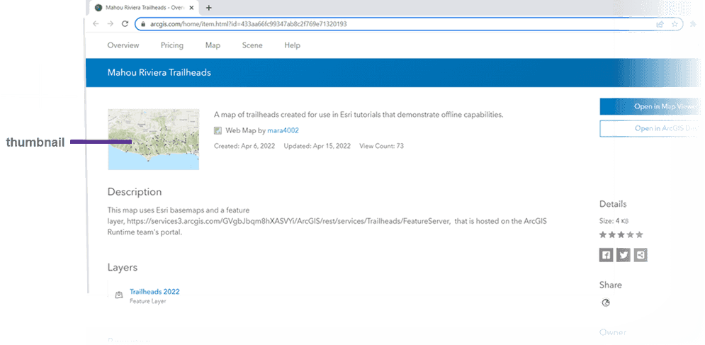
Click this link, Mahou Riviera, to open the Item Details page of the map you'll use in this tutorial. This data has been enabled for offline use.
If instead you were to use your own data, you would first need to enable it for offline use. For details and tips, see the ArcGIS Online discussion, enabling a map for offline use.
-
On the Mahou Riviera Trailheads page that displays, click Sign In and sign in using your ArcGIS Online credentials.
-
In order to create map areas, the map and data must be your own. Save the map and data as your own by doing the following:
- In the Item Details page, click the thumbnail.
- The map opens in the Map Viewer. Note that no Settings tab is present.
- Click Save and Open
 and then click Save As and navigate to the folder you want to save the tutorial data in.
- In the Item Details page, click the thumbnail.
-
The map is now your own and you can create map areas in it.
-
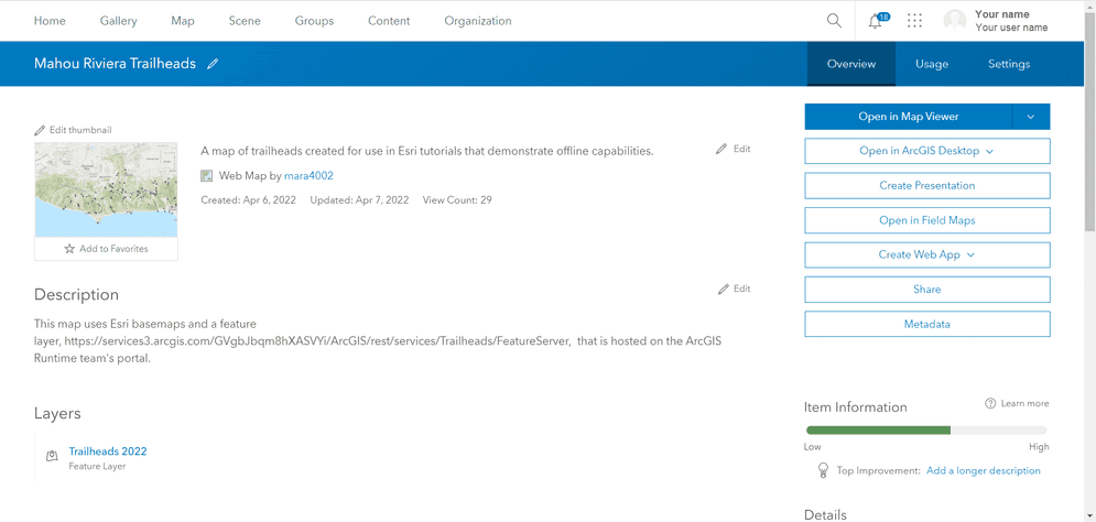
Click Map Properties
 and click Item Details. Your screen should resemble the following image. Note that now a Settings tab appears, which was not present the first time you looked at Item details in step 3.
-
Click Settings.
-
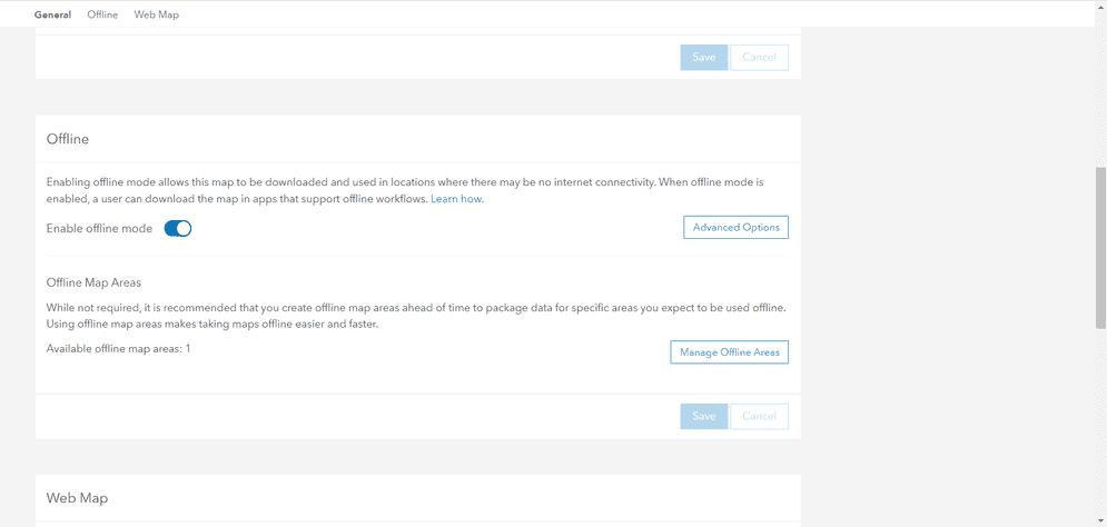
Scroll down to the Offline section, which should resemble the following image.
-
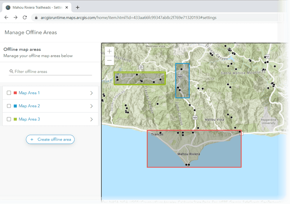
Click the Manage Offline Areas button.
-
In the left pane, click the Create offline area button.
-
On the toolbar in the map, click the Sketch rectangular map area tool
 and draw a rectangle around the area that juts into the water. This rectangle represents the area that you (the map owner) know has poor cell coverage in the Mahou Riviera. Your map should now resemble the following image.
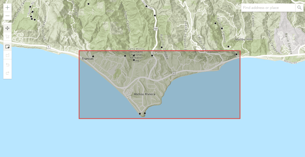
The rectangle you draw "slices" through all the layers in the map as it creates the package; it doesn't just grab the topmost layer.
-
Click Save in the left pane. You'll see that the word "Packaging" appears in the left pane while the offline map area is being created.
-
When the word "Packaging" disappears, your offline map area (the package) is ready for your users to use. They can download this area to their device before they head to Mahou Riviera. You can create additional map areas by repeating steps 9 through 11 above.
Additional information
For tips on creating offline map areas, see the ArcGIS Online discussion create, edit, and manage offline map areas.
For information on offline options, see the ArcGIS Online discussion, choosing the right advanced offline options.
Creating offline map areas ahead of time was previously known as the preplanned workflow. You may also know this workflow as preparing maps for download or predefining map areas.
What's next
Now that you've created offline map areas in your web map, you're ready to download the map, which will display the offline map areas you created.