Display a web map.
Use case
For displaying web maps stored on ArcGIS Online (e.g. terrestrial ecosystems, as demonstrated in this sample).
How to use the sample
A web map can be selected from the list. On selection the web map displays in the map view.
How it works
- Create a URL comprised of the Organization's Portal URL and the webmap of interest.
- Create a
Mapusing the URL. - Set the map to the
MapView.
Relevant API
- Map
- MapView
- Portal
- PortalItem
About the data
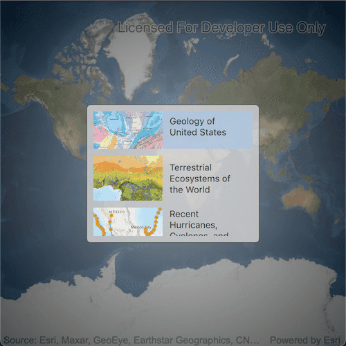
The web maps accessed by this sample show Geology for United States, Terrestrial Ecosystems of the World and Recent Hurricanes, Cyclones and Typhoons.
Tags
portal item, web map
Sample Code
OpenMapUrl.qml
// [WriteFile Name=OpenMapUrl, Category=Maps]
// [Legal]
// Copyright 2016 Esri.
// Licensed under the Apache License, Version 2.0 (the "License");
// you may not use this file except in compliance with the License.
// You may obtain a copy of the License at
// http://www.apache.org/licenses/LICENSE-2.0
// Unless required by applicable law or agreed to in writing, software
// distributed under the License is distributed on an "AS IS" BASIS,
// WITHOUT WARRANTIES OR CONDITIONS OF ANY KIND, either express or implied.
// See the License for the specific language governing permissions and
// limitations under the License.
// [Legal]
import QtQuick
import Esri.ArcGISRuntime
Rectangle {
width: 800
height: 600
// Create a MapView
MapView {
id: mapView
anchors.fill: parent
Component.onCompleted: {
// Set the focus on MapView to initially enable keyboard navigation
forceActiveFocus();
}
// Create an initial Map with the Imagery basemap
Map {
Basemap {
initStyle: Enums.BasemapStyleArcGISImageryStandard
}
}
}
// Create a list model with information about different webmaps
ListModel {
id: webmapListModel
ListElement { itemTitle: "Geology of United States"; imageUrl: "qrc:/Samples/Maps/OpenMapUrl/geology.jpg"; itemId: "92ad152b9da94dee89b9e387dfe21acd"}
ListElement { itemTitle: "Terrestrial Ecosystems of the World"; imageUrl: "qrc:/Samples/Maps/OpenMapUrl/ecosystems.png"; itemId: "5be0bc3ee36c4e058f7b3cebc21c74e6"}
ListElement { itemTitle: "Recent Hurricanes, Cyclones, and Typhoons"; imageUrl: "qrc:/Samples/Maps/OpenMapUrl/traces.png"; itemId: "064f2e898b094a17b84e4a4cd5e5f549"}
}
// Create a delegate for how the webmaps display in the view
Component {
id: webmapsDelegate
Item {
width: parent.width
height: 65
Row {
spacing: 10
Image {
source: imageUrl
width: 100
height: 65
}
Row {
anchors.verticalCenter: parent.verticalCenter
Text {
width: 100
text: itemTitle
wrapMode: Text.WordWrap
}
}
}
MouseArea {
anchors.fill: parent
// When an item in the list view is clicked
onClicked: {
webmapsListView.currentIndex = index
//! [Construct map from a webmap url]
// construct the webmap Url using the itemId
const organizationPortalUrl = "https://arcgis.com/sharing/rest/content/items/";
const webmapUrl = organizationPortalUrl + itemId;
// Create a new map and assign it the initUrl
const newMap = ArcGISRuntimeEnvironment.createObject("Map", {initUrl: webmapUrl});
//! [Construct map from a webmap url]
// Set the map to the MapView
mapView.map = newMap;
mapPickerWindow.visible = false;
}
}
}
}
// Create a window to display the different webmaps that can be selected
Rectangle {
id: mapPickerWindow
anchors.fill: parent
color: "transparent"
Rectangle {
anchors.fill: parent
color: "#60000000"
}
MouseArea {
anchors.fill: parent
onClicked: mouse => mouse.accepted = true
onWheel: wheel => wheel.accepted = true
}
Rectangle {
anchors.centerIn: parent
width: 250
height: 200
color: "lightgrey"
opacity: .8
radius: 5
border {
color: "#4D4D4D"
width: 1
}
// Create a list view to display the webmaps
ListView {
id: webmapsListView
anchors {
fill: parent
margins: 10
}
// Assign the model to the list model of webmaps
model: webmapListModel
// Assign the delegate to the delegate created above
delegate: webmapsDelegate
spacing: 10
clip: true
highlightFollowsCurrentItem: true
highlight: Rectangle { color: "lightsteelblue"; radius: 5 }
focus: true
}
}
}
// Create a button to show the map picker window
Rectangle {
id: switchButton
property bool pressed: false
visible: !mapPickerWindow.visible
anchors {
right: parent.right
bottom: parent.bottom
rightMargin: 20
bottomMargin: 40
}
width: 45
height: width
color: pressed ? "#959595" : "#D6D6D6"
radius: 100
border {
color: "#585858"
width: 1
}
Image {
anchors.centerIn: parent
width: 35
height: width
source: "qrc:/Samples/Maps/OpenMapUrl/SwitchMap.png"
}
MouseArea {
anchors.fill: parent
onPressed: switchButton.pressed = true
onReleased: switchButton.pressed = false
onClicked: {
// Show the add window when it is clicked
mapPickerWindow.visible = true;
}
}
}
}