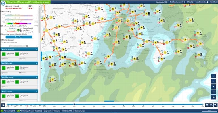
Thanks to the Winter Service Management System, the operational planners of the Motorway and Road Maintenance in Bavaria are able to react much earlier to icy conditions. The system bundles a large number of permanently incoming data, analyzes it, compiles it into a complete picture, and predicts the formation of black ice, packed snow and slush in the next few hours.
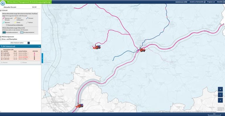
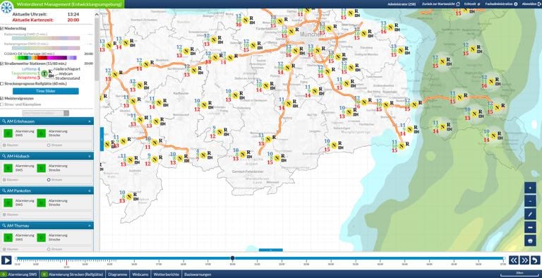
Extreme weather conditions in the winter months in the German state of Bavaria represent a serious challenge to road maintenance services in the region. Maintaining the flow of traffic throughout the road network requires a Winter Maintenance Service Management System that operates efficiently and with foresight. One of its main tasks is to coordinate the 600 public and 700 private service vehicles deployed to keep traffic moving along Bavaria's 22,000 kilometers of roads. With the digital winter service system, it has been possible to create a solution based on a variety of data in conjunction with appropriate equipment, which, despite the complexity of the assignment, is not only easy to use, but gives precise assistance to winter road maintenance services.
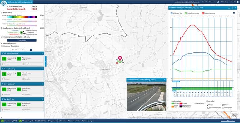
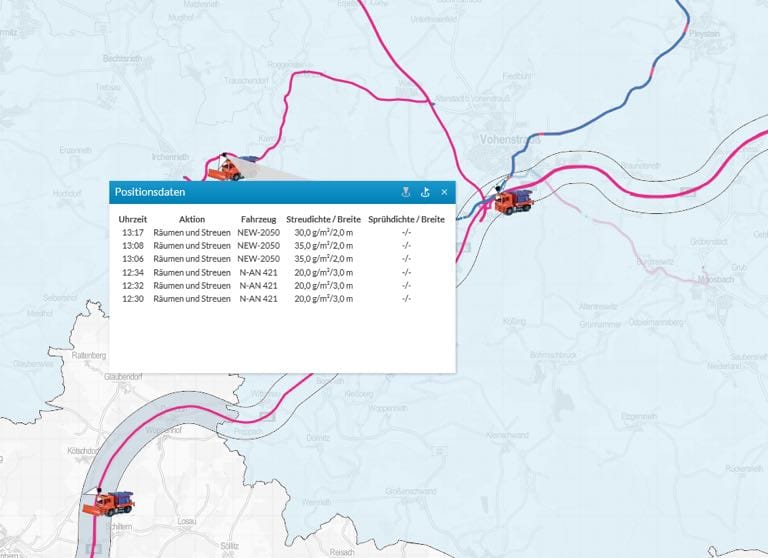
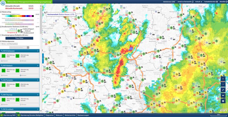
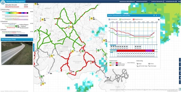
In technical terms, the client app, which is built using the map.apps framework – itself based on the ArcGIS API for JavaScript – incorporates a range of temporally-enabled web map services, both ArcGIS and WMS, such as precipitation and forecast data from the German weather service, as well as over 300 ice warning stations throughout Bavaria. The client also displays images from webcams, transmitted from the ice warning stations at ten minute intervals, as well as real time data from the service vehicles. However, the system's special feature is its alarm and forecast module, which gives warnings of icy road surfaces on individual routes over the coming 18 hours. This ability has given a considerable boost to personnel and material deployment. The system supports the proactive coordination of maintenance services and not only helps to limit their effect on the environment through more effective use of salt, but also keep the roads safe in winter.