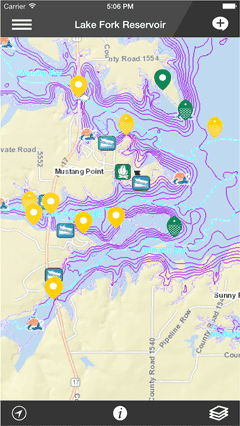
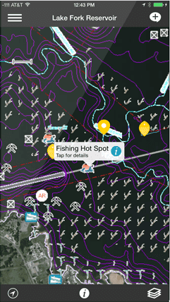
Fishidy is a waterway location-based app used by over 750,000 people who love to fish. Users can find local real-time fishing reports, log catches and spots on interactive fishing maps, and connect with local anglers.
Key features
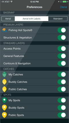
Basemaps
Choose from a variety of ArcGIS Online basemaps to give context to your geospatial application.
Search
Search for nearby waterways based on your current location.
App details
Fishidy, Inc. is the industry's premium online fishing community that helps anglers avoid unproductive water and head straight to the action. Featuring interactive mapping technology, accurate fishing maps, and social networking, Fishidy helps anglers of all abilities maximize their fishing potential. The app was created for iOS and Android platforms with the help of Esri Business Partner GeoDecisions and Fishing Hot Spots, the industry leader in developing and researching fishing maps and information. Users can discover shared catches and local fishing hot spots, stay up-to-date with the latest fishing reports, be better prepared with detailed waterway information, and track their position along depth contours on top waterways. Not only is Fishidy effective, it's fun! Connecting with new buddies and waterways exposes members to continuously updated, real-time fishing reports for use the next time they're on the water.