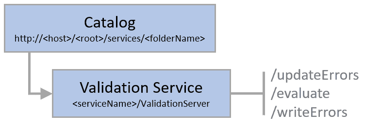
- URL:
- https://<root>/<serviceName>/ValidationServer
- Methods:
GET- Operations:
- Evaluate, Update Errors, Write Errors
- Version Introduced:
- 10.7
Description
The Validation service exposes the management capabilities necessary to support evaluation of geodatabase rules. This service is available when sharing to ArcGIS Enterprise by enabling the Validation capability. To learn more, see Additional layers and capabilities.
The following rule types can be evaluated using the evaluate operation:
- Topology rules
- Batch calculation and validation attribute rules
The validation server shares service instance settings and is tied to the published feature service as a server object extension (SOE).
Learn how to configure service instance settings
Capabilities
The capabilities property was introduced at ArcGIS Enterprise 11.1. This property returns the capabilities that the service supports. Refer to the JSON Response syntax section below for the ArcGIS Enterprise version when each capability was first introduced:
supports—TheTopology Validation evaluateoperation, supports theevaluationof topologyRules.Type supports—TheTopology Error Modification updateoperation supports theErrors ruleproperty for theType errorparameter. The property is to support theFeatures updateoperation for a topology.Errors supports—TheWrite Errors writeoperation supports the ability to write errors to GDB_Validation*Errors tables.Errors supports—TheWrite Errors With Sketch Geonetries writeoperation supports theErrors objectproperty for theId Sketch Geometry Pairs errorsparameter to enhance writing different types of sketched geometries to their corresponding GDB_Validation*Errors table.
JSON Response syntax
root
{
"name": "Validation Server",
"type": "Map Server Extension",
"capabilities": {
"supportsTopologyValidation": <true | false>, //Introduced in 10.8.1
"supportsTopologyErrorModification": <true | false>, //Introduced in 10.8.1
"supportsWriteErrors" : <true | false>, //Introduced at 11.3
"supportsWriteErrorsWithSketchGeometries" : <true | false>, //Introduced at 11.4
}
}Example usage
Request URL: https
JSON response:
{
"name": "Validation Server",
"type": "Map Server Extension",
"capabilities": {
"supportsTopologyValidation": true,
"supportsTopologyErrorModification": true,
"supportsWriteErrors": true
}
}