With different types of supported data layers on ArcGIS Online or ArcGIS Living Atlas, you can create immersive scenes of real-world cities within minutes by using the ArcGIS Maps SDK for Unity plugin. You can also leverage game engine capabilities such as sky components, water materials, and weather effects to make your scene more realistic and dynamic.
Featured data layer examples
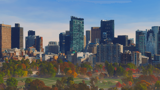
The following examples showcase a few sets of data that can be used to set up a scene categorized by different cities across the world. To learn how to set up a scene, refer to the tutorial pages.
Boston, MA, United States
- Origin Position:
- Longitude: -71.057083
- Latitude: 42.361145
- Altitude: 0
- Spatial Reference WKID: 4326
- Camera Position:
- Longitude: -71.066591
- Latitude: 42.355020
- Altitude: 82
- Spatial Reference WKID: 4326
- Camera Rotation:
- Heading: 90
- Pitch: 90
- Roll: 0
- Data Layers:
- ArcGIS Online item: Boston - 3D Tiles integrated mesh (WGS84)
- Type:
ArcGIS OG C 3 D Tiles Layer - Item page URL:
Use dark colors for code blocks Copy https://www.arcgis.com/home/item.html?id=1e4d88a748ee4fe989f8e45e52fdf75d
Christchurch, New Zealand

- Origin Position:
- Longitude: 172.636696
- Latitude: -43.530260
- Altitude: 0
- Spatial Reference WKID: 4326
- Camera Position:
- Longitude: 172.636864
- Latitude: -43.529333
- Altitude: 44.015807
- Spatial Reference WKID: 4326
- Camera Rotation:
- Heading: 149.47337
- Pitch: 78.275476
- Roll: 359.999423
- Data Layers:
-
ArcGIS Online item: ccbuildings_wgs84
-
Type:
ArcGIS 3 D Object Scene Layer -
Item page URL:
Use dark colors for code blocks Copy https://www.arcgis.com/home/item.html?id=9b833de0fb02443da36b650a7bfa7da4 -
ArcGIS Online item: Turanga Library
-
Type:
ArcGIS Building Scene Layer -
Item page URL:
Use dark colors for code blocks Copy https://www.arcgis.com/home/item.html?id=6047936953254454bf2c58ba02bd8e27
-
Frankfurt, Germany

- Origin Position:
- Longitude: 8.646070
- Latitude: 50.090001
- Altitude: 0
- Spatial Reference WKID: 4326
- Camera Position:
- Longitude: 8.665073
- Latitude: 50.098586
- Altitude: 203.958997
- Spatial Reference WKID: 4326
- Camera Rotation:
- Heading: 18.21456
- Pitch: 90.211967
- Roll: 0.008897
- Data Layers:
- ArcGIS Online item: Frankfurt Integrated Mesh
- Type:
ArcGIS Integrated Mesh Layer - Item page URL:
Use dark colors for code blocks Copy https://www.arcgis.com/home/item.html?id=7448c63c07514ec5918314dab1ada387
Hong Kong, China

- Origin Position:
- Longitude: 12711318.749200
- Latitude: 2548866.145700
- Altitude: 0
- Spatial Reference WKID: 3857
- Camera Position:
- Longitude: 114.159775
- Latitude: 22.278694
- Altitude: 193.049879
- Spatial Reference WKID: 3857
- Camera Rotation:
- Heading: 335.457335
- Pitch: 87.644199
- Roll: 359.963549
- Data Layers:
- ArcGIS Online item: LandsD 3D-BIT00 Building Models (Level 3)
- Type:
ArcGIS 3 D Object Scene Layer - Item page URL:
Use dark colors for code blocks Copy https://www.arcgis.com/home/item.html?id=dfc65d5eba804f289f1c45ec0628c5ee - ArcGIS Online item: LandsD 3D-BIT00 Building Models (Level 1)
- Type:
ArcGIS 3 D Object Scene Layer - Item page URL:
Use dark colors for code blocks Copy https://www.arcgis.com/home/item.html?id=aa6b63f9143a4356b6f491819cdc1c27
Montréal, QC, Canada

- Origin Position:
- Longitude: -73.603857
- Latitude: 45.485825
- Altitude: 0
- Spatial Reference WKID: 4326
- Camera Position:
- Longitude: -73.553191
- Latitude: 45.503395
- Altitude: 86.81108
- Spatial Reference WKID: 4326
- Camera Rotation:
- Heading: 272.372871
- Pitch: 91.065579
- Roll: 0.019082
- Data Layers:
- ArcGIS Online item: Montreal Buildings v17
- Type:
ArcGIS 3 D Object Scene Layer - Item page URL:
Use dark colors for code blocks Copy https://www.arcgis.com/home/item.html?id=c25ad987644e4048a015ea988e1d2418
New York City, NY, United States

- Origin Position:
- Longitude: -74
- Latitude: 41
- Altitude: 0
- Spatial Reference WKID: 4326
- Camera Position:
- Longitude: -74.019482
- Latitude: 40.703023
- Altitude: 410.095521
- Spatial Reference WKID: 4326
- Camera Rotation:
- Heading: 44.358559
- Pitch: 64.646284
- Roll: 0.217526
- Data Layers:
- ArcGIS Online item: New York Mesh
- Type:
ArcGIS Integrated Mesh Layer - Item page URL:
Use dark colors for code blocks Copy https://www.arcgis.com/home/item.html?id=c25ad987644e4048a015ea988e1d2418
Norfolk, VA, United States

- Origin Position:
- Longitude: -76.332562
- Latitude: 36.826480
- Altitude: 0
- Spatial Reference WKID: 4326
- Camera Position:
- Longitude: -76.288029
- Latitude: 36.841503
- Altitude: 74.70372
- Spatial Reference WKID: 4326
- Camera Rotation:
- Heading: 333.352814
- Pitch: 93.610245
- Roll: 0.038673
- Data Layers:
- ArcGIS Online item: Norfolk and ODU Mesh Merge_WSL3
- Type:
ArcGIS Integrated Mesh Layer - Item page URL:
Use dark colors for code blocks Copy https://www.arcgis.com/home/item.html?id=9db5d7dce5354cd99a879068832fdf85
Paris, France

- Origin Position:
- Longitude: 2.223559
- Latitude: 48.814136
- Altitude: 0
- Spatial Reference WKID: 4326
- Camera Position:
- Longitude: 2.304961
- Latitude: 48.856627
- Altitude: 145.967285
- Spatial Reference WKID: 4326
- Camera Rotation:
- Heading: 279.948727
- Pitch: 83.663647
- Roll: 0.051507
- Data Layers:
- ArcGIS Online item: Batiments_3D_Paris
- Type:
ArcGIS 3 D Object Scene Layer - Item page URL:
Use dark colors for code blocks Copy https://www.arcgis.com/home/item.html?id=d49d256a76a441f6a8c0b52f47683648 - ArcGIS Online item: Batiments_Remarquables_3D
- Type:
ArcGIS 3 D Object Scene Layer - Item page URL:
Use dark colors for code blocks Copy https://www.arcgis.com/home/item.html?id=38de38a2262d4f6b975818e088257c81 - ArcGIS Online item: World Street Map (Night - WGS84)
- Type:
ArcGIS Vector Tile Layers - Item page URL:
Use dark colors for code blocks Copy https://www.arcgis.com/home/item.html?id=0c66b684de734008a3dba6f6224b4efc
Prague, Czech Republic

- Origin Position:
- Longitude: 14.379450
- Latitude: 50.050415
- Altitude: 0
- Spatial Reference WKID: 4326
- Camera Position:
- Longitude: 14.419029
- Latitude: 50.087881
- Altitude: 283.890089
- Spatial Reference WKID: 4326
- Camera Rotation:
- Heading: 100.738976
- Pitch: 67.3977977
- Roll: 359.954803
- Data Layers:
- ArcGIS Online item: Prague Integrated Mesh
- Type:
ArcGIS Integrated Mesh Layer - Item page URL:
Use dark colors for code blocks Copy https://www.arcgis.com/home/item.html?id=21aa68f5b21643fe9620cf7a31d8169b
Tokyo, Japan

- Origin Position:
- Longitude: 139.685762
- Latitude: 35.532655
- Altitude: 0
- Spatial Reference WKID: 4326
- Camera Position:
- Longitude: 139.737876
- Latitude: 35.658697
- Altitude: 134.894836
- Spatial Reference WKID: 4326
- Camera Rotation:
- Heading: 71.783824
- Pitch: 94.617766
- Roll: 359.893258
- Data Layers:
- ArcGIS Online item: Tokyo23ku_LOD2_Building
- Type:
ArcGIS 3 D Object Scene Layer - Item page URL:
Use dark colors for code blocks Copy https://www.arcgis.com/home/item.html?id=9d1a43732ea54e27998a567a70aafc20