How to use the sample (SampleViewer)
- The SampleViewer Scene should open by default. If it is not open, click the SampleViewer scene to open it.
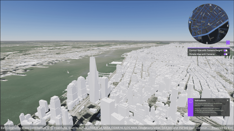
- Click play.
- Using the UI, enter an APIKey in the input field to the top left.
- Open the Samples drop down, and click Overviw Map to open the level.
- Use the W,A,S,D keys to move and right click and drag on the Game viewport to look around.
How to use the sample (HitTest Scene)
- Open the Overviw Map scene.
- Click on the ArcGISMap GameObject and set your API key in the Inspector window.
- Click play.
- Use the W,A,S,D keys to move and right click and drag on the Game viewport to look around.
How it works
- Create an ArcGIS Map and name it "ArcGIS Overview".
- Attach an ArcGIS Camera component to the active camera and set the rotation on the ArcGISLocation Component to be (0, 0, 0). This should have it facing down. Rename it "Overview Camera".
- Click on the Output drop down on the ArcGIS Overview and set the Target Texture to OverviewMap Render Texture in the Project Directory.
- Drag the Location Marker prefab into the scene as a child of the ArcGIS Map.
- Copy the ArcGIS Map you have in the scene and paste it into the scene. It should not be a child of any other game objects. Rename it to be "Main ArcGIS Map".
- Change the altitude of the Main ArcGIS Map to be -1000. This will position it above the ArcGIS Overview map.
- Remove the Location Marker from the Main ArcGIS Map.
- Click on the Overview Camera under Main ArcGIS Map and rename it to "ArcGIS Camera". Change the rotaiton to be facing forward.
- Right click in the Hierarchy and create a new Raw Image. Set the output of the raw image to the OverviewMap Render Texture.
- Click play and move around the screen. Observe the Overview Map update as you move the camera around and rotate the heading of the camera controller.
About the data
Building models for New York are loaded from a 3D object scene layer hosted by Esri.
Elevation data is loaded from the Terrain 3D elevation layer hosted by Esri.
Tags
OverviewMap