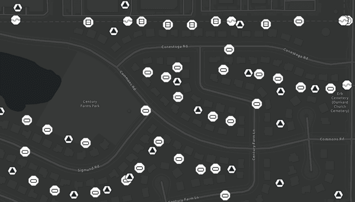
A utility network container allows a dense collection of features to be represented by a single feature, which can be used to reduce map clutter.
Use case
Offering a container view for features aids in the review for valid structural attachment and containment relationships and helps determine if a dataset has an association role set. Container views often model a cluster of electrical devices on a pole top or inside a cabinet or vault.
How to use the sample
Tap on a container feature to show all features inside the container. The container is shown as a polygon graphic with the content features contained within. The viewpoint and scale of the map are also changed to the container's extent. Connectivity and attachment associations inside the container are shown as red and blue dotted lines respectively.
How it works
- Load a web map that includes ArcGIS Pro Subtype Group Layers with only container features visible (i.e. fuse bank, switch bank, transformer bank, hand hole and junction box).
- Add a
GraphicsOverlayfor displaying a container view. - Create and load a
UtilityNetworkwith the same feature service URL as the layers in theMap. - Add an event handler for the
onTouchListenerlistener of theMapView. - Identify a feature and create a
UtilityElementfrom it. - Get the associations for this element using
GetAssociationsAsync(UtilityElement, UtilityAssociationType.CONTAINMENT). - Turn-off the visibility of all
OperationalLayers. - Get the features for the
UtilityElement(s) from the associations usingfetchFeaturesForElementsAsync(List<UtilityElement>) - Add a
Graphicwith the same geometry and symbol as these features. - Add another
Graphicthat represents this extent and zoom to this extent with some buffer. - Get associations for this extent using
GetAssociationsAsync(Envelope) - Add a
Graphicto represent the association geometry between them using a symbol that distinguishes betweenAttachmentandConnectivityassociation type. - Turn-on the visibility of all
OperationalLayers, clear theGraphicsand zoom out to the previous extent to exit the container view.
Relevant API
- SubtypeFeatureLayer
- UtilityAssociation
- UtilityAssociationType
- UtilityElement
- UtilityNetwork
About the data
The Naperville electric feature service contains a utility network layer used to find associations shown in this sample. The Naperville electric containers webmap uses the same feature service endpoint and displays only container features. Authentication is required and handled within the sample code.
Additional information
Using utility network on ArcGIS Enterprise 10.8 requires an ArcGIS Enterprise member account licensed with the Utility Network user type extension. Please refer to the utility network services documentation.
Tags
associations, connectivity association, containment association, structural attachment associations, utility network
Sample Code
/* Copyright 2022 Esri
*
* Licensed under the Apache License, Version 2.0 (the "License");
* you may not use this file except in compliance with the License.
* You may obtain a copy of the License at
*
* http://www.apache.org/licenses/LICENSE-2.0
*
* Unless required by applicable law or agreed to in writing, software
* distributed under the License is distributed on an "AS IS" BASIS,
* WITHOUT WARRANTIES OR CONDITIONS OF ANY KIND, either express or implied.
* See the License for the specific language governing permissions and
* limitations under the License.
*
*/
package com.esri.arcgisruntime.sample.displaycontentofutilitynetworkcontainer
import android.annotation.SuppressLint
import android.graphics.Color
import android.os.Bundle
import android.util.Log
import android.view.LayoutInflater
import android.view.MotionEvent
import android.view.View
import android.widget.Button
import android.widget.ProgressBar
import android.widget.Toast
import androidx.appcompat.app.AlertDialog
import androidx.appcompat.app.AppCompatActivity
import com.esri.arcgisruntime.data.ArcGISFeature
import com.esri.arcgisruntime.geometry.Geometry
import com.esri.arcgisruntime.geometry.GeometryEngine
import com.esri.arcgisruntime.geometry.Point
import com.esri.arcgisruntime.layers.SubtypeFeatureLayer
import com.esri.arcgisruntime.loadable.LoadStatus
import com.esri.arcgisruntime.mapping.ArcGISMap
import com.esri.arcgisruntime.mapping.Viewpoint
import com.esri.arcgisruntime.mapping.view.*
import com.esri.arcgisruntime.sample.displaycontentofutilitynetworkcontainer.databinding.ActivityMainBinding
import com.esri.arcgisruntime.sample.displaycontentofutilitynetworkcontainer.databinding.UtilityNetworkLegendBinding
import com.esri.arcgisruntime.security.AuthenticationChallengeHandler
import com.esri.arcgisruntime.security.AuthenticationChallengeResponse
import com.esri.arcgisruntime.security.AuthenticationManager
import com.esri.arcgisruntime.security.UserCredential
import com.esri.arcgisruntime.symbology.SimpleLineSymbol
import com.esri.arcgisruntime.symbology.Symbol
import com.esri.arcgisruntime.utilitynetworks.UtilityAssociation
import com.esri.arcgisruntime.utilitynetworks.UtilityAssociationType
import com.esri.arcgisruntime.utilitynetworks.UtilityElement
import com.esri.arcgisruntime.utilitynetworks.UtilityNetwork
class MainActivity : AppCompatActivity() {
private val TAG = MainActivity::class.java.simpleName
private val activityMainBinding by lazy {
ActivityMainBinding.inflate(layoutInflater)
}
private val mapView: MapView by lazy {
activityMainBinding.mapView
}
private val exitButton: Button by lazy {
activityMainBinding.exitButton
}
private val legendButton: Button by lazy {
activityMainBinding.legendButton
}
private val progressBar: ProgressBar by lazy {
activityMainBinding.progressBar
}
// create graphic overlay to display the utility network associations
private val graphicsOverlay: GraphicsOverlay = GraphicsOverlay()
// instance of the legend alert dialog
private var legendDialog: AlertDialog? = null
// create three new simple line symbols for displaying container view features
private val boundingBoxSymbol: SimpleLineSymbol =
SimpleLineSymbol(SimpleLineSymbol.Style.DASH, Color.YELLOW, 3F)
private val attachmentSymbol: SimpleLineSymbol =
SimpleLineSymbol(SimpleLineSymbol.Style.DOT, Color.BLUE, 3F)
private val connectivitySymbol: SimpleLineSymbol =
SimpleLineSymbol(SimpleLineSymbol.Style.DOT, Color.RED, 3F)
// the feature service url contains a utility network used to find associations shown in this sample
private val utilityNetwork: UtilityNetwork =
UtilityNetwork("https://sampleserver7.arcgisonline.com/server/rest/services/UtilityNetwork/NapervilleElectric/FeatureServer")
// use the previous viewpoint when exiting the container view
private var previousViewpoint: Viewpoint? = null
// needed to avoid the DefaultMapViewOnTouchListener accessibility warning
@SuppressLint("ClickableViewAccessibility")
override fun onCreate(savedInstanceState: Bundle?) {
super.onCreate(savedInstanceState)
setContentView(activityMainBinding.root)
// set user credentials to authenticate with the feature service and webmap url
// NOTE: a licensed user is required to perform utility network operations
// NOTE: Never hardcode login information in a production application. This is done solely for the sake of the sample.
val authenticationChallengeHandler =
AuthenticationChallengeHandler {
AuthenticationChallengeResponse(
AuthenticationChallengeResponse.Action.CONTINUE_WITH_CREDENTIAL,
UserCredential("viewer01", "I68VGU^nMurF")
)
}
AuthenticationManager.setAuthenticationChallengeHandler(authenticationChallengeHandler)
// create a new map from the web map URL (includes ArcGIS Pro subtype group layers with only container features visible)
val map =
ArcGISMap("https://sampleserver7.arcgisonline.com/portal/home/item.html?id=813eda749a9444e4a9d833a4db19e1c8")
.apply {
// add the utility network to the map's collection of utility networks, and load it
utilityNetworks.add(utilityNetwork)
}
// loads the features elements and the associations of the utility network
utilityNetwork.apply {
addDoneLoadingListener {
// handle error if the utility network did not load
if (utilityNetwork.loadStatus != LoadStatus.LOADED) {
onError("Error loading the utility network. Check URL used")
}
}
loadAsync()
}
mapView.apply {
// set the map to the MapView and set the MapView's viewpoint
this.map = map
setViewpoint(Viewpoint(41.801504, -88.163718, 4e3))
// hide the progress indicator once the map view is done loading
map.addDoneLoadingListener {
if (map.loadStatus == LoadStatus.LOADED) {
progressBar.visibility = View.GONE
} else if (map.loadStatus == LoadStatus.FAILED_TO_LOAD) {
progressBar.visibility = View.GONE
// handle error if map failed to load
map.loadError.message?.let { onError("Map failed to load: $it") }
}
}
// add graphics overlay to display container view contents
graphicsOverlays.add(graphicsOverlay)
}
// handle when map is clicked by retrieving the point
mapView.onTouchListener =
object : DefaultMapViewOnTouchListener(this@MainActivity, mapView) {
override fun onSingleTapConfirmed(event: MotionEvent?): Boolean {
if (event != null) {
// handle map click only if progressBar is not loading
if (progressBar.visibility == View.GONE) {
// display the progressBar
progressBar.visibility = View.VISIBLE
// create a point from where the user clicked
val screenPoint =
android.graphics.Point(event.x.toInt(), event.y.toInt())
// identify and handle the feature of the clicked at point
handleMapViewClicked(screenPoint)
}
}
return super.onSingleTapConfirmed(event)
}
}
// set up the attachmentSymbol, connectivitySymbol and
// the boundingBoxSymbol bitmaps for the legend view
setUpLegendView()
// sets the viewpoint, layers, and the graphics when user exits the container view
exitButton.setOnClickListener {
handleExitButtonClick()
}
// display the legend alert dialog when the button is clicked
legendButton.setOnClickListener {
legendDialog?.show()
}
}
/**
* Called when the user exits the container view.
* Clears graphics, resets the viewpoint
* and displays the operationalLayers
*/
private fun handleExitButtonClick() {
graphicsOverlay.graphics.clear()
mapView.setViewpointAsync(previousViewpoint)
mapView.map.operationalLayers.forEach { layer ->
layer.isVisible = true
}
// exits from the container view
handleContainerView(false)
}
/**
* Display legend, exit button and disable interaction
* when container view [isVisible]
*/
private fun handleContainerView(isVisible: Boolean) {
if (isVisible) {
// enable buttons
exitButton.isEnabled = true
legendButton.isEnabled = true
// disable map interactions
mapView.interactionOptions.apply {
isPanEnabled = false
isZoomEnabled = false
isRotateEnabled = false
}
} else {
// disable button
exitButton.isEnabled = false
legendButton.isEnabled = false
// enable map interactions
mapView.interactionOptions.apply {
isPanEnabled = true
isZoomEnabled = true
isRotateEnabled = true
}
}
}
/**
* Set up the attachmentSymbol, connectivitySymbol and
* the boundingBoxSymbol bitmaps for the legend view
*/
private fun setUpLegendView() {
// inflate the layout and get references to each of its components
val dialogBinding = UtilityNetworkLegendBinding.inflate(LayoutInflater.from(this))
// set the image bitmaps using the line symbols to the ImageViews
dialogBinding.apply {
attachmentImageView.setImageBitmap(
attachmentSymbol.createSwatchAsync(0x00000000, 1F).get()
)
connectivityImageView.setImageBitmap(
connectivitySymbol.createSwatchAsync(0x00000000, 1F).get()
)
boundingImageView.setImageBitmap(
boundingBoxSymbol.createSwatchAsync(0x00000000, 1F).get()
)
}
// create the alert dialog and bind it to the inflated layout
legendDialog = AlertDialog.Builder(this)
.setView(dialogBinding.root)
.setTitle("Legend")
.create()
}
/**
* Identifies the feature of the clicked [mapPoint], gets the selected feature's sublayerResults
* and retrieves the utility network associations of the selected ArcGISFeature
*/
private fun handleMapViewClicked(mapPoint: android.graphics.Point) {
try {
// identify the feature clicked on
val identifyLayerResultsFuture = mapView.identifyLayersAsync(mapPoint, 10.0, false)
identifyLayerResultsFuture.addDoneListener {
// get the result of the query
val identifyLayerResults = identifyLayerResultsFuture.get()
// if no layer identified then return
if (identifyLayerResults.isEmpty()) {
progressBar.visibility = View.GONE
return@addDoneListener
}
// finds the first layer where the LayerContent is a SubtypeFeatureLayer
val layerResult = identifyLayerResults.find { layerResult -> layerResult.layerContent is SubtypeFeatureLayer }
// user clicked on an empty space on map with no feature
if(layerResult == null){
progressBar.visibility = View.GONE
return@addDoneListener
}
// filter the sublayer result's elements to find the first one which is an ArcGIS feature
val selectedContainerFeature =
layerResult.sublayerResults.first().elements.filterIsInstance<ArcGISFeature>()
.first()
// create a container element using the selected feature
val containerElement = utilityNetwork.createElement(selectedContainerFeature)
// get the containment associations from this element to display its content
val containmentAssociationsFuture = utilityNetwork.getAssociationsAsync(
containerElement,
UtilityAssociationType.CONTAINMENT
)
containmentAssociationsFuture.addDoneListener {
// displays the features, symbols and the container element's associations
handleContainmentAssociations(
containmentAssociationsFuture.get(),
containerElement
)
}
}
} catch (e: Exception) {
onError("Error getting result: ${e.message}")
}
}
/**
* Displays the features, symbols and the container element's associations
*/
private fun handleContainmentAssociations(
containmentAssociations: List<UtilityAssociation>,
containerElement: UtilityElement
) {
// get and store a list of elements from the result of the query
val contentElements: MutableList<UtilityElement> = mutableListOf()
// get the list of containment associations and loop through them to get their elements
containmentAssociations.forEach { association ->
val utilityElement =
if (association.fromElement.objectId == containerElement.objectId) association.toElement
else association.fromElement
contentElements.add(utilityElement)
}
// save the viewpoint and hide the current operationalLayers
previousViewpoint = mapView.getCurrentViewpoint(Viewpoint.Type.BOUNDING_GEOMETRY)
mapView.map.operationalLayers.forEach { layer -> layer.isVisible = false }
// fetch the features from the elements
val fetchFeaturesFuture = utilityNetwork.fetchFeaturesForElementsAsync(contentElements)
fetchFeaturesFuture.addDoneListener {
// get the content features and give them each a symbol, and add them as a graphic to the graphics overlay
fetchFeaturesFuture.get().forEach { content ->
val symbol: Symbol =
content.featureTable.layerInfo.drawingInfo.renderer.getSymbol(content)
graphicsOverlay.graphics.add(Graphic(content.geometry, symbol))
}
val firstGraphic = graphicsOverlay.graphics[0].geometry
val containerViewScale = containerElement.assetType.containerViewScale
if (graphicsOverlay.graphics.size == 1 && firstGraphic is Point) {
mapView.setViewpointCenterAsync(firstGraphic, containerViewScale)
.addDoneListener {
// the bounding box, which defines the container view, may be computed using the extent of the features
// it contains or centered around its geometry at the container's view scale
val boundingBox =
mapView.getCurrentViewpoint(Viewpoint.Type.BOUNDING_GEOMETRY).targetGeometry
// identifies and displays associations for the specified geometry
identifyAssociationsWithExtent(boundingBox)
// since size is 1, no associations found
Toast.makeText(this, "This feature has no associations", Toast.LENGTH_SHORT)
.show()
}
} else {
// associations found, create a bounding box around them
val boundingBox: Geometry =
GeometryEngine.buffer(graphicsOverlay.extent, 0.05)
// get associations for the specified geometry and display its associations
identifyAssociationsWithExtent(boundingBox)
}
}
}
/**
* Get associations for the specified geometry and display its associations
* using [boundingBox] the geometry from which to get associations.
*/
private fun identifyAssociationsWithExtent(boundingBox: Geometry?) {
// display container view and hide progressBar
handleContainerView(true)
progressBar.visibility = View.GONE
// adds a graphic representing the bounding box of the associations identified and zooms to its extent
graphicsOverlay.graphics.add(Graphic(boundingBox, boundingBoxSymbol))
mapView.setViewpointGeometryAsync(GeometryEngine.buffer(graphicsOverlay.extent, 0.05))
// get the associations for this extent to display how content features are attached or connected.
val extentAssociations = utilityNetwork.getAssociationsAsync(graphicsOverlay.extent)
extentAssociations.addDoneListener {
try {
extentAssociations.get().forEach { association ->
// assign the appropriate symbol if the association is an attachment or connectivity type
val symbol: Symbol =
if (association.associationType === UtilityAssociationType.ATTACHMENT) attachmentSymbol
else connectivitySymbol
// add the symbol for each association in the container
graphicsOverlay.graphics.add(Graphic(association.geometry, symbol))
}
} catch (e: Exception) {
onError("Error getting extent associations")
}
}
}
private fun onError(message: String) {
Toast.makeText(this, message, Toast.LENGTH_SHORT).show()
Log.e(TAG, message)
progressBar.visibility = View.GONE
}
override fun onPause() {
mapView.pause()
super.onPause()
}
override fun onResume() {
super.onResume()
mapView.resume()
}
override fun onDestroy() {
mapView.dispose()
super.onDestroy()
}
}