Set the map view to a new viewpoint.
Use case
Programmatically navigate to a specified location in the map or scene. Use this to focus on a particular point or area of interest.
How to use the sample
The map view has several methods for setting its current viewpoint. Select a viewpoint from the UI to see the viewpoint changed using that method.
How it works
- Create a new
ArcGISMapViewwith anArcGISMapViewController, and assign anArcGISMapto theArcGISMapViewController.arcGISMapproperty. - Change the map’s
Viewpointusing one of the available methods:
- Use
ArcGISMapViewController.setViewpointGeometry()to set the viewpoint to a givenGeometry. - Use
ArcGISMapViewController.setViewpointCenter()to center the viewpoint on aArcGISPointand set a distance from the ground using a scale. - Use
ArcGISMapViewController.setViewpointAnimated()to pan to a viewpoint over the specified length of time.
Relevant API
- ArcGISMap
- ArcGISMapView
- ArcGISPoint
- Geometry
- Viewpoint
Additional information
Below are some other ways to set a viewpoint:
- ArcGISMapViewController.setViewpoint
- ArcGISMapViewController.setViewpointRotation
- ArcGISMapViewController.setViewpointScale
- ArcGISMapViewController.setViewpointWithDurationAndCurve
Tags
animate, extent, pan, rotate, scale, view, zoom
Sample code
change_viewpoint.dart
// Copyright 2024 Esri//// Licensed under the Apache License, Version 2.0 (the "License");// you may not use this file except in compliance with the License.// You may obtain a copy of the License at//// https://www.apache.org/licenses/LICENSE-2.0//// Unless required by applicable law or agreed to in writing, software// distributed under the License is distributed on an "AS IS" BASIS,// WITHOUT WARRANTIES OR CONDITIONS OF ANY KIND, either express or implied.// See the License for the specific language governing permissions and// limitations under the License.//
import 'package:arcgis_maps/arcgis_maps.dart';import 'package:arcgis_maps_sdk_flutter_samples/common/common.dart';import 'package:flutter/material.dart';
class ChangeViewpoint extends StatefulWidget { const ChangeViewpoint({super.key});
@override State<ChangeViewpoint> createState() => _ChangeViewpointState();}
class _ChangeViewpointState extends State<ChangeViewpoint> with SampleStateSupport { // Create a controller for the map view. final _mapViewController = ArcGISMapView.createController();
// Define the Redlands polygon. late PolygonBuilder _redlandsEnvelope;
// Define the Edinburgh polygon. late PolygonBuilder _edinburghEnvelope;
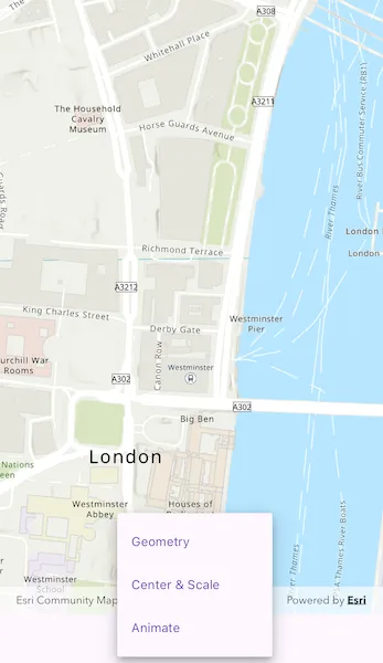
// String array to store titles for the viewpoints specified above. final _viewpointTitles = ['Geometry', 'Center & Scale', 'Animate'];
// Create variable for holding state relating to the viewpoint. String? _selectedViewpoint;
// Define an envelope that can navigate to the full extent. Envelope? _fullExtent;
// A flag for when the map view is ready and controls can be used. var _ready = false;
@override Widget build(BuildContext context) { return Scaffold( body: SafeArea( top: false, left: false, right: false, child: Stack( children: [ Column( children: [ Expanded( // Add a map view to the widget tree and set a controller. child: ArcGISMapView( controllerProvider: () => _mapViewController, onMapViewReady: onMapViewReady, ), ), // Build the bottom menu. buildBottomMenu(), ], ), // Display a progress indicator and prevent interaction until state is ready. LoadingIndicator(visible: !_ready), ], ), ), ); }
Future<void> onMapViewReady() async { // Create new Map with basemap and initial location. final map = ArcGISMap.withBasemapStyle(BasemapStyle.arcGISTopographic); // Assign the map to the ArcGISMapView. _mapViewController.arcGISMap = map;
// Load the map so that we get the full extent. await map.load(); _fullExtent = map.basemap!.baseLayers.first.fullExtent;
// Coordinates for Redlands. _redlandsEnvelope = PolygonBuilder( spatialReference: SpatialReference.webMercator, ); _redlandsEnvelope.addPointXY(x: -13049785.1566222, y: 4032064.6003424); _redlandsEnvelope.addPointXY(x: -13049785.1566222, y: 4040202.42595729); _redlandsEnvelope.addPointXY(x: -13037033.5780234, y: 4032064.6003424); _redlandsEnvelope.addPointXY(x: -13037033.5780234, y: 4040202.42595729);
// Coordinates for Edinburgh. _edinburghEnvelope = PolygonBuilder( spatialReference: SpatialReference.webMercator, ); _edinburghEnvelope.addPointXY(x: -354262.156621384, y: 7548092.94093301); _edinburghEnvelope.addPointXY(x: -354262.156621384, y: 7548901.50684376); _edinburghEnvelope.addPointXY(x: -353039.164455303, y: 7548092.94093301); _edinburghEnvelope.addPointXY(x: -353039.164455303, y: 7548901.50684376);
// Set the ready state variable to true to enable the sample UI. setState(() => _ready = true); }
Widget buildBottomMenu() { return Center( // A drop down menu for selecting viewpoint. child: DropdownMenu( hintText: 'Choose a style', trailingIcon: const Icon(Icons.arrow_drop_down), textStyle: Theme.of(context).textTheme.labelMedium, initialSelection: _selectedViewpoint, dropdownMenuEntries: _viewpointTitles.map((items) { return DropdownMenuEntry(value: items, label: items); }).toList(), onSelected: (viewpoint) { if (viewpoint != null) { changeViewpoint(viewpoint); } }, ), ); }
Future<void> changeViewpoint(String viewpoint) async { // Set the selected viewpoint. setState(() => _selectedViewpoint = viewpoint);
switch (_selectedViewpoint) { case 'Geometry': // Set Viewpoint using Redlands envelope defined above and a padding of 20. await _mapViewController.setViewpointGeometry( _redlandsEnvelope.toGeometry(), paddingInDiPs: 20, ); case 'Center & Scale': // Set Viewpoint so that it is centered on the London coordinates defined above. await _mapViewController.setViewpointCenter( ArcGISPoint( x: -13881.7678417696, y: 6710726.57374296, spatialReference: SpatialReference.webMercator, ), scale: 8762.7156655228955, ); case 'Animate': if (_fullExtent != null) { // Navigate to full extent of the first baselayer before animating to specified geometry. _mapViewController.setViewpoint( Viewpoint.fromTargetExtent(_fullExtent!.extent), );
// Set Viewpoint of ArcGISMapView to the Viewpoint created above and animate to it using a timespan of 5 seconds. await _mapViewController.setViewpointAnimated( Viewpoint.fromTargetExtent(_edinburghEnvelope.toGeometry()), duration: 5, ); } default: throw StateError('Unknown viewpoint type'); } }}