 Hide Table of Contents
 Analysis
 Dynamic Layers
 Editing
 Feature Layers
 Feature Table
 Graphics
 Map
Map
 Mobile
 Online and Portal
 Popups and Info Windows
 Query and Select
 Renderers, Symbols, Visualization
 Search

Map with GPX
Explore in the sandbox
View live sample
Description
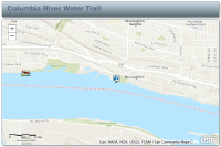
This sample application displays a web map generated using the ArcGIS.com map viewer. The web map's author used the tools in the map viewer to select a basemap, add the gpx file, define an initial extent and configure the popup for the river trail locations.
You can add data from csv or gpx files to an ArcGIS.com web map then display that web map in an application built with the ArcGIS API for JavaScript. View the ArcGIS.com help for more details.
The ArcGIS API for JavaScript has two utility methods that allow you to consume the web maps from a JavaScript application: esri.arcgis.utils.createMap. In this snippet, the utility methods are used to create a map using the unique id for the web map.
var mapDeferred = esri.arcgis.utils.createMap(itemInfo, "map", {mapOptions: {
slider: true,
nav:false
}
});
Code
<!DOCTYPE html>
<html>
  <head>
    <meta http-equiv="Content-Type" content="text/html; charset=utf-8">
    <meta name="viewport" content="initial-scale=1, maximum-scale=1,user-scalable=no">
    <title>Map with gpx data</title>

    <link rel="stylesheet" href="https://js.arcgis.com/3.46/dijit/themes/claro/claro.css">
    <link rel="stylesheet" href="https://js.arcgis.com/3.46/esri/css/esri.css">
    <link rel="stylesheet" href="css/app.css">

    <script>var dojoConfig = { parseOnLoad: true };</script>
    <script src="https://js.arcgis.com/3.46/"></script>
    <script>
      dojo.require("dijit.layout.BorderContainer");
      dojo.require("dijit.layout.ContentPane");
      dojo.require("esri.map");
      dojo.require("esri.arcgis.utils");
      dojo.require("esri.dijit.Scalebar");

      var map;

      function init() {
        var mapDeferred = esri.arcgis.utils.createMap("f532b1a36d7842a4b6d0a5a59dfff435", "map");
        mapDeferred.then(function(response) {
          dojo.byId("title").innerHTML = response.itemInfo.item.title;
          map = response.map;

          //add the legend
          var layers = response.itemInfo.itemData.operationalLayers;
          if (map.loaded) {
            initMap(layers);
          } else {
            dojo.connect(map,"onLoad",function(){
              initMap(layers);
            });
          }
        }, function(error) {
          console.log("Map creation failed: ", dojo.toJson(error));
        });
      }

      function initMap(layers){
        //add a scalebar
        var scalebar = new esri.dijit.Scalebar({
          map: map,
          scalebarUnit: 'english'
        });
      }

      //show map on load
      dojo.ready(init);
    </script>
  </head>

  <body class="claro">
    <div id="mainWindow" data-dojo-type="dijit.layout.BorderContainer" data-dojo-props="design:'headline'" style="width:100%; height:100%;">
      <div id="header" class="shadow roundedCorners" data-dojo-type="dijit.layout.ContentPane" data-dojo-props="region:'top'">
        <div id="title"></div>
      </div>
      <div id="map" class="roundedCorners shadow" data-dojo-type="dijit.layout.ContentPane" data-dojo-props="region:'center'"></div>
    </div>
  </body>
</html>