You can filter 3D layers in your scene using numeric or text attributes in the data to visualize or highlight the important features and hide unnecessary data. You can also apply spatial filters to 3D layers to hide features within a specific area or show only the features within that area. Depending on the type of layers you are working with, different operations are available to help you achieve the desired effect.
| Operation | Can apply to | Description |
|---|---|---|
| Material by attribute | Access material attributes via shaders to filter 3D objects (features) and manipulate how they are displayed, for example by styling differently based on specific attributes or ranges of attributes. | |
| Spatial filtering | Remove 3D objects inside or outside of a specific area. | |
| Mesh modification | Modify meshes in your scene to clip out areas to see features below, to show only the area of the mesh within the boundaries of a geographic area, or to flatten and replace an area of the mesh with new construction. | |
| Building filtering | Filter parts of the building based on building scene layer attributes. | |
| Identify | Query attributes of layers. |
Material by attribute
For 3D object scene layers, you can filter objects by attributes and customize the shader to create different visual results by changing the material applied to objects. This is useful when you want to visualize objects that match specific criteria.

Spatial filtering
You may want to remove some parts of 3D object scene layers and building scene layers after they are added to your ArcGIS Map. Spatial filtering enables you to remove areas of 3D object scene layers and building scene layers in your ArcGIS Map by providing polygon geometries to specify the areas.

Mesh modification
Clip, mask, and replace modifications can be made to integrated mesh scene layers, elevation surfaces, and 3D Tiles layers, enabling you to incorporate other spatial data or actors with the layers without modifying the underlying source data. This capability also enables you to add other ground surface data for a specific area without modifying the elevation source data.

Building filtering
For building scene layers, you can filter parts of the building structure based on building attributes. As building information is visually complex, it is useful to filter out elements to see only relevant or important information.

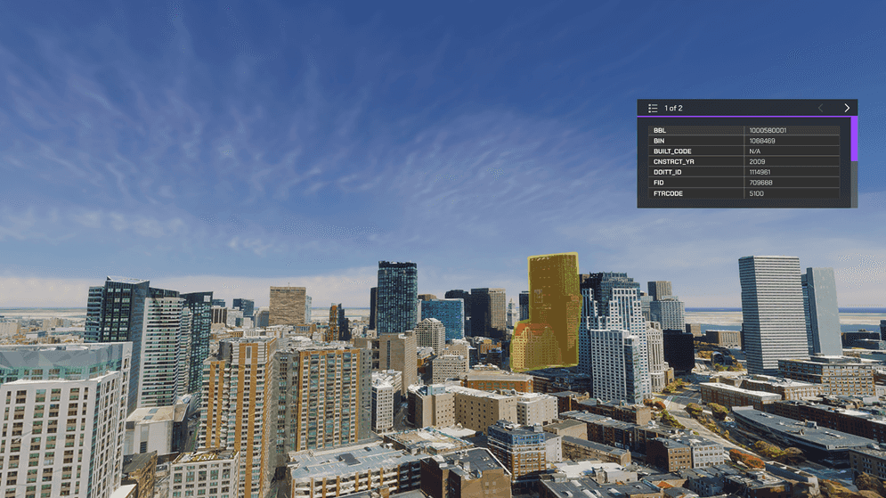
Identify
For 3d object scene layers, you can use identify to query attributes.