Geocode addresses to locations and reverse geocode locations to addresses offline.
Use case
You can use an address locator file to geocode addresses and locations. For example, you could provide offline geocoding capabilities to field workers repairing critical infrastructure in a disaster when network availability is limited.
How to use the sample
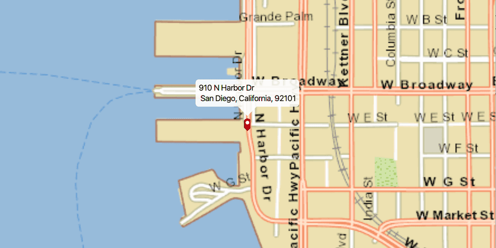
Select an address from the drop-down list to geocode the address and view the result on the map. Click the location you want to reverse geocode. Click on the pin to highlight it and then move the mouse to perform reverse geocoding in real-time.
How it works
- Use the path of a .loc file to create a
LocatorTaskobject. - Set up
GeocodeParametersand callGeocodeAsyncto get geocode results.
Relevant API
- GeocodeParameters
- GeocodeResult
- LocatorTask
- ReverseGeocodeParameters
Additional information
This sample uses the San Diego Streets Tile Package and the San Diego Offline Locator.
Tags
geocode, geocoder, locator, offline, package, query, search
Sample Code
OfflineGeocodeSample.java
/*
* Copyright 2017 Esri.
*
* Licensed under the Apache License, Version 2.0 (the "License"); you may not
* use this file except in compliance with the License. You may obtain a copy of
* the License at
*
* http://www.apache.org/licenses/LICENSE-2.0
*
* Unless required by applicable law or agreed to in writing, software
* distributed under the License is distributed on an "AS IS" BASIS, WITHOUT
* WARRANTIES OR CONDITIONS OF ANY KIND, either express or implied. See the
* License for the specific language governing permissions and limitations under
* the License.
*/
package com.esri.samples.offline_geocode;
import java.io.File;
import java.util.List;
import javafx.application.Application;
import javafx.application.Platform;
import javafx.event.EventHandler;
import javafx.geometry.Insets;
import javafx.geometry.Point2D;
import javafx.geometry.Pos;
import javafx.scene.Scene;
import javafx.scene.control.Alert;
import javafx.scene.control.ComboBox;
import javafx.scene.image.Image;
import javafx.scene.input.MouseButton;
import javafx.scene.input.MouseEvent;
import javafx.scene.layout.StackPane;
import javafx.stage.Stage;
import javafx.util.Duration;
import com.esri.arcgisruntime.concurrent.ListenableFuture;
import com.esri.arcgisruntime.data.TileCache;
import com.esri.arcgisruntime.geometry.Point;
import com.esri.arcgisruntime.layers.ArcGISTiledLayer;
import com.esri.arcgisruntime.loadable.LoadStatus;
import com.esri.arcgisruntime.mapping.ArcGISMap;
import com.esri.arcgisruntime.mapping.Basemap;
import com.esri.arcgisruntime.mapping.view.Callout;
import com.esri.arcgisruntime.mapping.view.Callout.LeaderPosition;
import com.esri.arcgisruntime.mapping.view.Graphic;
import com.esri.arcgisruntime.mapping.view.GraphicsOverlay;
import com.esri.arcgisruntime.mapping.view.IdentifyGraphicsOverlayResult;
import com.esri.arcgisruntime.mapping.view.MapView;
import com.esri.arcgisruntime.symbology.PictureMarkerSymbol;
import com.esri.arcgisruntime.tasks.geocode.GeocodeParameters;
import com.esri.arcgisruntime.tasks.geocode.GeocodeResult;
import com.esri.arcgisruntime.tasks.geocode.LocatorTask;
import com.esri.arcgisruntime.tasks.geocode.ReverseGeocodeParameters;
public class OfflineGeocodeSample extends Application {
private MapView mapView;
private ArcGISTiledLayer tiledLayer;
private LocatorTask locatorTask;
private GeocodeParameters geocodeParameters;
private ReverseGeocodeParameters reverseGeocodeParameters;
private GraphicsOverlay graphicsOverlay;
private PictureMarkerSymbol pinSymbol;
private ComboBox<String> searchBox;
private ListenableFuture<IdentifyGraphicsOverlayResult> identifyResults;
private boolean realtimeMode = false;
@Override
public void start(Stage stage) {
try {
// create stack pane and application scene
StackPane stackPane = new StackPane();
Scene scene = new Scene(stackPane);
// set title, size, and add scene to stage
stage.setTitle("Offline Geocode Sample");
stage.setWidth(800);
stage.setHeight(700);
stage.setScene(scene);
stage.show();
// create search box
searchBox = new ComboBox<>();
searchBox.setPromptText("Search");
searchBox.setEditable(true);
searchBox.setMaxWidth(260.0);
// add example address suggestions
String[] recent = {
"910 N Harbor Dr, San Diego, CA 92101",
"2920 Zoo Dr, San Diego, CA 92101",
"111 W Harbor Dr, San Diego, CA 92101",
"868 4th Ave, San Diego, CA 92101",
"750 A St, San Diego, CA 92101"
};
searchBox.getItems().addAll(recent);
// event to get geocode when query is submitted
searchBox.setOnAction((e) -> {
// get the user's query
String query;
if (searchBox.getSelectionModel().getSelectedIndex() == -1) {
// user supplied their own query
query = searchBox.getEditor().getText();
} else {
// user chose a suggested query
query = searchBox.getSelectionModel().getSelectedItem();
}
if (!query.equals("")) {
// hide callout if showing
mapView.getCallout().dismiss();
// run the locatorTask geocode task
ListenableFuture<List<GeocodeResult>> results = locatorTask.geocodeAsync(query, geocodeParameters);
// add a listener to display the result when loaded
results.addDoneListener(new ResultsLoadedListener(results));
}
});
// create a basemap from a local tile package
File tpkxFile = new File(System.getProperty("data.dir"), "./samples-data/sandiego/streetmap_SD.tpkx");
TileCache tileCache = new TileCache(tpkxFile.getAbsolutePath());
tiledLayer = new ArcGISTiledLayer(tileCache);
Basemap basemap = new Basemap(tiledLayer);
// create ArcGISMap with imagery basemap
ArcGISMap map = new ArcGISMap(basemap);
// create a view and set ArcGISMap to it
mapView = new MapView();
mapView.setMap(map);
// add a graphics overlay
graphicsOverlay = new GraphicsOverlay();
mapView.getGraphicsOverlays().add(graphicsOverlay);
// create a pin graphic
Image img = new Image(getClass().getResourceAsStream("/pin.png"), 0, 80, true, true);
pinSymbol = new PictureMarkerSymbol(img);
pinSymbol.loadAsync();
tiledLayer.addDoneLoadingListener(() -> {
if (tiledLayer.getLoadStatus() == LoadStatus.LOADED) {
Platform.runLater(() -> {
// center the view over the tiled layer's extent
mapView.setViewpointGeometryAsync(tiledLayer.getFullExtent());
});
} else {
Alert alert = new Alert(Alert.AlertType.ERROR, "Tiled Layer Failed to Load!");
alert.show();
}
});
// set the callout's default style
Callout callout = mapView.getCallout();
callout.setLeaderPosition(LeaderPosition.BOTTOM);
// create a locator task
final String locatorPath =
new File(System.getProperty("data.dir"), "./samples-data/sandiego/SanDiego_StreetAddress.loc").getAbsolutePath();
locatorTask = new LocatorTask(locatorPath);
// set geocode task parameters
geocodeParameters = new GeocodeParameters();
geocodeParameters.getResultAttributeNames().add("*"); // return all attributes
geocodeParameters.setMaxResults(1); // get closest match
// set reverse geocode task parameters
reverseGeocodeParameters = new ReverseGeocodeParameters();
reverseGeocodeParameters.getResultAttributeNames().add("*");
reverseGeocodeParameters.setOutputSpatialReference(mapView.getSpatialReference());
// create mouse moved event handler
MouseMovedHandler handler = new MouseMovedHandler();
// start or stop real-time geocoding mode
mapView.setOnMouseClicked(event -> {
if (event.isStillSincePress() && event.getButton() == MouseButton.PRIMARY) {
Point2D clickLocation = new Point2D(event.getX(), event.getY());
Point point = mapView.screenToLocation(clickLocation);
if (realtimeMode) {
// disable the real-time geocoding mode
realtimeMode = false;
// clear graphic selections
graphicsOverlay.clearSelection();
// remove the mouse moved handler
mapView.setOnMouseMoved(null);
} else {
// identify the selected graphic
identifyResults = mapView.identifyGraphicsOverlayAsync(graphicsOverlay, clickLocation, 10, false);
identifyResults.addDoneListener(() -> {
try {
List<Graphic> graphics = identifyResults.get().getGraphics();
if (graphics.size() > 0) {
// set the graphic as selected
Graphic graphic = graphics.get(0);
graphic.setSelected(true);
// start real-time mode
realtimeMode = true;
// add a mouse move event handler to get real-time geocodes
mapView.setOnMouseMoved(handler);
} else {
// reverse geocode the selected point
ListenableFuture<List<GeocodeResult>> results = locatorTask.reverseGeocodeAsync(point,
reverseGeocodeParameters);
results.addDoneListener(new ResultsLoadedListener(results));
}
} catch (Exception e) {
e.printStackTrace();
}
});
}
}
});
// add map view and searchBox to stack pane
stackPane.getChildren().addAll(mapView, searchBox);
StackPane.setAlignment(searchBox, Pos.TOP_LEFT);
StackPane.setMargin(searchBox, new Insets(10, 0, 0, 10));
} catch (Exception e) {
// on any error, print the stack trace
e.printStackTrace();
}
}
/**
* Performs reverse geocode based on mouse location and display the result in
* real-time.
*/
private class MouseMovedHandler implements EventHandler<MouseEvent> {
@Override
public void handle(MouseEvent event) {
// get the mouse location coordinates
Point point = mapView.screenToLocation(new Point2D(event.getX(), event.getY()));
// disable the move event listener to reduce unnecessary geocode calls
mapView.setOnMouseMoved(null);
// run the locator task
ListenableFuture<List<GeocodeResult>> results = locatorTask.reverseGeocodeAsync(point, reverseGeocodeParameters);
results.addDoneListener(() -> {
try {
// get the geocode from the result
List<GeocodeResult> geocodes = results.get();
GeocodeResult geocodeResult = geocodes.get(0);
// update the marker's position and display result of the geocode result in a callout
graphicsOverlay.getGraphics().get(0).setGeometry(geocodeResult.getDisplayLocation());
displayCallout(geocodeResult);
} catch (Exception e) {
// mouse is out of bounds
e.printStackTrace();
}
// re-enable the mouse move listener
mapView.setOnMouseMoved(this);
});
}
}
/**
* Updates marker and callout when new results are loaded.
*/
private class ResultsLoadedListener implements Runnable {
private final ListenableFuture<List<GeocodeResult>> results;
/**
* Constructs a runnable listener for the geocode results.
*
* @param results results from a {@link LocatorTask#geocodeAsync} task
*/
ResultsLoadedListener(ListenableFuture<List<GeocodeResult>> results) {
this.results = results;
}
@Override
public void run() {
try {
List<GeocodeResult> geocodes = results.get();
if (geocodes.size() > 0) {
// get the top result
GeocodeResult geocodeResult = geocodes.get(0);
// set the viewpoint to the marker
Point location = geocodeResult.getDisplayLocation();
mapView.setViewpointCenterAsync(location, 10000);
// create the marker and display result of the geocode result in a callout
Graphic marker = new Graphic(location, pinSymbol);
displayCallout(geocodeResult);
// remove marker from previous query
graphicsOverlay.getGraphics().clear();
// add the marker showing the location of the current geocode query to the graphics overlay
graphicsOverlay.getGraphics().add(marker);
}
} catch (Exception e) {
e.printStackTrace();
}
}
}
/**
* Displays the address from the geocode result in a callout.
*
* @param geocodeResult the geocode result to get attributes from
*/
private void displayCallout(GeocodeResult geocodeResult) {
// get attributes from the result for the callout
Object matchAddr = geocodeResult.getAttributes().get("Match_addr");
String title = matchAddr.toString().split(",")[0];
String detail = matchAddr.toString().substring(matchAddr.toString().indexOf(",") + 1);
// update the callout
Callout callout = mapView.getCallout();
callout.setTitle(title);
callout.setDetail(detail);
callout.showCalloutAt(geocodeResult.getDisplayLocation(), new Point2D(0, -24), Duration.ZERO);
}
/**
* Stops and releases all resources used in application.
*/
@Override
public void stop() {
// release resources when the application closes
if (mapView != null) {
mapView.dispose();
}
}
/**
* Opens and runs application.
*
* @param args arguments passed to this application
*/
public static void main(String[] args) {
Application.launch(args);
}
}