Use a geoprocessing service and a set of features to identify statistically significant hot spots and cold spots.
Use case
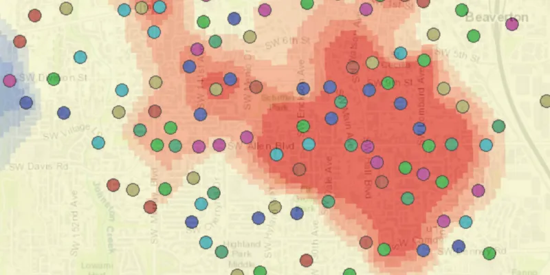
This tool identifies statistically significant spatial clusters of high values (hot spots) and low values (cold spots). For example, a hotspot analysis based on the frequency of 911 calls within a set region.
How to use the sample
Select a date range (between 1998-01-01 and 1998-05-31) from the dialog and click “Analyze Hotspots”. The results will be shown on the map upon successful completion of the geoprocessing job.
How it works
- Create a
GeoprocessingTaskwith the URL set to the endpoint of a geoprocessing service. - Create a query string with the date range as an input of
GeoprocessingParameters. - Use the
GeoprocessingTaskto create aGeoprocessingJobwith theGeoprocessingParametersinstance. - Start the
GeoprocessingJoband wait for it to complete and return aGeoprocessingResult. - Get the resulting
ArcGISMapImageLayerusingGeoprocessingResult.getMapImageLayer(). - Add the layer to the map’s operational layers.
Relevant API
- GeoprocessingJob
- GeoprocessingParameters
- GeoprocessingResult
- GeoprocessingTask
Tags
analysis, density, geoprocessing, hot spots, hotspots
Sample code
AnalyzeHotspotsSample.java
/* * Copyright 2018 Esri. * * Licensed under the Apache License, Version 2.0 (the "License"); you may not * use this file except in compliance with the License. You may obtain a copy of * the License at * * http://www.apache.org/licenses/LICENSE-2.0 * * Unless required by applicable law or agreed to in writing, software * distributed under the License is distributed on an "AS IS" BASIS, WITHOUT * WARRANTIES OR CONDITIONS OF ANY KIND, either express or implied. See the * License for the specific language governing permissions and limitations under * the License. */
package com.esri.samples.analyze_hotspots;
import java.sql.Timestamp;import java.text.SimpleDateFormat;import java.time.LocalDate;import java.util.concurrent.ExecutionException;
import javafx.application.Application;import javafx.geometry.Insets;import javafx.geometry.Pos;import javafx.scene.Scene;import javafx.scene.control.Alert;import javafx.scene.control.Alert.AlertType;import javafx.scene.control.Button;import javafx.scene.control.DatePicker;import javafx.scene.control.ProgressIndicator;import javafx.scene.layout.Background;import javafx.scene.layout.BackgroundFill;import javafx.scene.layout.CornerRadii;import javafx.scene.layout.StackPane;import javafx.scene.layout.VBox;import javafx.scene.paint.Paint;import javafx.stage.Stage;
import com.esri.arcgisruntime.ArcGISRuntimeEnvironment;import com.esri.arcgisruntime.concurrent.Job;import com.esri.arcgisruntime.concurrent.ListenableFuture;import com.esri.arcgisruntime.geometry.Point;import com.esri.arcgisruntime.geometry.SpatialReferences;import com.esri.arcgisruntime.layers.ArcGISMapImageLayer;import com.esri.arcgisruntime.loadable.LoadStatus;import com.esri.arcgisruntime.mapping.ArcGISMap;import com.esri.arcgisruntime.mapping.BasemapStyle;import com.esri.arcgisruntime.mapping.Viewpoint;import com.esri.arcgisruntime.mapping.view.MapView;import com.esri.arcgisruntime.tasks.geoprocessing.GeoprocessingJob;import com.esri.arcgisruntime.tasks.geoprocessing.GeoprocessingParameters;import com.esri.arcgisruntime.tasks.geoprocessing.GeoprocessingResult;import com.esri.arcgisruntime.tasks.geoprocessing.GeoprocessingString;import com.esri.arcgisruntime.tasks.geoprocessing.GeoprocessingTask;
public class AnalyzeHotspotsSample extends Application {
  private MapView mapView;  private DatePicker begDatePicker;  private DatePicker endDatePicker;  private GeoprocessingJob geoprocessingJob;  private GeoprocessingTask geoprocessingTask; // keep loadable in scope to avoid garbage collection
  @Override  public void start(Stage stage) {
    try {      // create stack pane and application scene      StackPane stackPane = new StackPane();      Scene scene = new Scene(stackPane);
      // set title, size, and add scene to stage      stage.setTitle("Analyze Hotspots Sample");      stage.setWidth(800);      stage.setHeight(700);      stage.setScene(scene);      stage.show();
      // authentication with an API key or named user is required to access basemaps and other location services      String yourAPIKey = System.getProperty("apiKey");      ArcGISRuntimeEnvironment.setApiKey(yourAPIKey);
      // create a map with the topographic basemap style      ArcGISMap map = new ArcGISMap(BasemapStyle.ARCGIS_TOPOGRAPHIC);
      // create a map view and set the map to it      mapView = new MapView();      mapView.setMap(map);
      // set a viewpoint on the map view      mapView.setViewpoint(new Viewpoint(new Point(-13671170, 5693633, SpatialReferences.getWebMercator()), 57779));
      // show progress indicator when geoprocessing task is loading or geoprocessing job is running      ProgressIndicator progress = new ProgressIndicator(ProgressIndicator.INDETERMINATE_PROGRESS);      progress.setMaxWidth(30);
      // create date pickers to choose the date range, initialize with the min & max dates      SimpleDateFormat dateFormat = new SimpleDateFormat("yyyy-MM-dd HH:mm:ss");      Timestamp minDate = Timestamp.valueOf("1998-01-01 00:00:00");      Timestamp maxDate = Timestamp.valueOf("1998-05-31 00:00:00");      LocalDate minLocalDate = minDate.toLocalDateTime().toLocalDate();      LocalDate maxLocalDate = maxDate.toLocalDateTime().toLocalDate();      begDatePicker = new DatePicker(minLocalDate);      endDatePicker = new DatePicker(maxLocalDate);      setUpDatePickerUI();
      // create a button to create and start the geoprocessing job, disable until geoprocessing task is loaded      Button analyzeButton = new Button("Analyze Hotspots");      analyzeButton.setDisable(true);
      VBox controlsVBox = new VBox(6);      controlsVBox.setBackground(new Background(new BackgroundFill(Paint.valueOf("rgba(0,0,0,0.3)"), CornerRadii.EMPTY,          Insets.EMPTY)));      controlsVBox.setPadding(new Insets(10.0));      controlsVBox.setMaxSize(180, 110);      controlsVBox.getChildren().addAll(begDatePicker, endDatePicker, analyzeButton);
      // add the map view, controls, and progress indicator to the stack pane      stackPane.getChildren().addAll(mapView, controlsVBox, progress);      StackPane.setAlignment(progress, Pos.CENTER);      StackPane.setAlignment(controlsVBox, Pos.TOP_LEFT);      StackPane.setMargin(controlsVBox, new Insets(10, 0, 0, 10));
      // create the geoprocessing task with the service URL and load it      geoprocessingTask = new GeoprocessingTask("https://sampleserver6.arcgisonline.com/arcgis/rest/services/911CallsHotspot/GPServer/911%20Calls%20Hotspot");      geoprocessingTask.loadAsync();
      geoprocessingTask.addDoneLoadingListener(() -> {        if (geoprocessingTask.getLoadStatus() == LoadStatus.LOADED) {          // hide the progress when the geoprocessing task is done loading and enable the button          progress.setVisible(false);          analyzeButton.setDisable(false);
          analyzeButton.setOnAction(e -> {            // clear any previous results, and show the progress indicator until the job is complete            map.getOperationalLayers().clear();            progress.setVisible(true);
            // get the task's default geoprocessing parameters            ListenableFuture<GeoprocessingParameters> defaultParameters = geoprocessingTask.createDefaultParametersAsync();            defaultParameters.addDoneListener(() -> {              try {                GeoprocessingParameters parameters = defaultParameters.get();
                // get timestamps from the datepickers                Timestamp beg = Timestamp.valueOf(begDatePicker.getValue().atStartOfDay());                Timestamp end = Timestamp.valueOf(endDatePicker.getValue().atStartOfDay());
                // check that the timestamps are in the valid range for the data                if (beg.getTime() >= minDate.getTime() && beg.getTime() <= maxDate.getTime() && end.getTime() >=                    minDate.getTime() && end.getTime() <= maxDate.getTime()) {
                  // add a date range query to the geoprocessing parameters                  String begTimestamp = dateFormat.format(beg);                  String endTimestamp = dateFormat.format(end);                  String query = "(\"DATE\" > date '" + begTimestamp + "' AND \"Date\" < date '" + endTimestamp + "')";                  parameters.getInputs().put("Query", new GeoprocessingString(query));
                  // create a geoprocessing job from the task with the parameters                  geoprocessingJob = geoprocessingTask.createJob(parameters);
                  // start the job and wait for the result                  geoprocessingJob.start();                  geoprocessingJob.addJobDoneListener(() -> {                    if (geoprocessingJob.getStatus() == Job.Status.SUCCEEDED) {                      // get the map image layer from the job's result                      GeoprocessingResult geoprocessingResult = geoprocessingJob.getResult();                      ArcGISMapImageLayer hotSpotLayer = geoprocessingResult.getMapImageLayer();                      // make the layer semi-transparent to reference the basemap streets underneath                      hotSpotLayer.setOpacity(0.7f);                      // add the layer to the map and zoom to it when loaded                      map.getOperationalLayers().add(hotSpotLayer);                      hotSpotLayer.loadAsync();                      hotSpotLayer.addDoneLoadingListener(() -> {                        if (hotSpotLayer.getLoadStatus() == LoadStatus.LOADED) {                          mapView.setViewpointGeometryAsync(hotSpotLayer.getFullExtent());                        } else {                          new Alert(AlertType.ERROR, "Result layer failed to load: " + hotSpotLayer.getLoadError()                              .getMessage()).show();                        }                      });                    } else {                      new Alert(AlertType.ERROR, "Geoprocessing job failed: " + geoprocessingJob.getError().getMessage()).show();                    }                    // hide the progress when the job is complete                    progress.setVisible(false);                    // cancel the job if it's still going and set it to null to re-enable the mouse click listener                    if (geoprocessingJob != null) {                      geoprocessingJob.cancelAsync();                      geoprocessingJob = null;                    }                  });                } else {                  // display alert and reset time range in date pickers                  new Alert(AlertType.ERROR, "Time range must be within " + minLocalDate                    + " and " + maxLocalDate).show();                  progress.setVisible(false);                  begDatePicker.setValue(minLocalDate);                  endDatePicker.setValue(maxLocalDate);                }              } catch (InterruptedException | ExecutionException ex) {                new Alert(AlertType.ERROR, "Error creating default geoprocessing parameters").show();                progress.setVisible(false);              }            });          });        } else {          new Alert(AlertType.ERROR, "Failed to load geoprocessing task").show();          progress.setVisible(false);        }      });    } catch (Exception e) {      // on any error, display the stack trace.      e.printStackTrace();    }  }
  /**   * Handles user interaction with the date picker to ensure the end date time is not earlier than the start date, and that   * the start date is not later than the end date.   */  private void handleDatePickerInteraction() {
    if (begDatePicker.getValue().toEpochDay() > endDatePicker.getValue().toEpochDay()) {      endDatePicker.setValue(begDatePicker.getValue());    }  }
  /**   * Sets up each date picker's prompt text, disables keyboard interaction, and ensures a start date cannot be chosen later   * than the end date, and an end date cannot be chosen earlier than the start date.   */  private void setUpDatePickerUI() {
    begDatePicker.setPromptText("Beg");    endDatePicker.setPromptText("End");    begDatePicker.setOnAction(e -> handleDatePickerInteraction());    endDatePicker.setOnAction(e -> handleDatePickerInteraction());    begDatePicker.getEditor().setDisable(true);    begDatePicker.getEditor().setOpacity(1);    endDatePicker.getEditor().setDisable(true);    endDatePicker.getEditor().setOpacity(1);  }
  /**   * Stops and releases all resources used in application.   */  @Override  public void stop() {
    if (mapView != null) {      mapView.dispose();    }  }
  /**   * Opens and runs application.   *   * @param args arguments passed to this application   */  public static void main(String[] args) {
    Application.launch(args);  }}