Find features in a spatial table related to features in a non-spatial table.
Use case
The non-spatial tables contained by a map service may contain additional information about sublayer features. Such information can be accessed by traversing table relationships defined in the service.
How to use the sample
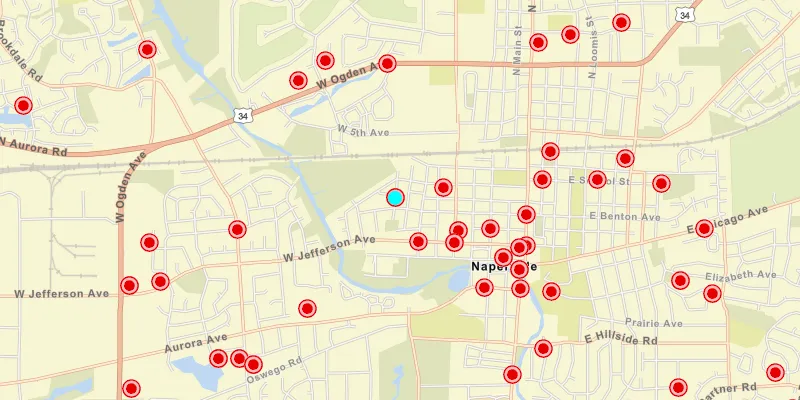
Once the map image layer loads, a list view will be populated with comment data from non-spatial features. Click on one of the comments to query related spatial features and display the first result on the map.
How it works
- Create an
ArcGISMapImageLayerwith the URL of a map image service. - Load the layer and get one of its tables with
imageLayer.getTables().get(index). - To query the table, create a
QueryParametersobject. You can usequeryParameters.setWhereClause(sqlQueryString)to filter the requested features. - Use
table.queryFeaturesAsync(parameters)to get aFeatureQueryResultobject. - The
FeatureQueryResultis an iterable, so simply loop through it to get each resultFeature. - To query for related features, get the table’s relationship info with
table.getLayerInfo().getRelationshipInfos(). This returns a list ofRelationshipInfoobjects. Choose which one to base your query on. - Now create
RelatedQueryParameterspassing in theRelationshipInfo. To query related features, usetable.queryRelatedFeaturesAsync(feature, relatedQueryParameters). - This returns a list of
RelatedFeatureQueryResultobjects, each containing a set of related features.
Relevant API
- ArcGISFeature
- ArcGISMapImageLayer
- Feature
- FeatureQueryResult
- QueryParameters
- RelatedFeatureQueryResult
- RelatedQueryParameters
- RelationshipInfo
- ServiceFeatureTable
Additional information
You can use ArcGISMapImageLayer.loadTablesAndLayersAsync() to recursively load all sublayers and tables associated with a map image layer.
Tags
features, query, related features, search
Sample code
MapImageLayerTablesSample.java
/* * Copyright 2018 Esri. * * Licensed under the Apache License, Version 2.0 (the "License"); you may not * use this file except in compliance with the License. You may obtain a copy of * the License at * * http://www.apache.org/licenses/LICENSE-2.0 * * Unless required by applicable law or agreed to in writing, software * distributed under the License is distributed on an "AS IS" BASIS, WITHOUT * WARRANTIES OR CONDITIONS OF ANY KIND, either express or implied. See the * License for the specific language governing permissions and limitations under * the License. */
package com.esri.samples.map_image_layer_tables;
import java.util.List;import java.util.concurrent.ExecutionException;
import javafx.application.Application;import javafx.geometry.Insets;import javafx.geometry.Pos;import javafx.scene.Scene;import javafx.scene.control.Alert;import javafx.scene.control.ListCell;import javafx.scene.control.ListView;import javafx.scene.layout.StackPane;import javafx.scene.paint.Color;import javafx.stage.Stage;
import com.esri.arcgisruntime.ArcGISRuntimeEnvironment;import com.esri.arcgisruntime.arcgisservices.RelationshipInfo;import com.esri.arcgisruntime.concurrent.ListenableFuture;import com.esri.arcgisruntime.data.ArcGISFeature;import com.esri.arcgisruntime.data.Feature;import com.esri.arcgisruntime.data.FeatureQueryResult;import com.esri.arcgisruntime.data.QueryParameters;import com.esri.arcgisruntime.data.RelatedFeatureQueryResult;import com.esri.arcgisruntime.data.RelatedQueryParameters;import com.esri.arcgisruntime.data.ServiceFeatureTable;import com.esri.arcgisruntime.geometry.Point;import com.esri.arcgisruntime.layers.ArcGISMapImageLayer;import com.esri.arcgisruntime.loadable.LoadStatus;import com.esri.arcgisruntime.mapping.ArcGISMap;import com.esri.arcgisruntime.mapping.BasemapStyle;import com.esri.arcgisruntime.mapping.Viewpoint;import com.esri.arcgisruntime.mapping.view.Graphic;import com.esri.arcgisruntime.mapping.view.GraphicsOverlay;import com.esri.arcgisruntime.mapping.view.MapView;import com.esri.arcgisruntime.symbology.SimpleMarkerSymbol;import com.esri.arcgisruntime.symbology.SimpleRenderer;
public class MapImageLayerTablesSample extends Application {
  private MapView mapView;  private GraphicsOverlay graphicsOverlay;  private ServiceFeatureTable commentsTable;  private ListView<Feature> commentsListView;  private ArcGISFeature relatedFeature; // keep loadable in scope to avoid garbage collection
  /**   * Starting point of this application.   *   * @param args arguments to this application.   */  public static void main(String[] args) {
    Application.launch(args);  }
  @Override  public void start(Stage stage) {
    try {      // create a stack pane and application scene      StackPane stackPane = new StackPane();      Scene scene = new Scene(stackPane);      scene.getStylesheets().add(getClass().getResource("/map_image_layer_tables/style.css").toExternalForm());
      // size the stage and add a title      stage.setTitle("Map Image Layer Tables Sample");      stage.setWidth(800);      stage.setHeight(700);      stage.setScene(scene);      stage.show();
      // authentication with an API key or named user is required to access basemaps and other location services      String yourAPIKey = System.getProperty("apiKey");      ArcGISRuntimeEnvironment.setApiKey(yourAPIKey);
      // create a map with the streets basemap style      ArcGISMap map = new ArcGISMap(BasemapStyle.ARCGIS_STREETS);
      // create and add a map image layer to the map's operational layers      // the map image layer contains a feature table with related spatial and non-spatial comment features      ArcGISMapImageLayer imageLayer = new ArcGISMapImageLayer(          "https://sampleserver6.arcgisonline.com/arcgis/rest/services/ServiceRequest/MapServer");      map.getOperationalLayers().add(imageLayer);
      // create a map view and set the map to it      mapView = new MapView();      mapView.setMap(map);
      // create a graphics overlay to show the related spatial features in      graphicsOverlay = new GraphicsOverlay();      mapView.getGraphicsOverlays().add(graphicsOverlay);
      // show the related graphics as cyan circles      SimpleRenderer renderer = new SimpleRenderer();      renderer.setSymbol(new SimpleMarkerSymbol(SimpleMarkerSymbol.Style.CIRCLE, Color.CYAN, 14));      graphicsOverlay.setRenderer(renderer);
      // create a list view to show the non-spatial comment features      commentsListView = new ListView<>();      commentsListView.setMaxSize(200.0, 150.0);      // show the comments attribute of the feature in the list      commentsListView.setCellFactory(listView -> new ListCell<Feature>() {        @Override        protected void updateItem(Feature item, boolean empty) {          super.updateItem(item, empty);          if (item != null) {            ArcGISFeature feature = (ArcGISFeature) item;            setText((String) feature.getAttributes().get("comments"));          }        }      });
      // when a comment is selected, query its related spatial features and show the first result on the map      commentsListView.getSelectionModel().selectedItemProperty().addListener(observable -> showRelatedRequests());
      // when the layer is loaded, get the comment features      imageLayer.addDoneLoadingListener(() -> {        if (imageLayer.getLoadStatus() == LoadStatus.LOADED) {          // zoom to the layer's extent          mapView.setViewpoint(new Viewpoint(imageLayer.getFullExtent()));
          // get the comments feature table          commentsTable = imageLayer.getTables().get(0);
          // create query parameters to get features that have non-empty comments          QueryParameters queryParameters = new QueryParameters();          queryParameters.setWhereClause("requestid <> '' AND comments <> ''");
          // query the comments table for features          ListenableFuture<FeatureQueryResult> featureQuery = commentsTable.queryFeaturesAsync(queryParameters);          featureQuery.addDoneListener(() -> {            try {              // add the returned features to the list view              FeatureQueryResult results = featureQuery.get();              for (Feature f : results) {                commentsListView.getItems().addAll(f);              }            } catch (InterruptedException | ExecutionException ex) {              new Alert(Alert.AlertType.ERROR, "Error querying comment features");            }          });        } else {          new Alert(Alert.AlertType.ERROR, imageLayer.getLoadError().getMessage()).show();        }      });
      // add the map view and list view to the stack pane      stackPane.getChildren().addAll(mapView, commentsListView);      StackPane.setAlignment(commentsListView, Pos.TOP_LEFT);      StackPane.setMargin(commentsListView, new Insets(10, 0, 0, 10));
    } catch (Exception e) {      // on any error, display the stack trace.      e.printStackTrace();    }  }
  /**   * Queries for spatial features related to the selected comment in the list view and shows the first result on the   * map as a graphic.   */  private void showRelatedRequests() {    // clear any previous results    graphicsOverlay.getGraphics().clear();
    // get the selected comment feature from the list view    Feature selectedCommentFeature = commentsListView.getSelectionModel().getSelectedItem();    if (selectedCommentFeature != null) {
      // get the relationships info between layers in the table      ArcGISFeature feature = (ArcGISFeature) selectedCommentFeature;      List<RelationshipInfo> relationshipInfos = commentsTable.getLayerInfo().getRelationshipInfos();      if (!relationshipInfos.isEmpty()) {
        // use the first relationship for the related query parameters        RelationshipInfo commentsRelationshipInfo = relationshipInfos.get(0);        RelatedQueryParameters relatedQueryParameters = new RelatedQueryParameters(commentsRelationshipInfo);        relatedQueryParameters.setReturnGeometry(true);
        // query the table for related features using the parameters        ListenableFuture<List<RelatedFeatureQueryResult>> relatedFeaturesRequest = commentsTable            .queryRelatedFeaturesAsync(feature, relatedQueryParameters);        relatedFeaturesRequest.addDoneListener(() -> {          try {            // loop through the returned related features            List<RelatedFeatureQueryResult> results = relatedFeaturesRequest.get();            if (!results.isEmpty()) {              RelatedFeatureQueryResult relatedResult = results.get(0);              if (relatedResult.iterator().hasNext()) {                // get the first related feature                relatedFeature = (ArcGISFeature) relatedResult.iterator().next();                // load the feature and get its geometry to show as a graphic on the map                relatedFeature.loadAsync();                relatedFeature.addDoneLoadingListener(() -> {                  if (relatedFeature.getLoadStatus() == LoadStatus.LOADED) {                    Point point = (Point) relatedFeature.getGeometry();                    Graphic graphic = new Graphic(point);                    graphicsOverlay.getGraphics().add(graphic);                    // zoom to the graphic                    mapView.setViewpointCenterAsync(point, 40000);                  }                });              }            } else {              new Alert(Alert.AlertType.INFORMATION, "No related features found").show();            }          } catch (InterruptedException | ExecutionException ex) {            new Alert(Alert.AlertType.ERROR, "Failed to query relationships").show();          }        });      }    }
  }
  @Override  public void stop() {
    // releases resources when the application closes    if (mapView != null) {      mapView.dispose();    }  }}