Find the location for an address.
Use case
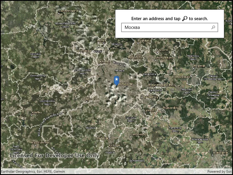
A user can input a raw address into your app’s search bar and zoom to the address location.
How to use the sample
For simplicity, the sample comes loaded with a set of suggested addresses. Choose an address from the suggestions or submit your own address to show its location on the map in a callout.
How it works
- Create a
LocatorTaskusing the URL to a locator service. - Set the
GeocodeParametersfor the locator task and specify the geocode’s attributes. - Get the matching results from the
GeocodeResultusinglocatorTask.GeocodeAsync(addressString, geocodeParameters). - Create a
Graphicwith the geocode result’s location and store the geocode result’s attributes in the graphic’s attributes. - Show the graphic in a
GraphicsOverlay.
Relevant API
- GeocodeParameters
- GeocodeResult
- LocatorTask
Additional information
This sample uses the World Geocoding Service. For more information, see the Geocoding service help topic on the ArcGIS Developer website.
Tags
address, geocode, locator, search
Sample code
// Copyright 2017 Esri.//// Licensed under the Apache License, Version 2.0 (the "License"); you may not use this file except in compliance with the License.// You may obtain a copy of the License at: http://www.apache.org/licenses/LICENSE-2.0//// Unless required by applicable law or agreed to in writing, software distributed under the License is distributed on an// "AS IS" BASIS, WITHOUT WARRANTIES OR CONDITIONS OF ANY KIND, either express or implied. See the License for the specific// language governing permissions and limitations under the License.
using ArcGIS.Samples.Shared.Managers;using Esri.ArcGISRuntime.Data;using Esri.ArcGISRuntime.Geometry;using Esri.ArcGISRuntime.Mapping;using Esri.ArcGISRuntime.Symbology;using Esri.ArcGISRuntime.Tasks.Geocoding;using Esri.ArcGISRuntime.UI;using Esri.ArcGISRuntime.UI.Controls;using Microsoft.UI.Xaml.Controls;using System;using System.Collections.Generic;using System.IO;using System.Linq;using System.Reflection;using System.Threading.Tasks;
namespace ArcGIS.WinUI.Samples.FindAddress{    [ArcGIS.Samples.Shared.Attributes.Sample(        name: "Find address",        category: "Search",        description: "Find the location for an address.",        instructions: "For simplicity, the sample comes loaded with a set of suggested addresses. Choose an address from the suggestions or submit your own address to show its location on the map in a callout.",        tags: new[] { "address", "geocode", "locator", "search" })]    [ArcGIS.Samples.Shared.Attributes.EmbeddedResource(@"PictureMarkerSymbols\pin_star_blue.png")]    public partial class FindAddress    {        // Addresses for suggestion.        private readonly string[] _addresses =        {            "277 N Avenida Caballeros, Palm Springs, CA",            "380 New York St, Redlands, CA 92373",            "Београд",            "Москва",            "北京"        };
        // The LocatorTask provides geocoding services.        private LocatorTask _geocoder;
        // Service Uri to be provided to the LocatorTask (geocoder).        private readonly Uri _serviceUri =            new Uri("https://geocode-api.arcgis.com/arcgis/rest/services/World/GeocodeServer");
        public FindAddress()        {            InitializeComponent();
            // Setup the control references and execute initialization.            _ = Initialize();        }
        private async Task Initialize()        {            if (await ApiKeyManager.CheckKeyValidity() != ApiKeyStatus.Valid)            {                await new MessageDialog2("Please use the settings dialog to configure an API Key.", "Error").ShowAsync();                return;            }
            // Create new Map with basemap.            Map myMap = new Map(BasemapStyle.ArcGISImagery);
            // Enable tap-for-info pattern on results.            MyMapView.GeoViewTapped += MyMapView_GeoViewTapped;
            // Assign the map to the MapView.            MyMapView.Map = myMap;
            try            {                // Initialize the LocatorTask with the provided service Uri.                _geocoder = await LocatorTask.CreateAsync(_serviceUri);
                // Enable UI controls now that the geocoder is ready.                AutoSuggestBox.IsEnabled = true;                AutoSuggestBox.IsSuggestionListOpen = true;            }            catch (Exception e)            {                await new MessageDialog2(e.ToString(), "Error").ShowAsync();            }        }
        private async void UpdateSearch()        {            // Get the text in the search bar.            string enteredText = AutoSuggestBox.Text;
            // Clear existing marker.            MyMapView.GraphicsOverlays.Clear();
            // Return gracefully if the textbox is empty or the geocoder isn't ready.            if (string.IsNullOrWhiteSpace(enteredText) || _geocoder == null)            {                return;            }
            try            {                // Get suggestions based on the input text.                IReadOnlyList<SuggestResult> suggestions = await _geocoder.SuggestAsync(enteredText);
                // Stop gracefully if there are no suggestions.                if (suggestions.Count < 1)                {                    return;                }
                // Get the full address for the first suggestion.                SuggestResult firstSuggestion = suggestions[0];                IReadOnlyList<GeocodeResult> addresses = await _geocoder.GeocodeAsync(firstSuggestion.Label);
                // Stop gracefully if the geocoder does not return a result.                if (addresses.Count < 1)                {                    return;                }
                // Place a marker on the map - 1. Create the overlay.                GraphicsOverlay resultOverlay = new GraphicsOverlay();                // 2. Get the Graphic to display.                Graphic point = await GraphicForPoint(addresses.First().DisplayLocation);                // 3. Add the Graphic to the GraphicsOverlay.                resultOverlay.Graphics.Add(point);                // 4. Add the GraphicsOverlay to the MapView.                MyMapView.GraphicsOverlays.Add(resultOverlay);
                // Update the map extent to show the marker.                MyMapView.SetViewpoint(new Viewpoint(addresses.First().Extent));            }            catch (Exception e)            {                await new MessageDialog2(e.ToString(), "Error").ShowAsync();            }        }
        /// <summary>        /// Creates and returns a Graphic associated with the given MapPoint.        /// </summary>        private async Task<Graphic> GraphicForPoint(MapPoint point)        {            // Get current assembly that contains the image.            Assembly currentAssembly = GetType().GetTypeInfo().Assembly;
            // Get image as a stream from the resources.            // Picture is defined as EmbeddedResource and DoNotCopy.            Stream resourceStream = currentAssembly.GetManifestResourceStream(                "ArcGIS.WinUI.Viewer.Resources.PictureMarkerSymbols.pin_star_blue.png");
            // Create new symbol using asynchronous factory method from stream.            PictureMarkerSymbol pinSymbol = await PictureMarkerSymbol.CreateAsync(resourceStream);            pinSymbol.Width = 60;            pinSymbol.Height = 60;            // The image is a pin; offset the image so that the pinpoint            //     is on the point rather than the image's true center.            pinSymbol.LeaderOffsetX = 30;            pinSymbol.OffsetY = 14;            return new Graphic(point, pinSymbol);        }
        /// <summary>        /// Handle tap event on the map; displays callouts showing the address for a tapped search result.        /// </summary>        private async void MyMapView_GeoViewTapped(object sender, GeoViewInputEventArgs e)        {            try            {                // Search for the graphics underneath the user's tap.                IReadOnlyList<IdentifyGraphicsOverlayResult> results =                    await MyMapView.IdentifyGraphicsOverlaysAsync(e.Position, 12, false);
                // Return gracefully if there was no result.                if (results.Count < 1 || results[0].Graphics.Count < 1)                {                    return;                }
                // Reverse geocode to get addresses.                IReadOnlyList<GeocodeResult> addresses = await _geocoder.ReverseGeocodeAsync(e.Location);
                // Get the first result.                GeocodeResult address = addresses.First();                // Use the city and region for the Callout Title.                string calloutTitle = address.Attributes["City"] + ", " + address.Attributes["Region"];                // Use the metro area for the Callout Detail.                string calloutDetail = address.Attributes["MetroArea"].ToString();
                // Define the callout.                CalloutDefinition calloutBody = new CalloutDefinition(calloutTitle, calloutDetail);
                // Show the callout on the map at the tapped location.                MyMapView.ShowCalloutAt(e.Location, calloutBody);            }            catch (Exception ex)            {                await new MessageDialog2(ex.ToString(), "Error").ShowAsync();            }        }
        private void Search_Submitted(AutoSuggestBox sender, AutoSuggestBoxQuerySubmittedEventArgs args)        {            UpdateSearch();        }
private void AutoSuggestBox_OnSuggestionChosen(AutoSuggestBox sender, AutoSuggestBoxSuggestionChosenEventArgs args) { AutoSuggestBox.Text = args.SelectedItem.ToString(); UpdateSearch(); } }}<UserControl x:Class="ArcGIS.WinUI.Samples.FindAddress.FindAddress" xmlns="http://schemas.microsoft.com/winfx/2006/xaml/presentation" xmlns:x="http://schemas.microsoft.com/winfx/2006/xaml" xmlns:esriUI="using:Esri.ArcGISRuntime.UI.Controls"> <Grid> <esriUI:MapView x:Name="MyMapView" /> <Border Style="{StaticResource BorderStyle}"> <StackPanel> <TextBlock FontWeight="SemiBold" IsColorFontEnabled="False" Text="Enter an address and tap 🔎 to search." TextAlignment="Center" /> <AutoSuggestBox x:Name="AutoSuggestBox" Margin="0,5,0,0" HorizontalAlignment="Stretch" IsEnabled="False" ItemsSource="{x:Bind _addresses}" QueryIcon="Find" QuerySubmitted="Search_Submitted" SuggestionChosen="AutoSuggestBox_OnSuggestionChosen" /> </StackPanel> </Border> </Grid></UserControl>