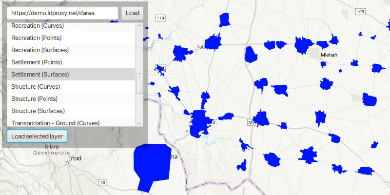
Browse an OGC API feature service for layers and add them to the map.
Use case
OGC API standards are used for sharing geospatial data on the web. As an open standard, the OGC API aims to improve access to geospatial or location information and could be a good choice for sharing data internationally or between organizations. That data could be of any type, including, for example, transportation layers shared between government organizations and private businesses.
How to use the sample
Select a layer to display from the list of layers shown in an OGC API feature service.
How it works
- Create an
OgcFeatureServicewith a URL to an OGC API feature service, and load it. - Obtain the
OgcFeatureServiceInfowithogcFeatureService.getServiceInfo(). - Create a list of feature collections from the OGC feature service information with
.getFeatureCollectionInfos(). - When a feature collection is selected, create an
OgcFeatureCollectionTablefrom theOgcFeatureCollectionInfo. - Populate the
OgcFeatureCollectionTableusing.populateFromServiceAsync()withQueryParameters. - Create a
FeatureLayerfrom the feature collection table. - Add the feature layer to the
ArcGISMap.
Relevant API
- OgcFeatureCollectionInfo
- OgcFeatureCollectionTable
- OgcFeatureService
- OgcFeatureServiceInfo
About the data
The Daraa, Syria test data is OpenStreetMap data converted to the Topographic Data Store schema of NGA.
Additional information
See the OGC API website for more information on the OGC API family of standards.
Tags
browse, catalog, feature, layers, OGC, OGC API, service, web
Sample code
/* * Copyright 2021 Esri. * * Licensed under the Apache License, Version 2.0 (the "License"); you may not * use this file except in compliance with the License. You may obtain a copy of * the License at * * http://www.apache.org/licenses/LICENSE-2.0 * * Unless required by applicable law or agreed to in writing, software * distributed under the License is distributed on an "AS IS" BASIS, WITHOUT * WARRANTIES OR CONDITIONS OF ANY KIND, either express or implied. See the * License for the specific language governing permissions and limitations under * the License. */
package com.esri.samples.browse_ogc_api_feature_service;
import java.util.List;
import com.esri.arcgisruntime.ArcGISRuntimeEnvironment;import com.esri.arcgisruntime.concurrent.ListenableFuture;import com.esri.arcgisruntime.data.FeatureQueryResult;import com.esri.arcgisruntime.data.OgcFeatureCollectionTable;import com.esri.arcgisruntime.data.QueryParameters;import com.esri.arcgisruntime.data.ServiceFeatureTable;import com.esri.arcgisruntime.geometry.Envelope;import com.esri.arcgisruntime.layers.FeatureLayer;import com.esri.arcgisruntime.layers.OgcFeatureCollectionInfo;import com.esri.arcgisruntime.layers.OgcFeatureService;import com.esri.arcgisruntime.layers.OgcFeatureServiceInfo;import com.esri.arcgisruntime.loadable.LoadStatus;import com.esri.arcgisruntime.mapping.ArcGISMap;import com.esri.arcgisruntime.mapping.BasemapStyle;import com.esri.arcgisruntime.mapping.view.MapView;import com.esri.arcgisruntime.symbology.SimpleFillSymbol;import com.esri.arcgisruntime.symbology.SimpleLineSymbol;import com.esri.arcgisruntime.symbology.SimpleMarkerSymbol;import com.esri.arcgisruntime.symbology.SimpleRenderer;
import javafx.application.Application;import javafx.geometry.Insets;import javafx.geometry.Pos;import javafx.scene.Scene;import javafx.scene.control.Alert;import javafx.scene.control.Button;import javafx.scene.control.ListCell;import javafx.scene.control.ListView;import javafx.scene.control.ProgressIndicator;import javafx.scene.control.TextField;import javafx.scene.layout.Background;import javafx.scene.layout.BackgroundFill;import javafx.scene.layout.CornerRadii;import javafx.scene.layout.HBox;import javafx.scene.layout.Priority;import javafx.scene.layout.StackPane;import javafx.scene.layout.VBox;import javafx.scene.paint.Color;import javafx.scene.paint.Paint;import javafx.stage.Stage;
public class BrowseOgcApiFeatureServiceSample extends Application {
  private ArcGISMap map;  private MapView mapView;  private ListView<OgcFeatureCollectionInfo> ogcLayerNamesListView;  private OgcFeatureService ogcFeatureService; // keep loadable in scope to avoid garbage collection
  // UI class variables  private ProgressIndicator progressIndicator;  private TextField textField;  private Button loadButton;  private Button loadSelectedLayerButton;
  @Override  public void start(Stage stage) {
    // create stack pane and JavaFX app scene    StackPane stackPane = new StackPane();    Scene scene = new Scene(stackPane);    scene.getStylesheets().add(getClass().getResource("/browse_ogc_api_feature_service/style.css").toExternalForm());
    // set title, size, and add JavaFX scene to stage    stage.setTitle("Browse OGC API Feature Service");    stage.setWidth(800);    stage.setHeight(700);    stage.setScene(scene);    stage.show();
    // authentication with an API key or named user is required to access basemaps and other location services    String yourAPIKey = System.getProperty("apiKey");    ArcGISRuntimeEnvironment.setApiKey(yourAPIKey);
    // create a progress indicator    progressIndicator = new ProgressIndicator();    progressIndicator.setVisible(false);
    // create a map with the topographic basemap style    map = new ArcGISMap(BasemapStyle.ARCGIS_TOPOGRAPHIC);
    // create a map view and set the map to it    mapView = new MapView();    mapView.setMap(map);
    // add the map view, UI controls, and the progress indicator to the stack pane    stackPane.getChildren().addAll(mapView, uiControlsVBox(), progressIndicator);
    // when the load button is clicked, load the provided OGC API service url    loadButton.setOnAction(e -> loadOgcApiService(textField.getText()));
    // when the load selected layer button is clicked, load the selected layer from the list view    loadSelectedLayerButton.setOnAction(e -> updateMap(ogcLayerNamesListView.getSelectionModel().getSelectedItem()));
  }
  /**   * Loads an OGC feature service from the provided service URL string.   *   * @param serviceUrl the service url of the OGC feature service   */  private void loadOgcApiService(String serviceUrl) {
    // clear any previously loaded OGC layers from the list view, and show the progress indicator    ogcLayerNamesListView.getItems().clear();    progressIndicator.setVisible(true);
    // check if the text box is populated before instantiating and loading a new OGC feature service from the provided URL    if (!textField.getText().isEmpty()) {
      ogcFeatureService = new OgcFeatureService(serviceUrl);      ogcFeatureService.loadAsync();
      // when the feature service has loaded, get a list of its layers and add them to the list view      ogcFeatureService.addDoneLoadingListener(() -> {        if (ogcFeatureService.getLoadStatus() == LoadStatus.LOADED) {
          // hide progress indicator          progressIndicator.setVisible(false);
          // get the service metadata and then a list of available collections          OgcFeatureServiceInfo serviceInfo = ogcFeatureService.getServiceInfo();          List<OgcFeatureCollectionInfo> layerList = serviceInfo.getFeatureCollectionInfos();          ogcLayerNamesListView.getItems().addAll(layerList);
          // populate the list view with layer names          ogcLayerNamesListView.setCellFactory(list -> new ListCell<>() {
            @Override            protected void updateItem(OgcFeatureCollectionInfo ogcFeatureCollectionInfo, boolean bln) {              super.updateItem(ogcFeatureCollectionInfo, bln);              if (ogcFeatureCollectionInfo != null) {                String titleOfOgcFeatureServiceLayer = ogcFeatureCollectionInfo.getTitle();                setText(titleOfOgcFeatureServiceLayer);              }            }          });          // when a layer is selected, enable the load selected layer button          ogcLayerNamesListView.setOnMouseClicked(e -> loadSelectedLayerButton.setDisable(false));
          // if the feature service fails to load, display an error        } else {          new Alert(Alert.AlertType.ERROR, "Failed to load OGC feature service").show();          if (ogcFeatureService.getLoadError() !=  null) {            ogcFeatureService.getLoadError().printStackTrace();          }          textField.clear();          progressIndicator.setVisible(false);        }      });
      // if the text field is blank and the load button is clicked, display an error    } else {      new Alert(Alert.AlertType.ERROR, "Enter a service url to continue").show();      progressIndicator.setVisible(false);    }  }
  /**   * Adds an OGCFeatureCollectionInfo to the map's operational layers.   *   * @param ogcFeatureCollectionInfo the ogcFeatureCollectionInfo that the map will display   */  private void updateMap(OgcFeatureCollectionInfo ogcFeatureCollectionInfo) {
    progressIndicator.setVisible(true);
    // clear the map's operational layers    map.getOperationalLayers().clear();
    // create an OGC feature collection table from the feature collection info    var ogcFeatureCollectionTable = new OgcFeatureCollectionTable(ogcFeatureCollectionInfo);
    // set the feature request mode to manual    // in this mode, the table must be manually populated as panning and zooming won't request features automatically.    ogcFeatureCollectionTable.setFeatureRequestMode(ServiceFeatureTable.FeatureRequestMode.MANUAL_CACHE);
    // create new query parameters    var queryParameters = new QueryParameters();    // set a limit of 1000 on the number of returned features per request, the default on some services could be as low as 10    queryParameters.setMaxFeatures(1000);
    try {      // populate and load the table with the query parameters      // set the clearCache parameter to false to include existing table entries, and set the outfields parameter to null to request all fields      ListenableFuture<FeatureQueryResult> result = ogcFeatureCollectionTable.populateFromServiceAsync(queryParameters, false, null);      result.addDoneListener(() -> progressIndicator.setVisible(false));
    } catch (Exception exception) {      exception.printStackTrace();      new Alert(Alert.AlertType.ERROR, exception.getMessage()).show();    }
    // apply a renderer to the feature layer once the table is loaded (the renderer is based on the table's geometry type)    ogcFeatureCollectionTable.addDoneLoadingListener(() -> {
      // create a feature layer to visualize the OGC features      FeatureLayer ogcFeatureLayer = new FeatureLayer(ogcFeatureCollectionTable);
      switch (ogcFeatureCollectionTable.getGeometryType()) {        case POINT:        case MULTIPOINT:          ogcFeatureLayer.setRenderer(new SimpleRenderer(            new SimpleMarkerSymbol(SimpleMarkerSymbol.Style.CIRCLE, Color.BLUE, 5)));          break;        case POLYGON:        case ENVELOPE:          ogcFeatureLayer.setRenderer(new SimpleRenderer(            new SimpleFillSymbol(SimpleFillSymbol.Style.SOLID, Color.BLUE, null)));          break;        case POLYLINE:          ogcFeatureLayer.setRenderer(new SimpleRenderer(            new SimpleLineSymbol(SimpleLineSymbol.Style.SOLID, Color.BLUE, 1)));          break;      }
      // add the layer to the map's operational layers      map.getOperationalLayers().add(ogcFeatureLayer);
      // set the map view's viewpoint to the extent of the layer      Envelope collectionExtent = ogcFeatureLayer.getFullExtent();      if (!collectionExtent.isEmpty()) {        mapView.setViewpointGeometryAsync(collectionExtent, 100);      }    });
  }
  /**   * Sets up the user interaction controls by adding a text field, load button, list view and load selected layer button to a VBox.   *   * @return a VBox containing user interaction controls   */  private VBox uiControlsVBox() {
    // create a control panel    VBox controlsVBox = new VBox(6);    controlsVBox.setBackground(new Background(new BackgroundFill(Paint.valueOf("rgba(0,0,0,0.3)"), CornerRadii.EMPTY,      Insets.EMPTY)));    controlsVBox.setPadding(new Insets(10.0));    controlsVBox.setMaxSize(300, 300);
    // create a text field for entering a service URL, and provide an example service url to start with    textField = new TextField();    textField.setMaxWidth(300);    textField.setText("https://demo.ldproxy.net/daraa");
    // create a button that allows the provided service to be loaded    loadButton = new Button("Load");
    // create a list view to show all of the layers in an OGC API feature service    ogcLayerNamesListView = new ListView<>();    ogcLayerNamesListView.setMaxSize(300, 250);
    // create a button that loads the layer selected in the list    loadSelectedLayerButton = new Button("Load selected layer");    loadSelectedLayerButton.setDisable(true);
    HBox hbox = new HBox(6);    hbox.getChildren().addAll(textField, loadButton);    HBox.setHgrow(textField, Priority.ALWAYS);    controlsVBox.getChildren().addAll(hbox, ogcLayerNamesListView, loadSelectedLayerButton);    StackPane.setAlignment(controlsVBox, Pos.TOP_LEFT);    StackPane.setMargin(controlsVBox, new Insets(10, 0, 0, 10));
    return controlsVBox;
  }
  /**   * Stops and releases all resources used in application.   */  @Override  public void stop() {    if (mapView != null) {      mapView.dispose();    }  }
  /**   * Opens and runs application.   *   * @param args arguments passed to this application   */  public static void main(String[] args) {
    Application.launch(args);  }}