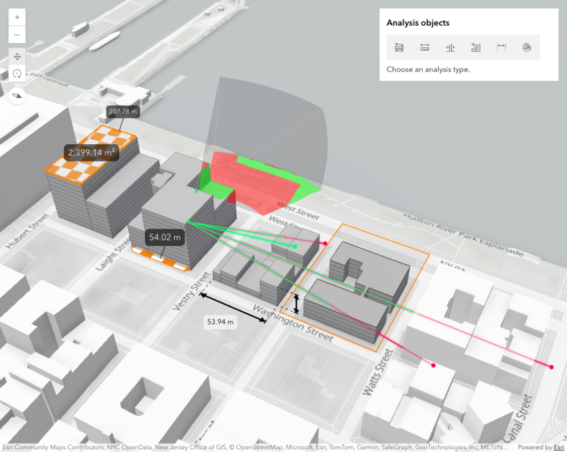
This sample shows how to display area measurements for polygons that are selected by the user. Create and add an AreaMeasurementAnalysis Object to the Scene component. Add a arcgisViewClick event listener to the scene. If the user clicked on a parcel polygon, add the polygon to the geometry property of the AreaMeasurementAnalysis Object.
// create an AreaMeasurement object and add it to the `view.analyses`const areaMeasurementAnalysis = new AreaMeasurementAnalysis();viewElement.analyses.add(areaMeasurementAnalysis);
viewElement.addEventListener("arcgisViewClick", async (event) => {  // remove the current measured geometry from the layer when the user clicks on the map  areaMeasurementAnalysis.geometry = null;  // get results only from the "Parcels" layer  const hitTestResult = await viewElement.hitTest(event.detail, {    include: hitTestLayers,  });  if (hitTestResult.results.length === 0) {    return;  }  const geometry = hitTestResult.results[0].graphic.geometry;  // pass the polygon geometry to the areaMeasurementAnalysis to display a new measurement  areaMeasurementAnalysis.geometry = geometry;  // zoom to the selected geometry  viewElement.goTo(geometry);});
For using the other analysis object see also the sample Analysis objects.