Showcase
Discover how key SDK capabilities combine to create engaging, interactive applications for real-world workflows.

City Download Portal
Export buildings and terrain as a glTF model.
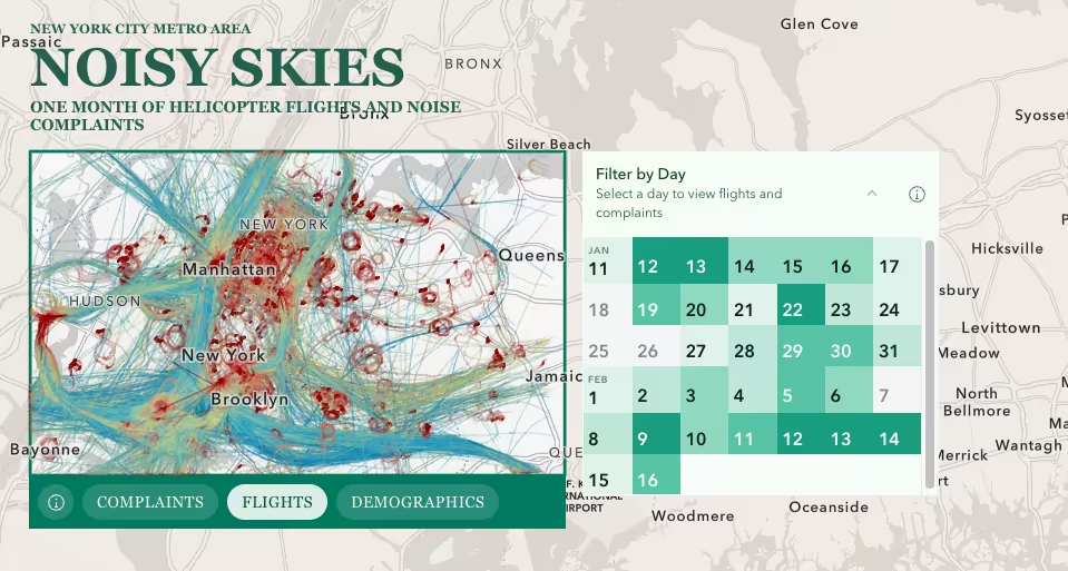
NYC Helicopter Noise Explorer
Mapping one month of helicopter flights and noise complaints across the New York City metro area.
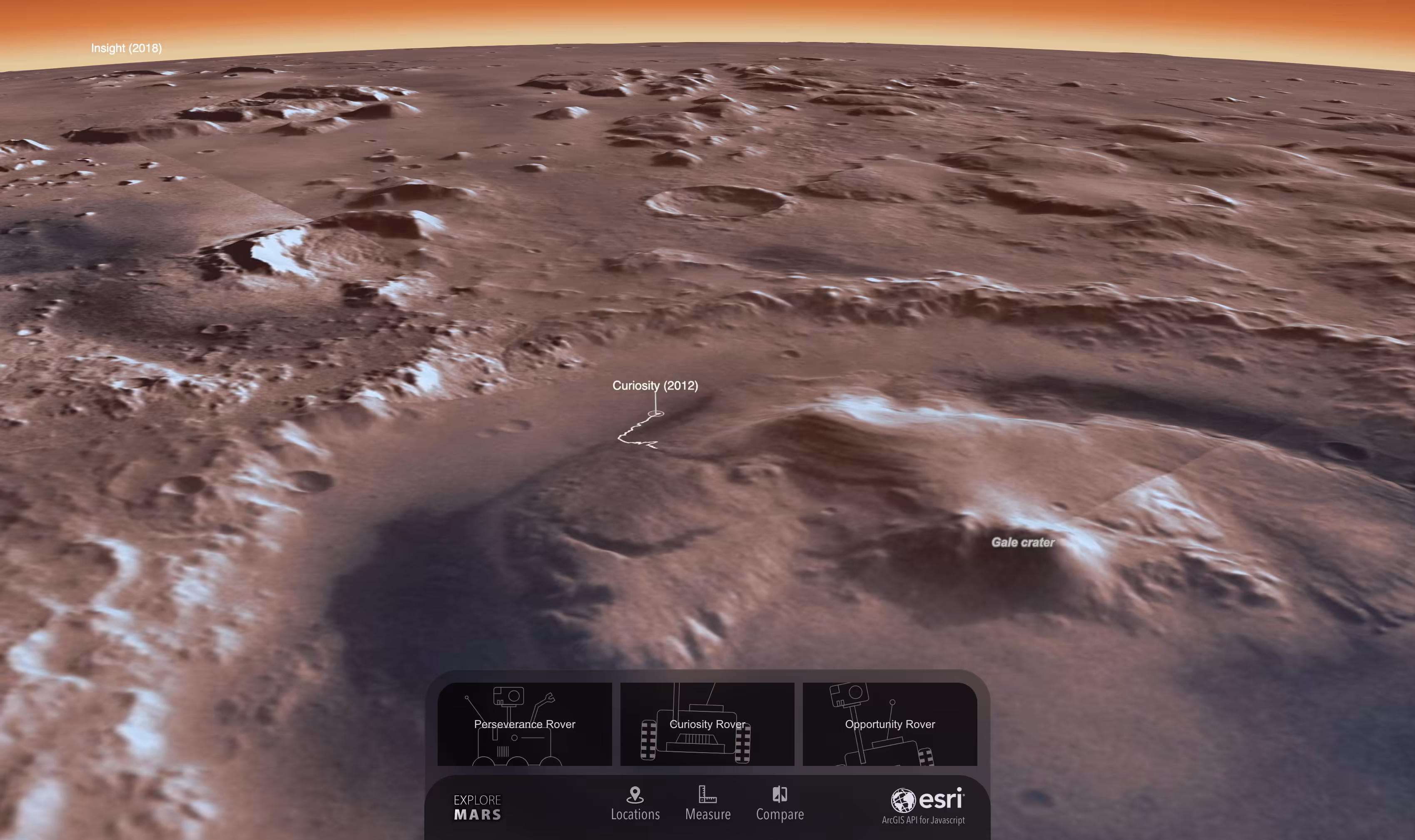
Explore Mars
Explore the Martian surface using a 3D web app.

U.S. Vessel Traffic
Explore U.S. maritime activity, analyze spatial patterns, and download shipping tracks since Jan 2015.
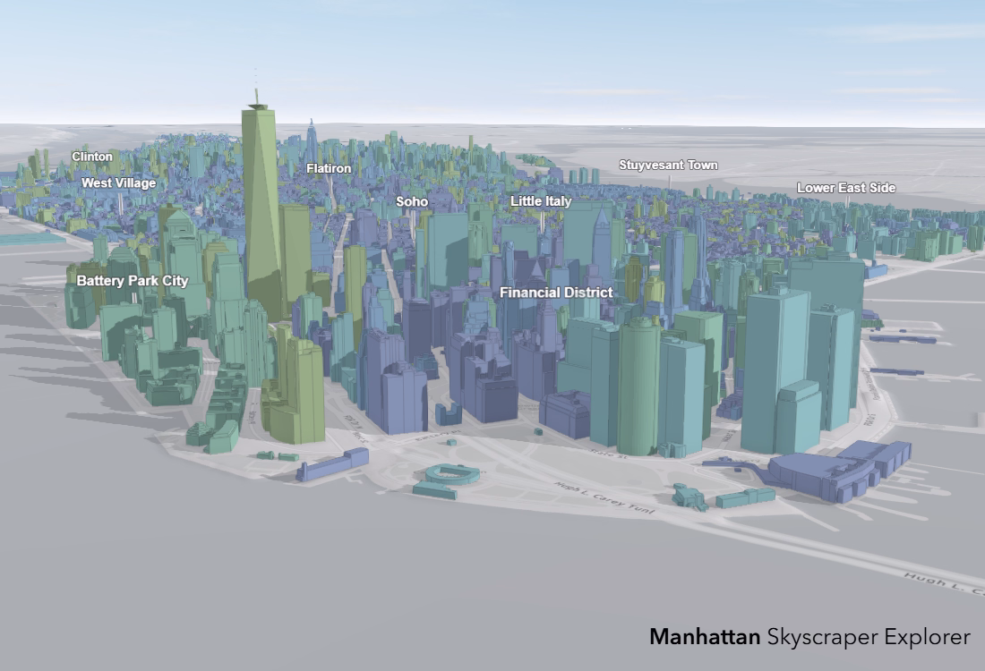
Manhattan Skyscraper Explorer
Explore Manhattan’s tallest buildings in 3D
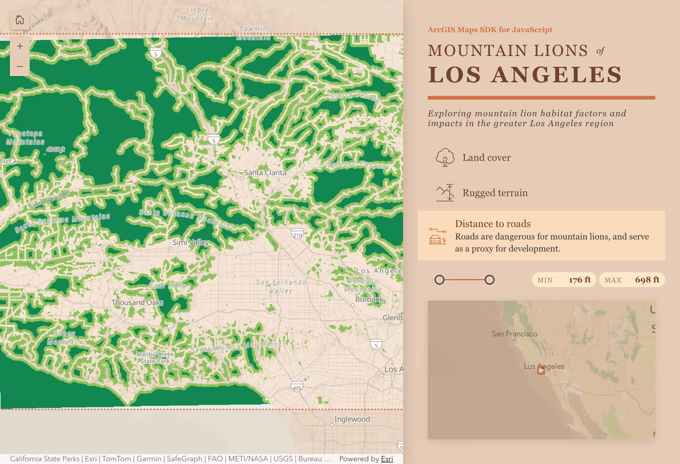
Mountain Lion Habitat Analysis
Analyze mountain lion habitat suitability factors in the greater Los Angeles area.
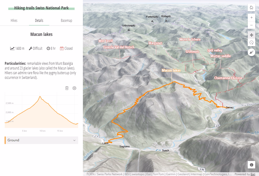
Hike in the Swiss National Park
Select and visualize hiking trails using a 3D web app

Participatory Planning
Create your next neighborhood in 3D
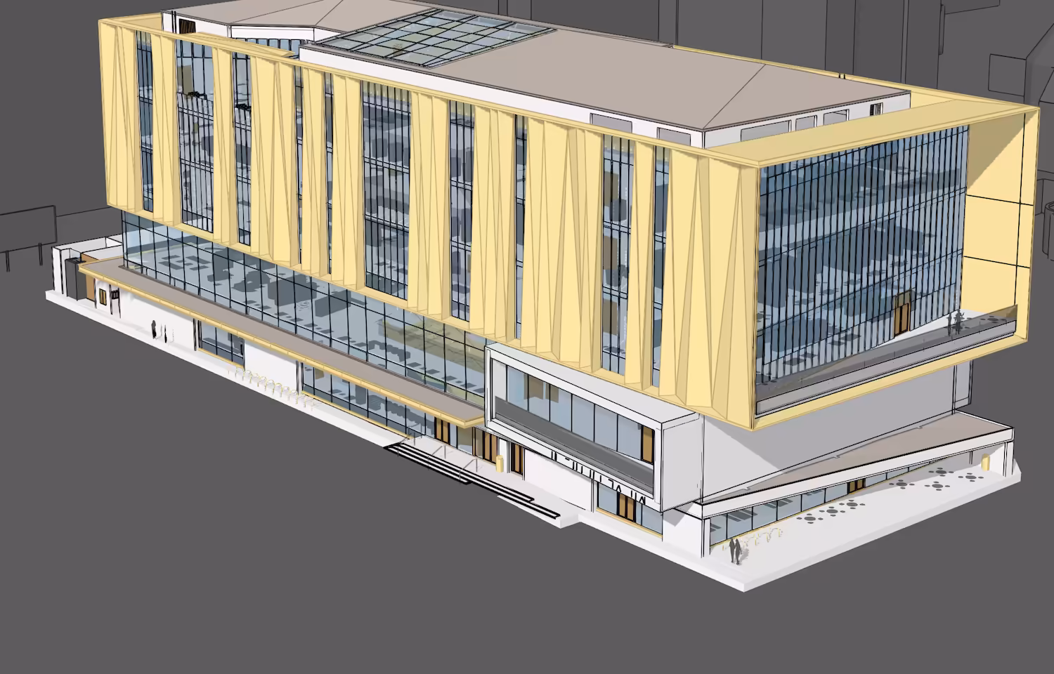
Building Viewer
Create a website that showcases your BIM data