Display a web tiled layer.
Use case
Tiled map services are a set of pre-generated images (e.g. “tiles”) arranged in folders for each row, column, and zoom level. As you navigate the map, map tiles are requested for the current extent. ArcGISTiledLayer and WmtsLayer are types of tiled map services used for specific data types. WebTiledLayer is useful for displaying other data sources that contain tiles arranged in a row/column/level directory structure, such as OpenStreetMap.
How to use the sample
Run the sample and a map will appear. As you navigate the map, map tiles will be fetched automatically and displayed on the map.
How it works
- Create a
WebTiledLayerfrom a URL. - Set the
attributionproperty on the web tiled layer. Note: this is a necessary step because web tiled services don’t have associated service metadata. - Create a new
Basemapfrom the layer and apply it to the mapView for display.
Relevant API
- Basemap
- WebTiledLayer
About the data
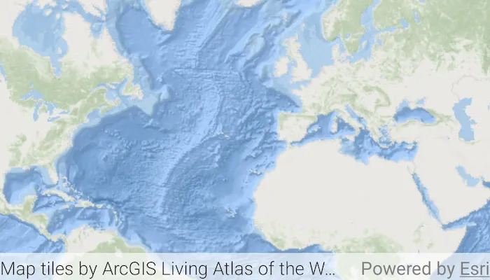
The basemap in this sample is provided by ArcGIS Living Atlas of the World. ArcGIS Living Atlas of the World provides tiled services with several unique styles.
Additional information
Web tiled services use a uniform addressing scheme with pre-rendered tiles. Image tiles are accessed via a URL template string, with parameters for subdomain, level, column, and row.
- Subdomain is optional and allows ArcGIS Maps SDK to balance requests among multiple servers for enhanced performance.
- Level, row, and column select the tiles to load based on the visible extent of the map.
This sample uses the GeoView-Compose Toolkit module to be able to implement a composable MapView.
For more information about web tiled layers, see the following resources:
Tags
arcgis living atlas, geoview-compose, layer, ogc, tiled, tiles, toolkit
Sample code
/* * Copyright 2024 Esri * * Licensed under the Apache License, Version 2.0 (the "License"); * you may not use this file except in compliance with the License. * You may obtain a copy of the License at * *    http://www.apache.org/licenses/LICENSE-2.0 * * Unless required by applicable law or agreed to in writing, software * distributed under the License is distributed on an "AS IS" BASIS, * WITHOUT WARRANTIES OR CONDITIONS OF ANY KIND, either express or implied. * See the License for the specific language governing permissions and * limitations under the License. * */package com.esri.arcgismaps.sample.addwebtiledlayer.components
import android.app.Applicationimport androidx.core.content.ContextCompat.getStringimport androidx.lifecycle.AndroidViewModelimport androidx.lifecycle.viewModelScopeimport com.arcgismaps.mapping.ArcGISMapimport com.arcgismaps.mapping.Basemapimport com.arcgismaps.mapping.layers.WebTiledLayerimport com.esri.arcgismaps.sample.addwebtiledlayer.Rimport com.esri.arcgismaps.sample.sampleslib.components.MessageDialogViewModelimport kotlinx.coroutines.launch
class AddWebTiledLayerViewModel(application: Application) : AndroidViewModel(application) {    // build the web tiled layer from ArcGIS Living Atlas of the World tile service url    private val webTiledLayer = WebTiledLayer.create(        urlTemplate = "https://server.arcgisonline.com/arcgis/rest/services/Ocean/World_Ocean_Base/MapServer/tile/{level}/{row}/{col}.jpg"    ).apply {        // set the attribution on the layer        attribution = getString(application, R.string.living_atlas_attribution)    }
    // use web tiled layer as Basemap    val arcGISMap = ArcGISMap(Basemap(webTiledLayer))
    // create a message dialog view model for handling error messages    val messageDialogVM = MessageDialogViewModel()
    init {        viewModelScope.launch {            arcGISMap.load().onFailure { error ->                messageDialogVM.showMessageDialog(                    "Failed to load map",                    error.message.toString()                )            }        }    }}
/* * Copyright 2024 Esri * * Licensed under the Apache License, Version 2.0 (the "License"); * you may not use this file except in compliance with the License. * You may obtain a copy of the License at * * http://www.apache.org/licenses/LICENSE-2.0 * * Unless required by applicable law or agreed to in writing, software * distributed under the License is distributed on an "AS IS" BASIS, * WITHOUT WARRANTIES OR CONDITIONS OF ANY KIND, either express or implied. * See the License for the specific language governing permissions and * limitations under the License. * */package com.esri.arcgismaps.sample.addwebtiledlayer
import android.os.Bundleimport androidx.activity.ComponentActivityimport androidx.activity.compose.setContentimport androidx.activity.enableEdgeToEdgeimport androidx.compose.material3.MaterialThemeimport androidx.compose.material3.Surfaceimport androidx.compose.runtime.Composableimport com.arcgismaps.ApiKeyimport com.arcgismaps.ArcGISEnvironmentimport com.esri.arcgismaps.sample.addwebtiledlayer.screens.AddWebTiledLayerScreenimport com.esri.arcgismaps.sample.sampleslib.theme.SampleAppTheme
class MainActivity : ComponentActivity() {
override fun onCreate(savedInstanceState: Bundle?) { super.onCreate(savedInstanceState) // authentication with an API key or named user is // required to access basemaps and other location services ArcGISEnvironment.apiKey = ApiKey.create(BuildConfig.ACCESS_TOKEN)
enableEdgeToEdge() setContent { SampleAppTheme { AddWebTiledLayerApp() } } }
@Composable private fun AddWebTiledLayerApp() { Surface(color = MaterialTheme.colorScheme.background) { AddWebTiledLayerScreen( sampleName = getString(R.string.add_web_tiled_layer_app_name) ) } }}/* * Copyright 2024 Esri * * Licensed under the Apache License, Version 2.0 (the "License"); * you may not use this file except in compliance with the License. * You may obtain a copy of the License at * * http://www.apache.org/licenses/LICENSE-2.0 * * Unless required by applicable law or agreed to in writing, software * distributed under the License is distributed on an "AS IS" BASIS, * WITHOUT WARRANTIES OR CONDITIONS OF ANY KIND, either express or implied. * See the License for the specific language governing permissions and * limitations under the License. * */package com.esri.arcgismaps.sample.addwebtiledlayer.screens
import androidx.compose.foundation.layout.Columnimport androidx.compose.foundation.layout.fillMaxSizeimport androidx.compose.foundation.layout.paddingimport androidx.compose.material3.Scaffoldimport androidx.compose.runtime.Composableimport androidx.compose.ui.Modifierimport androidx.lifecycle.viewmodel.compose.viewModelimport com.arcgismaps.toolkit.geoviewcompose.MapViewimport com.esri.arcgismaps.sample.addwebtiledlayer.components.AddWebTiledLayerViewModelimport com.esri.arcgismaps.sample.sampleslib.components.MessageDialogimport com.esri.arcgismaps.sample.sampleslib.components.SampleTopAppBar
/** * Main screen layout for the sample app */@Composablefun AddWebTiledLayerScreen(sampleName: String) { val mapViewModel: AddWebTiledLayerViewModel = viewModel() Scaffold( topBar = { SampleTopAppBar(title = sampleName) }, content = { Column( modifier = Modifier .fillMaxSize() .padding(it), ) { MapView( modifier = Modifier .fillMaxSize() .weight(1f), arcGISMap = mapViewModel.arcGISMap ) }
mapViewModel.messageDialogVM.apply { if (dialogStatus) { MessageDialog( title = messageTitle, description = messageDescription, onDismissRequest = ::dismissDialog ) } } } )}