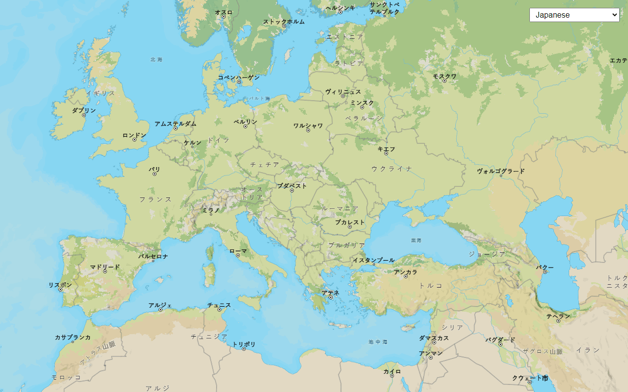
Learn how to show places
The ArcGIS Basemap Styles service
In this tutorial, you set the basemap style preferences to show places using the MapLibre ArcGIS plugin and return place details from the ArcGIS Places service
Prerequisites
You need an ArcGIS Location Platform account.
Steps
Get the starter app
Select a type of authentication and follow the steps to create a new app.
Choose API key authentication if you:
- Want the easiest way to get started.
- Want to build public applications
A public application is an application that allows anonymous access without requiring users to sign in with an ArcGIS account. It supports API key or app authentication. that access ArcGIS Location ServicesArcGIS Location Services, also referred to as Location Services, are services hosted by Esri that provide geospatial functionality for developing mapping applications. They include the ArcGIS Basemap Styles service, ArcGIS Static Basemap Tiles service, ArcGIS Static Maps service, ArcGIS Places service, ArcGIS Geocoding service, ArcGIS Routing service, ArcGIS GeoEnrichment service, and ArcGIS Elevation service. An ArcGIS Location Platform or ArcGIS Online account is required to use the services. and secure itemsAn item, also known as a content item, is a resource stored in a portal such as a web map, hosted layer, style, script tool, file, or notebook. . - Have an ArcGIS Location Platform or ArcGIS Online account.
Choose user authentication if you:
- Want to build private applications.
- Require application users to sign in with their own ArcGIS account
An ArcGIS account is an identity with a user type and set of privileges that can access specific ArcGIS products, tools, APIs, services, and resources. The main account types that can be used for development are an ArcGIS Location Platform account, ArcGIS Online account, and ArcGIS Enterprise account. ArcGIS Location Platform and ArcGIS Online accounts are also associated with a subscription. and access resources their behalf. - Have an ArcGIS Online account.
To learn more about both types of authentication, go to Authentication.
Set up authentication
Set developer credentials
Use the API key or OAuth developer credentials
Display attributed places
The arcgis/navigation style contains a set of places that show up on the map based on the current zoom level and extent. The places displayed can be refined with the places parameter to show all places, no places, or places with attributes. The main attributes returned with the attributed value are name and esri.
-
Update the basemap style to
arcgis/navigationand set style preferences to display places in theBasemapobject.Style Use dark colors for code blocks Copy const map = new maplibregl.Map({ container: "map", zoom: 16, center: [-118.33873, 34.10151] }); const basemapStyle = maplibreArcGIS.BasemapStyle.applyStyle(map, { style: "arcgis/navigation", token: accessToken, preferences: { places: "attributed" } }); -
When the mouse moves, call
queryto list the hovered features. If a hovered feature contains theRendered Features esriattribute, it is a place of interest (POI)._place _id Use dark colors for code blocks const map = new maplibregl.Map({ container: "map", zoom: 16, center: [-118.33873, 34.10151] }); const basemapStyle = maplibreArcGIS.BasemapStyle.applyStyle(map, { style: "arcgis/navigation", token: accessToken, preferences: { places: "attributed" } }); map.once("load", () => { map.on("mousemove", function (e) { const features = map.queryRenderedFeatures(e.point); if (features.length && features[0].properties.esri_place_id) { map.getCanvas().style.cursor = "pointer"; } else { map.getCanvas().style.cursor = ""; } }); }); -
Initialize a
maplibregl.object.Popup Use dark colors for code blocks map.once("load", () => { map.on("mousemove", function (e) { const features = map.queryRenderedFeatures(e.point); if (features.length && features[0].properties.esri_place_id) { map.getCanvas().style.cursor = "pointer"; } else { map.getCanvas().style.cursor = ""; } }); }); const popup = new maplibregl.Popup({ closeButton: true, closeOnClick: false }); popup.setMaxWidth("350"); -
Create a
showfunction that displays information about a place in a popup. When a POI is hovered, callPopup showto display the place name and ID.Popup Use dark colors for code blocks map.once("load", () => { map.on("mousemove", function (e) { const features = map.queryRenderedFeatures(e.point); if (features.length && features[0].properties.esri_place_id) { map.getCanvas().style.cursor = "pointer"; showPopup(features[0]); } else { map.getCanvas().style.cursor = ""; } }); }); const popup = new maplibregl.Popup({ closeButton: true, closeOnClick: false }); popup.setMaxWidth("350"); const showPopup = (feature) => { popup.setLngLat(feature.geometry.coordinates); popup.setHTML(`<b>Name</b>: ${feature.properties._name}</br> <b>Place ID</b>: ${feature.properties.esri_place_id}</br>` ).addTo(map); }; -
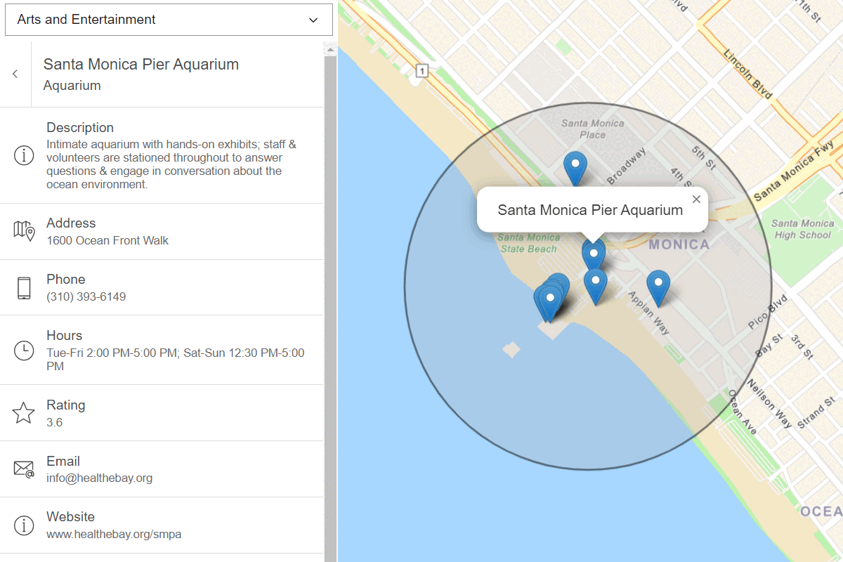
Run the app. You should be able to see places displayed on the basemap. When you hover over them you should see a pop-up containing the place name and ID.
Add script references
Each attributed place contains an esri. You can use the place ID with ArcGIS REST JS to call the Places serviceplace/place operation and additional attributes. Add references to ArcGIS REST JS and Calcite Components to your application.
-
In the
<headelement, add references to the ArcGIS REST JS> requestandplaceslibraries.Use dark colors for code blocks <!-- Load MapLibre GL JS and MapLibre ArcGIS from CDN --> <script type="importmap"> { "imports": { "maplibre-gl": "https://unpkg.com/maplibre-gl@6.12.0/dist/maplibre-gl.mjs", "@esri/maplibre-arcgis": "https://unpkg.com/@esri/maplibre-arcgis@1.3.1/dist/esm/maplibre-arcgis.min.js" } } </script> <link href="https://unpkg.com/maplibre-gl@6.12.0/dist/maplibre-gl.css" rel="stylesheet"> <script src="https://unpkg.com/@esri/arcgis-rest-request@4/dist/bundled/request.umd.js"></script> <script src="https://unpkg.com/@esri/arcgis-rest-places@1/dist/bundled/places.umd.js"></script> -
Add references to the Calcite Components library, which will be used to display results.
Use dark colors for code blocks <!-- Load MapLibre GL JS and MapLibre ArcGIS from CDN --> <script type="importmap"> { "imports": { "maplibre-gl": "https://unpkg.com/maplibre-gl@6.12.0/dist/maplibre-gl.mjs", "@esri/maplibre-arcgis": "https://unpkg.com/@esri/maplibre-arcgis@1.3.1/dist/esm/maplibre-arcgis.min.js" } } </script> <link href="https://unpkg.com/maplibre-gl@6.12.0/dist/maplibre-gl.css" rel="stylesheet"> <script src="https://unpkg.com/@esri/arcgis-rest-request@4/dist/bundled/request.umd.js"></script> <script src="https://unpkg.com/@esri/arcgis-rest-places@1/dist/bundled/places.umd.js"></script> <script type="module" src="https://js.arcgis.com/calcite-components/5.1"></script> -
Create an HTML results panel using the
<calcite-paneland> <calcite-blockelements. This panel will be hidden by default, and display when place details are returned from the Places service> The places service, also known as ArcGIS Places service, is a location service hosted by Esri that can search for businesses and geographic locations around the world and return detailed information about each place. .Use dark colors for code blocks <body> <div id="map"></div> <calcite-panel id="panelPlace" closable hidden> <calcite-block id="addressLabel" class="hide" heading="Address" scale="l" description="" > <calcite-icon scale="m" slot="icon" icon="map-pin"></calcite-icon> </calcite-block> <calcite-block id="phoneLabel" class="hide" heading="Phone" scale="l" description="" > <calcite-icon scale="m" slot="icon" icon="mobile"></calcite-icon> </calcite-block> <calcite-block id="emailLabel" class="hide" heading="Email" scale="l" description="" > <calcite-icon scale="m" slot="icon" icon="email-address"></calcite-icon> <calcite-action slot="control" text="Information"></calcite-action> </calcite-block> <calcite-block id="websiteLabel" class="hide" heading="Website" scale="l" description="" > <calcite-icon scale="m" slot="icon" icon="information"></calcite-icon> <calcite-action slot="control" text="Information"></calcite-action> </calcite-block> <calcite-block id="facebookLabel" class="hide" heading="Facebook" scale="l" description="" > <calcite-icon scale="m" slot="icon" icon="speech-bubble-social"></calcite-icon> <calcite-action slot="control" text="Information"></calcite-action> </calcite-block> <calcite-block id="twitterLabel" class="hide" heading="Twitter" scale="l" description="" > <calcite-icon scale="m" slot="icon" icon="speech-bubbles"></calcite-icon> <calcite-action slot="control" text="Information"></calcite-action> </calcite-block> <calcite-block id="instagramLabel" class="hide" heading="Instagram" scale="l" description="" > <calcite-icon scale="m" slot="icon" icon="camera"></calcite-icon> <calcite-action slot="control" text="Information"></calcite-action> </calcite-block> </calcite-panel> </body> <script type="module"> import * as maplibregl from "maplibre-gl"; import * as maplibreArcGIS from "@esri/maplibre-arcgis"; /* Use for API key authentication */ const accessToken = "YOUR_ACCESS_TOKEN"; // or /* Use for user authentication */ // const session = await arcgisRest.ArcGISIdentityManager.beginOAuth2({ // clientId: "YOUR_CLIENT_ID", // Your client ID from OAuth credentials // redirectUri: "YOUR_REDIRECT_URI", // The redirect URL registered in your OAuth credentials // portal: "https://www.arcgis.com/sharing/rest" // Your portal URL // }) // const accessToken = session.token; const panel = document.getElementById("panelPlace");
Get details on click
When a user clicks on a POI, use the get method from ArcGIS REST JS to request detailed attributes for the selected place and display them in a Calcite panel.
-
When a user clicks on the map, call
query. If a POI feature is clicked, zoom to its location and show the calcite panel.Rendered Features Use dark colors for code blocks map.once("load", () => { map.on("mousemove", function (e) { const features = map.queryRenderedFeatures(e.point); if (features.length && features[0].properties.esri_place_id) { map.getCanvas().style.cursor = "pointer"; showPopup(features[0]); } else { map.getCanvas().style.cursor = ""; } }); map.on("click", function (e) { const features = map.queryRenderedFeatures(e.point); if (features.length && features[0].properties.esri_place_id) { map.flyTo({ center: features[0].geometry.coordinates }); panel.hidden = false; panel.closed = false; } }); }); -
Create a
showfunction that is called when a POI feature is clicked. Use the ArcGIS REST JSPlace Details getmethod to make a request to the Places servicePlace Details The places service, also known as ArcGIS Places service, is a location service hosted by Esri that can search for businesses and geographic locations around the world and return detailed information about each place. using theesriof the selected place._place _id Use dark colors for code blocks map.on("click", function (e) { const features = map.queryRenderedFeatures(e.point); if (features.length && features[0].properties.esri_place_id) { map.flyTo({ center: features[0].geometry.coordinates }); panel.hidden = false; panel.closed = false; showPlaceDetails(features[0]); } }); }); const popup = new maplibregl.Popup({ closeButton: true, closeOnClick: false }); popup.setMaxWidth("350"); const showPopup = (feature) => { popup.setLngLat(feature.geometry.coordinates); popup.setHTML(`<b>Name</b>: ${feature.properties._name}</br> <b>Place ID</b>: ${feature.properties.esri_place_id}</br>` ).addTo(map); }; const showPlaceDetails = (feature) => { const placeID = feature.properties.esri_place_id; arcgisRest .getPlaceDetails({ placeId: placeID, requestedFields: "all", authentication }) }; -
Access the results from the Places service. Style the
<calcite-panelwith the place name and close button logic.> Use dark colors for code blocks const showPlaceDetails = (feature) => { const placeID = feature.properties.esri_place_id; arcgisRest .getPlaceDetails({ placeId: placeID, requestedFields: "all", authentication }) .then((result) => { setPlaceDetails(result.placeDetails); }); }; const setPlaceDetails = (placeDetails) => { panel.setAttribute("heading", placeDetails.name); panel.addEventListener("calcitePanelClose", function () { panel.hidden = true; panel.closed = true; }); }; -
Create a helper function
setthat styles the Calcite HTML. Call the helper function for each relevant field of the current place.Element Properties Use dark colors for code blocks const setPlaceDetails = (placeDetails) => { panel.setAttribute("heading", placeDetails.name); setElementProperties("addressLabel", placeDetails?.address?.streetAddress); setElementProperties("phoneLabel", placeDetails?.contactInfo?.telephone); setElementProperties("emailLabel", placeDetails?.contactInfo?.email); setElementProperties("websiteLabel", placeDetails?.contactInfo?.website?.split("://")[1].split("/")[0]); setElementProperties("facebookLabel", (placeDetails?.socialMedia?.facebookId) ? `www.facebook.com/${placeDetails.socialMedia.facebookId}` : null); setElementProperties("twitterLabel", (placeDetails?.socialMedia?.twitter) ? `www.twitter.com/${placeDetails.socialMedia.twitter}` : null); setElementProperties("instagramLabel", (placeDetails?.socialMedia?.instagram) ? `www.instagram.com/${placeDetails.socialMedia.instagram}` : null); panel.addEventListener("calcitePanelClose", function () { panel.hidden = true; panel.closed = true; }); }; const setElementProperties = (id, validValue) => { const element = document.getElementById(id); if (validValue) { element.classList.remove("hide"); element.description = validValue; } else { element.classList.add("hide"); element.description = ""; } };
Run the app
Run the app.
The map should display thearcgis/navigation basemap styleWhat's next?
Learn how to use additional location services in these tutorials: