Display a basemap centered at an initial location and scale.
Use case
You can set a map’s initial location when you want to highlight a particular feature or area to establish the context.
How to use the sample
When the map loads, note the specific location and scale of the initial map view.
How it works
- Create a
Map, specifying a basemap type, latitude and longitude in WGS84, and a level of detail. - Display the map in a map view.
Relevant API
- BasemapStyle
- Map
- MapView
About the data
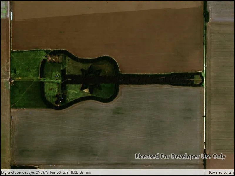
The map opens with satellite imagery of a guitar-shaped field in the Pampas region of north central Argentina.
Tags
basemap, center, envelope, extent, initial, lat, latitude, level of detail, location, LOD, long, longitude, scale, zoom level
Sample code
// Copyright 2016 Esri.//// Licensed under the Apache License, Version 2.0 (the "License"); you may not use this file except in compliance with the License.// You may obtain a copy of the License at: http://www.apache.org/licenses/LICENSE-2.0//// Unless required by applicable law or agreed to in writing, software distributed under the License is distributed on an// "AS IS" BASIS, WITHOUT WARRANTIES OR CONDITIONS OF ANY KIND, either express or implied. See the License for the specific// language governing permissions and limitations under the License.
using Esri.ArcGISRuntime.Mapping;
namespace ArcGIS.WinUI.Samples.SetInitialMapLocation{    [ArcGIS.Samples.Shared.Attributes.Sample(        name: "Set initial map location",        category: "Map",        description: "Display a basemap centered at an initial location and scale.",        instructions: "When the map loads, note the specific location and scale of the initial map view.",        tags: new[] { "LOD", "basemap", "center", "envelope", "extent", "initial", "lat", "latitude", "level of detail", "location", "long", "longitude", "scale", "zoom level" })]    public partial class SetInitialMapLocation    {        public SetInitialMapLocation()        {            InitializeComponent();
            // Create the UI, setup the control references and execute initialization.            Initialize();        }
        private void Initialize()        {            // Create a map with 'Imagery with Labels' basemap and an initial location.            Map myMap = new Map(BasemapStyle.ArcGISImagery);            myMap.InitialViewpoint = new Viewpoint(-33.867886, -63.985, 25000);
// Assign the map to the MapView MyMapView.Map = myMap; } }}<UserControl x:Class="ArcGIS.WinUI.Samples.SetInitialMapLocation.SetInitialMapLocation" xmlns="http://schemas.microsoft.com/winfx/2006/xaml/presentation" xmlns:x="http://schemas.microsoft.com/winfx/2006/xaml" xmlns:esriUI="using:Esri.ArcGISRuntime.UI.Controls"> <Grid> <esriUI:MapView x:Name="MyMapView" /> </Grid></UserControl>