- URL:
- https://<root>/System/RasterAnalysisTools/GPServer/MergeMultidimensionalRasters
- Methods:
GET- Version Introduced:
- 10.9
Description
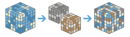
The Merge task combines multiple multidimensional raster datasets spatially or across variables and dimensions.
Request parameters
| Parameter | Details |
|---|---|
(Required) | The list of input multidimensional image service layers to combine. This can be specified as a list of Portal Item IDs, Image Service URLs, cloud multidimensional raster datasets or shared multidimensional raster datasets. Syntax: The JSON object describes the input multidimensional rasters. At least one type of input must be provided in the JSON object. If multiple inputs are given, the itemIds takes priority. Example: |
| The output image service name that will be created. If the image service already exists, the portal item ID or service URL can be provided and the output path of the raster dataset generated in the raster store will be used to update the existing service definition. Otherwise, a new image service will be created. The output hosted image service is stored in the raster store and shared on the image hosting ArcGIS Image Server or the raster analysis ArcGIS Image Server, depending on your configuration. Syntax: A JSON object describes the name of the output or the output raster. Example: |
| Specifies the method used to handle overlapping pixels when merging rasters spatially or dimensionally.
Syntax: String. Example: |
| Contains additional settings that affect task execution. This task has the following settings:
Example: |
| The response format. The default response format is Values: |
Response
When you submit a request, the task assigns a unique job ID for the transaction.
Syntax:
{ "jobId": "<unique job identifier>", "jobStatus": "<job status>" }After the initial request is submitted, you can use the job to periodically check the status of the job and messages, as described in Checking job status. Once the job has successfully completed, use the job to retrieve the results. To track the status, you can make a request of the following form:
https://<analysis-url>/MergeMultidimensionalRasters/jobs/<jobId>When the status of the job request is esri, you can access the results of the analysis by making a request of the following form:
http://<raster analysis url>/MergeMultidimensionalRasters/jobs/<jobId>/results/ outputMultidimensionalRaster?token=<your token>&f=jsonExample usage
Below is a sample request URL for Merge:
https://services.myserver.com/arcgis/rest/services/System/RasterAnalysisTools/ImageServer/MergeMultidimensionalRasters/submitJobJSON Response example
The response returns the output output parameter, which has properties for parameter name, data type, and value. The content of value is always the output raster dataset item and the image service URL.
{
"paramName": "outputMultidimensionalRaster",
"dataType": "GPString",
"value": {
"itemId": "c267610d0feb4370bf38cc6e2c4ac261",
"url": "https://services.myserver.com/arcgis/rest/services/Hosted/<service name>/ImageServer"
}
}