Version 2.4.0 - August, 2026.
This page provides details about enhancements, deprecations, resolved issues, and known issues in the 2.4 release of ArcGIS Maps SDK for Unity.
Enhancements
This section outlines new features and improvements (what's new).
Support for Gaussian splat layers
Support for Gaussian Splat Layers has been added in this release. Gaussian Splat Layers provide a new layer type for visualizing georeferenced Gaussian splat datasets in 3D scenes. Unlike traditional mesh or point cloud representations, Gaussian splats render reality capture data using collections of volumetric primitives that can preserve fine geometric detail, thin structures, vegetation, transparency, and reflective surfaces. Gaussian Splat Layers can be displayed alongside existing ArcGIS layer types and support integration with geospatial workflows that require accurate visualization of reality capture content. Initial support is provided for desktop platforms, with mobile support planned for a future release. For more information, see the Gaussian Splat Layers topic.
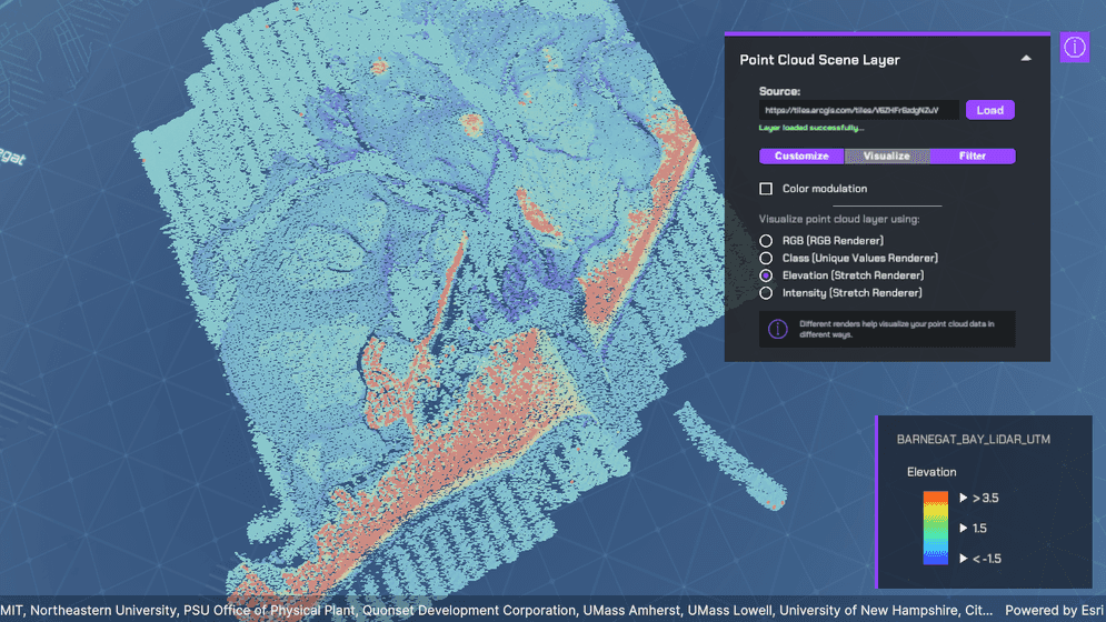
Point cloud layers rendering and filtering
Point Cloud Scene Layers now support rendering and filtering APIs, providing greater control over the visualization of LiDAR and other point cloud datasets in Unity and Unreal Engine applications. Developers can render points using attributes such as RGB values, elevation, intensity, and classification to create meaningful visual representations of their data. Filtering capabilities make it easy to focus on relevant subsets of points, such as ground surfaces, buildings, and vegetation, helping to reduce visual clutter and highlight important features. Additional controls for point size and color modulation further enhance visualization quality, improving readability and supporting more effective exploration and analysis of large-scale 3D point cloud datasets. For more information, see the Point cloud layer rendering and filtering topic and the Point cloud layer rendering and filtering sample.
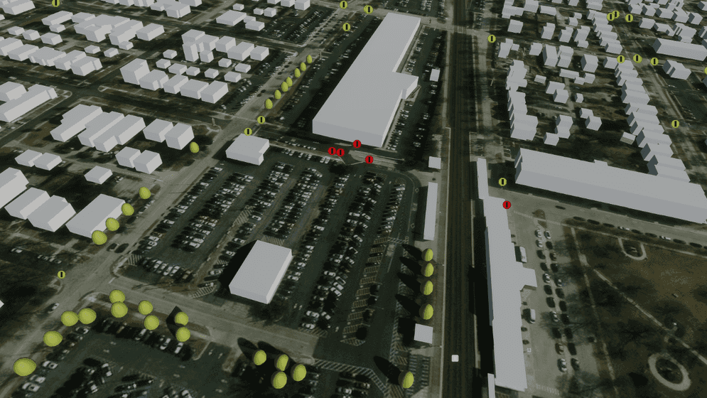
Point scene layers 2D symbology
Point Scene Layers now support 2D marker symbols, expanding the available symbology options beyond the 3D model symbols introduced in the previous release. Developers can visualize point features using billboarded picture and vector markers. Billboarded markers are rotated to "stand up" and always face toward you (toward the "camera") when you navigate through a scene. With support for these additional symbol types in simple, unique value, and class break renderers, Point scene layers provide increased flexibility for creating meaningful, attribute-driven visualizations while continuing to support realistic 3D model symbols and primitives. Current support focuses on billboarded marker symbols, and does not yet include draped or flat markers, text, or labels. For more information, see the Point Scene Layers topic.
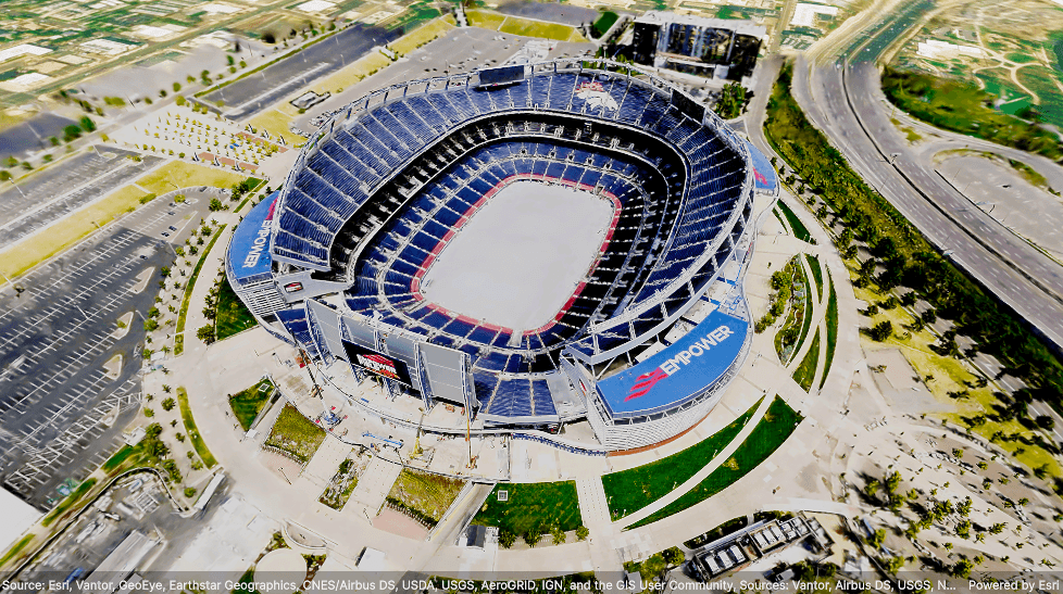
Improved 3D Tiles visualization and attribution support
This release introduces several improvements to 3D Tiles visualization, enabling more efficient rendering and better support for large-scale reality capture datasets. Enhancements to tile prioritization, level-of-detail selection, and culling behavior improve scene coverage while reducing memory usage, duplicate calculations, and rendering overhead. In addition, this release also adds support for dynamic attribution and copyright, enabling the display of 3D Tiles attribution and copyright information that varies depending on the map data requested for the current viewpoint. These enhancements improve the overall performance and usability of 3D Tiles layers, while providing developers with greater convenience in meeting data attribution requirements.
C# API
ArcGIShas been added to represent color values.Color ArcGISclass has been added to support a collection of double values.Double Clollection ArcGISclass has been added to provide a layer for visualizing Gaussian splats.Gaussian Splat Layer ArcGISenum value has been added to theGaussian Splat Layer ArcGISenum.Layer Type ArcGISclass has been added to support point cloud attribute representation.Point Cloud Attribute ArcGISclass has been added to support an immutable collection of point cloud attributes.Point Cloud Attribute Immutable Collection ArcGISenum has been added to define the transform type of thePoint Cloud Attribute Transform Type ArcGISclass.Point Cloud Attribute ArcGISenum has been added to define the value type of thePoint Cloud Attribute Value Type ArcGISclass.Point Cloud Attribute ArcGISclass has been added to support point cloud bitfield filtering that controls which points are rendered according to their associated flags.Point Cloud Bitfield Filter ArcGISclass has been added to support rendering point clouds based on class breaks.Point Cloud Class Breaks Renderer ArcGISclass has been added to define color class breaks for rendering point cloud points based on attribute value ranges.Point Cloud Color Class Break ArcGISclass has been added to manage a collection ofPoint Cloud Color Class Break Collection ArcGISvalues.Point Cloud Color Class Break ArcGISclass has been added to support rendering point cloud points with color modulation based on attribute values.Point Cloud Color Modulation ArcGISclass has been added to define color stops for rendering point cloud points using attribute-driven color ramps.Point Cloud Color Stop ArcGISclass has been added to manage a collection of color stops for rendering point cloud points based on attribute value ranges.Point Cloud Color Stop Collection ArcGISclass has been added to define colors for rendering point cloud points based on specific attribute values.Point Cloud Color Unique Value ArcGISclass has been added to manage a collection ofPoint Cloud Color Unique Value Collection ArcGISvalues.Point Cloud Color Unique Value ArcGISclass has been added to define filters that hide point cloud points that do not satisfy specified criteria.Point Cloud Filter ArcGISclass has been added to manage a collection of point cloud filters values.Point Cloud Filter Collection ArcGISclass has been added to support rendering point cloud points with a fixed size in either meters or screen space.Point Cloud Fixed Size Algorithm ArcGIShas been added to define how points in aPoint Cloud Renderer ArcGISare rendered.Point Cloud Layer ArcGISclass has been added to support including or excluding point cloud points based on their return type.Point Cloud Return Filter ArcGISenum has been added to define point cloud return types.Point Cloud Return Type ArcGISclass has been added to manage a collection of point cloud return types.Point Cloud Return Type Collection ArcGISclass has been added to support rendering point clouds based on RGB color values.Point Cloud RGB Renderer ArcGISclass has been added to support rendering point cloud points as splats with fixed sizing in meters or screen space.Point Cloud Splat Algorithm ArcGISclass has been added as a base class for defining point cloud point sizing algorithms.Point Cloud Size Algorithm ArcGISclass has been added to support rendering point clouds based on stretch values.Point Cloud Stretch Renderer ArcGISclass has been added to support rendering point clouds based on unique values.Point Cloud Unique Value Renderer ArcGISclass has been added to support including or excluding point cloud points based on their attribute values.Point Cloud Value Filter ArcGISenum has been added to define the mode of thePoint Cloud Value Filter Mode ArcGISclass.Point Cloud Value Filter ArcGISRGBclass has been added to support RGB color representation for point cloud rendering.Color ArcGISclass has been added to support a collection of string values.String Collection ArcGISclass has been added to support a collection of unsigned 32-bit integer values.Uint32 Collection featureproperty has been added to theFilter ArcGISclass to support filtering of features in a point scene layer.Point Scene Layer filtersandrendererproperties have been added to theArcGISclass to support point cloud filtering and rendering.Point Cloud Layer
Components
- A Gaussian splat layer option has been added to the ArcGISMap component in the layer type drop-down in the Layers section. Users can now add Gaussian splat layers to their maps from the ArcGISMap component.
Map Creator UI
- A Gaussian spat layer has been added to the layer type drop-down in the Layers tab in the Map Creator UI. Users can now add Gaussian splat layers to their maps directly from the UI.
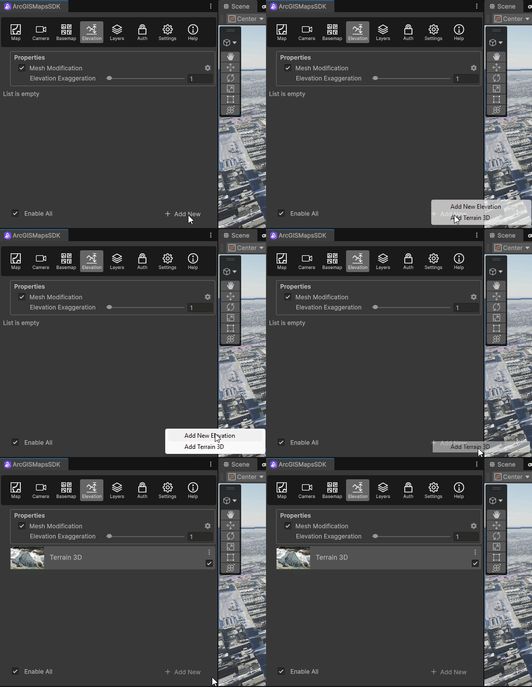
- A new drop-down menu has been added to the + Add New button in the Elevation tab, allowing you to create either an empty elevation source or the default 3D elevation source.
Deprecations
This section lists OS and framework deprecation information.
OS and framework deprecations
- iOS/iPadOS 17 is no longer supported. A minimum of iOS/iPadOS 18 is now required with this release.
- macOS Sonoma (version 14) is no longer supported. A minimum of macOS Sequoia (version 15) is now required with this release.
- Support for Android 9 (API 28) is deprecated. This release (2.4) is the last release that supports Android 9. Android 10 (API 29) will be the minimum supported version in the next release.
- Support for the Unity editor on Mac computers with Intel-based x64 processors is deprecated. The next release of ArcGIS Maps SDK for Unity will support the Unity editor on Mac computers with only Apple Silicon processors.
Issues resolved
- ENH-000180595: Allow
ArcGISto include Google Maps Photorealistic 3D Tiles attribution in ArcGIS Maps SDK for Game EnginesView. Attribution Text
- BUG-000169957: Local file packages cannot be added from the ArcGIS Map component using the ellipsis menu (three dots icon).
Known issues
-
Question on Esri Community: ArcGIS Maps SDK for Unity integrated mesh layer is rendered behind mountains when using the Universal Render Pipeline (URP).
Summary: When an integrated mesh scene layer is behind terrain such as behind a mountain, the layer is visible.
Workaround: None available.
-
BUG-000169956: Custom basemaps disappear from the basemap gallery after entering Play mode.
Summary: After adding custom basemaps from the Map Creator UI, click Play once removes all custom basemaps that are not currently selected.
Workaround: None available.
-
BUG-000169776: Custom basemap name is lost after clicking Play.
Summary: The name for the custom basemap that is added from the Map Creator UI is automatically changed to User Basemap after clicking Play.
Workaround: None available.
-
Question on Esri Community: Collider offsets in rendered OSM 3D buildings.
Summary: The collision mesh is not properly aligned with the corresponding rendered OSM 3D building, which can result in inaccurate collision detection or unexpected behavior when interacting with the 3D environment.
Workaround: None available.
-
BUG-000186431: Unity 3D objects may be incorrectly rendered behind Gaussian splat layers.
Summary: 3D objects placed between the camera and a Gaussian splat layer, or within the Gaussian splat content itself, may not be visible because Gaussian splat layers currently occlude other scene content.
Workaround: None available.
-
BUG-000186432: Gaussian splat layer opacity cannot be modified.
Summary: Gaussian splat layers are always rendered as opaque. Layer opacity cannot currently be adjusted.
Workaround: None available.
-
BUG-000186515: Flickering of 2D Markers in Point Scene Layers with Temporal Anti-Aliasing (TAA)
Summary: When rendering point scene layers that use 2D markers, users may observe noticeable flickering artifacts. This issue occurs specifically when Temporal Anti-Aliasing (TAA) is enabled. The flickering is caused by the interaction between TAA’s frame-to-frame sampling and the occlusion logic applied to 2D markers, resulting in inconsistent visibility or “popping” effects as the camera moves or the scene updates.
Workaround: To mitigate or eliminate the flickering, it is recommended to switch to an alternative anti-aliasing technique. Both Fast Approximate Anti-Aliasing (FXAA) and Subpixel Morphological Anti-Aliasing (SMAA) are supported and do not exhibit this flickering behavior with 2D markers.
- Open your application’s rendering or display settings.
- Locate the anti-aliasing configuration option.
- Change the anti-aliasing method from TAA to either FXAA or SMAA.
- Save or apply the changes and restart the scene if necessary.
Related topics
- Product life cycle (Esri Support Site)