https://static-maps-api.arcgis.com/arcgis/rest/services/static-maps-service/v1/static-maps/arcgis/{arcgis-style}/attributionEsri and data attribution must be displayed whenever the static map is visible. Attribution should be placed near the map, embedded within the image or provided through a popup or menu if the map is embedded in an application or website.
The data attribution for an ArcGIS Basemap style can be retrieved from the /static-maps/arcgis/{arcgis-style}/attribution endpoint.
To learn more about attribution requirements for static maps, see Esri and data attribution.
Query parameters
| Name | Type | Required | Default value | Description |
|---|---|---|---|---|
f | string | json | Optional, case-sensitive parameter to specify the format in which responses are given. Can either be json or pjson. | |
token | string | | An access token with the static maps service privilege. To pass the token as an authorization header, see HTTP authorization headers. |
f
Optional, case-sensitive parameter to specify the format in which responses are given. Can either be json or pjson.
- Default
- json
Enumerated values
token
An access token with the static maps service privilege. To pass the token as an authorization header, see HTTP authorization headers.
The token parameter can be either an API Key or short-lived token.
This parameter is required unless you supply an access token in the request header with one of the following keys using the "Bearer" scheme:
Authorization: Bearer <YOUR_TOKEN>X-Esri-Authorization: Bearer <YOUR_TOKEN>
The provided token must be created from an ArcGIS Location Platform account and have the necessary premium:user:staticMaps privilege to use the static maps service.
Path parameters
| Name | Type | Required | Description |
|---|---|---|---|
arcgis-style | string | The ArcGIS basemap style used to render the map. |
arcgis-style
The ArcGIS basemap style used to render the map.
| Group | Style | Example | Description | Data attribution |
|---|---|---|---|---|
| Streets | navigation | 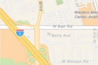 | A custom navigation style designed for use during daylight hours | Esri, TomTom, Garmin, FAO, NOAA, USGS, © OpenStreetMap contributors, and the GIS User Community |
| Streets | navigation-night | 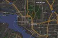 | A custom navigation style designed for use in hours of darkness | Esri, TomTom, Garmin, FAO, NOAA, USGS, © OpenStreetMap contributors, and the GIS User Community |
| Streets | streets | 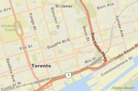 | A classic Esri street map style designed for use during daylight hours | Esri, TomTom, Garmin, FAO, NOAA, USGS, © OpenStreetMap contributors, and the GIS User Community |
| Streets | streets-night | 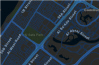 | A classic Esri street map style designed for use in hours of darkness | Esri, TomTom, Garmin, FAO, NOAA, USGS, © OpenStreetMap contributors, and the GIS User Community |
| Satellite | imagery |  | Low-resolution satellite imagery for the world and high-resolution satellite and aerial imagery, typically within 3-5 years of currency, for most of the world. | Esri, Vantor, GeoEye, Earthstar Geographics, CNES/Airbus DS, USDA, USGS, AeroGRID, IGN, © OpenStreetMap contributors, TomTom, Garmin, FAO, NOAA, and the GIS User Community |
Enumerated values
Response status
| Status | Meaning | Description | Schema |
|---|---|---|---|
| 200 | OK | Attribution for a map style. | Attribution |
| 400 | Bad Request | Invalid query parameters / Incorrect portal item type / Data URL parse failure. | Error |
| 401 | Unauthorized | Authentication Error. The API key or token is missing, invalid or expired. | Error |
| 403 | Forbidden | The requested resource cannot be accessed because of incorrect sharing permissions. | Error |
| 5XX | Server Error | An error occurred on the server. | Error |
Examples
Request
# You can also use wget
curl -X GET 'https://static-maps-api.arcgis.com/arcgis/rest/services/static-maps-service/v1/static-maps/arcgis/streets/attribution?token=YOUR_TOKEN'Response
{
"attribution": "Esri, TomTom, Garmin, FAO, NOAA, USGS, © OpenStreetMap contributors, and the GIS User Community.\n"
}