https://static-maps-api.arcgis.com/arcgis/rest/services/static-maps-service/v1/static-maps/arcgis/{arcgis-style}/with-overlayReturns a static map that displays an ArcGIS Basemap style and an overlay with a mixture of points, polygons and polylines. The center of the map is specified by center.x and center.y. If the map center is not supplied, it is defined by the extent of the supplied overlay geometry. If neither the center or geometry is supplied then the service will return a 400 error. You can control the geographical extent of the static map with padding values or by defining the zoom or radius parameter.
The static map image width and height can be defined, along with the image format, which can be png, jpeg, or webp.
Choose this option if you want to:
- Display a mixture of points, polygons and polylines
Esri and data attribution must be displayed whenever the static map is visible. Attribution should be placed near the map, embedded within the image or provided through a popup or menu if the map is embedded in an application or website.
The data attribution for an ArcGIS Basemap style can be retrieved from the /static-maps/arcgis/{arcgis-style}/attribution endpoint.
To learn more about attribution requirements for static maps, see Esri and data attribution.
Body parameters
Supported content types: application/json, application/x-www-form-urlencoded
| Name | Type | Required | Description |
|---|---|---|---|
overlay | Overlay | An array of geometries to display on the static map, including point, polyline, and/or polygon. Supports up to 64 geometries. | |
symbolDictionary | SymbolDictionary | Dictionary of custom SVG marker symbols keyed by a unique ID. Values must be base64 data URLs referenced via | |
image | Image | The image object defines the image | |
map | Map | A map view that specifies the center location, visible geographic area of the map, and basemap reference details. |
overlay
An array of geometries to display on the static map, including point, polyline, and/or polygon. Supports up to 64 geometries.
Each geometry can define its own symbol and label. Point geometries support either default marker symbols or custom SVG marker symbols referenced from symbolDictionary, while polyline and polygon geometries define their own line and fill styles.
When neither a radius nor a zoom level is specified, the map extent is automatically determined from the map's center or the extent of the geometries in the overlay.
symbolDictionary
Dictionary of custom SVG marker symbols keyed by a unique ID. Values must be base64 data URLs referenced via customSymbolId.
The key is a unique string, such as campground or parkEntrance, and the value is a base64-encoded data URL string representing the SVG
image. To symbolize a specific geometry with a custom symbol, pass the
key to the customSymbolId.
The general format of a base64-encoded data URL string is
data:[<mediatype>][;base64],<data>, as specified
here.
To construct the data URL for an SVG image follow these steps:
- Obtain the XML string from the SVG file.
- Encode the XML string into base64 format.
- Append the base64-formatted string to
data:image/svg+xml;base64,.
There is a range of SVG symbols from ESRI available from the Calcite point symbols repository or the Esri developer Place icons site.
The maximum length of the base64-encoded data URL string is 8000 characters.
Unsupported SVG Features
- SVG images must not reference external resources using URLs.
- Embedded raster images, such as
png,jpeg, andwebpformats, are not supported. - SVG images that contain font-based text elements are not supported.
- It is recommended that text is converted into vector paths so that it can be rendered in custom symbols.
image
The image object defines the image width, height, format, padding and attribution of the static map.
Height and width controls the image size between 128px to 1024px inclusive. Format controls the requested image format which can be either webp, png or jpeg.
Padding applied to the static map adds extra map content between the static map's extent and the edge of the image. Padding value is a % of the static map image's width and/or height.
Attribution defines the theme of the embed attribution within the map. This can be one either auto, dark, light or none.
map
A map view that specifies the center location, visible geographic area of the map, and basemap reference details.
This object specifies:
radius: The distance from the center point, or the centroid of supplied geometry, that determines the coverage area.
zoom: The map zoom level controlling the scale and detail of the map.
center: The geographic coordinates (latitude and longitude) of the focal point for the map.
basemapOptions.referenceDetails: A basemap option that controls the visibility of labels and feature symbology. This parameter is currently supported only for the arcgis/imagery style.
zoom and radius are mutually exclusive.
Path parameters
| Name | Type | Required | Description |
|---|---|---|---|
arcgis-style | string | The ArcGIS basemap style used to render the map. |
arcgis-style
The ArcGIS basemap style used to render the map.
| Group | Style | Example | Description | Data attribution |
|---|---|---|---|---|
| Streets | navigation | 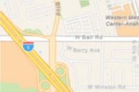 | A custom navigation style designed for use during daylight hours | Esri, TomTom, Garmin, FAO, NOAA, USGS, © OpenStreetMap contributors, and the GIS User Community |
| Streets | navigation-night | 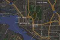 | A custom navigation style designed for use in hours of darkness | Esri, TomTom, Garmin, FAO, NOAA, USGS, © OpenStreetMap contributors, and the GIS User Community |
| Streets | streets | 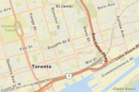 | A classic Esri street map style designed for use during daylight hours | Esri, TomTom, Garmin, FAO, NOAA, USGS, © OpenStreetMap contributors, and the GIS User Community |
| Streets | streets-night | 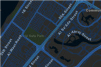 | A classic Esri street map style designed for use in hours of darkness | Esri, TomTom, Garmin, FAO, NOAA, USGS, © OpenStreetMap contributors, and the GIS User Community |
| Satellite | imagery |  | Low-resolution satellite imagery for the world and high-resolution satellite and aerial imagery, typically within 3-5 years of currency, for most of the world. | Esri, Vantor, GeoEye, Earthstar Geographics, CNES/Airbus DS, USDA, USGS, AeroGRID, IGN, © OpenStreetMap contributors, TomTom, Garmin, FAO, NOAA, and the GIS User Community |
Enumerated values
Response status
| Status | Meaning | Description | Schema |
|---|---|---|---|
| 200 | OK | Static map in a desired image format. | string(binary) |
| 400 | Bad Request | Invalid query parameters / Incorrect portal item type / Data URL parse failure. | Error |
| 401 | Unauthorized | Authentication Error. The API key or token is missing, invalid or expired. | Error |
| 403 | Forbidden | The requested resource cannot be accessed because of incorrect sharing permissions. | Error |
| 404 | Not Found | The requested resource cannot be found - this could be due to missing map data at the requested location and zoom level. | Error |
| 5XX | Server Error | An error occurred on the server. | Error |
Examples
Request
# You can also use wget
curl -X POST 'https://static-maps-api.arcgis.com/arcgis/rest/services/static-maps-service/v1/static-maps/arcgis/streets/with-overlay' \
-H 'Content-Type: application/json' \
-H 'Authorization: Bearer <YOUR_TOKEN>' \
--data '{"overlay":[{"type":"point","geometry":{"x":-117.1957,"y":34.0561,"spatialReference":{"wkid":4326}},"symbol":{"customSymbolId":"campground","scale":1,"offsetX":0,"offsetY":0}}],"symbolDictionary":{"parkEntrance":"data:image/svg+xml;base64,PHN2ZyB4bWxucz0iaHR0cDovL3d3dy53My5vcmcvMjAwMC9zdmciIHZpZXdCb3g9IjAgMCAyMSAyMSI+PHBhdGggZD0iTTE4IDkuOTk4di0xbC03LjUtNi03LjUgNnYxaDF2NkgzdjFoMTV2LTFoLTF2LTZoMXptLTEyIDBoM3YzSDZ2LTN6bTYgNnYtNmgzdjZoLTN6Ii8+PC9zdmc+","campground":"data:image/svg+xml;base64,PHN2ZyB4bWxucz0iaHR0cDovL3d3dy53My5vcmcvMjAwMC9zdmciIHZpZXdCb3g9IjAgMCAyMSAyMSI+PHBhdGggZD0iTTEyLjQwMiAxNi45NzZIMTlMMTAuNTAzIDIuOTk4IDIgMTYuOTc2aDYuNjI2bDEuODg4LTguOTR6Ii8+PC9zdmc+"},"image":{"width":500,"height":500,"format":"png","padding":[10,0,10,20],"attribution":"auto"},"map":{"radius":1000,"zoom":12,"center":{"x":-117.1957,"y":34.0561,"spatialReference":{"wkid":4326}},"basemapOptions":{"referenceDetails":"all"}}}'