Display a feature layer from a service using the manual cache feature request mode.
Use case
ServiceFeatureTable supports three request modes, which define how features are requested from the service and stored in the local table. The feature request modes have different performance characteristics. Use manual cache in scenarios where you want to explicitly control requests for features.
How to use the sample
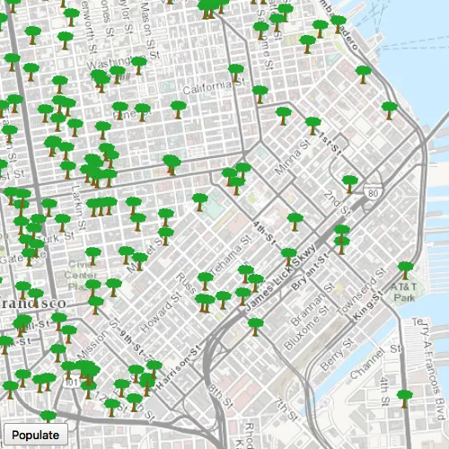
Run the sample and pan and zoom around the map. No features will be requested and displayed automatically. Press Populate, and features will display.
How it works
- Set the
ServiceFeatureTable::setFeatureRequestModeproperty of the service feature table toFeatureRequestMode::ManualCachebefore the table is loaded. - Load the table.
- Call
populateFromServiceAsyncon the table to request features.
Relevant API
- FeatureLayer
- FeatureRequestMode::ManualCache
- ServiceFeatureTable
- ServiceFeatureTable::populateFromServiceAsync
- ServiceFeatureTable::setFeatureRequestMode
About the data
The samples uses an incident feature layer queried to show tree maintenance or damage. The sample opens with an initial visible extent centered over San Francisco.
Additional information
In manual cache mode, features are never automatically populated from the service. All features are loaded manually using calls to PopulateFromService.
Tags
cache, feature request mode, performance
Sample code
// [WriteFile Name=ServiceFeatureTableManualCache, Category=Features]// [Legal]// Copyright 2016 Esri.//// Licensed under the Apache License, Version 2.0 (the "License");// you may not use this file except in compliance with the License.// You may obtain a copy of the License at// http://www.apache.org/licenses/LICENSE-2.0//// Unless required by applicable law or agreed to in writing, software// distributed under the License is distributed on an "AS IS" BASIS,// WITHOUT WARRANTIES OR CONDITIONS OF ANY KIND, either express or implied.// See the License for the specific language governing permissions and// limitations under the License.// [Legal]
#ifdef PCH_BUILD#include "pch.hpp"#endif // PCH_BUILD
// sample headers#include "ServiceFeatureTableManualCache.h"
// ArcGIS Maps SDK headers#include "Basemap.h"#include "FeatureLayer.h"#include "GeodatabaseTypes.h"#include "LayerListModel.h"#include "Map.h"#include "MapQuickView.h"#include "MapTypes.h"#include "MapViewTypes.h"#include "Point.h"#include "QueryParameters.h"#include "ServiceFeatureTable.h"#include "SpatialReference.h"#include "Viewpoint.h"
// Qt headers#include <QFuture>#include <QStringList>#include <QUrl>
using namespace Esri::ArcGISRuntime;
ServiceFeatureTableManualCache::ServiceFeatureTableManualCache(QQuickItem* parent) :  QQuickItem(parent){}
ServiceFeatureTableManualCache::~ServiceFeatureTableManualCache() = default;
void ServiceFeatureTableManualCache::init(){  qmlRegisterType<MapQuickView>("Esri.Samples", 1, 0, "MapView");  qmlRegisterType<ServiceFeatureTableManualCache>("Esri.Samples", 1, 0, "ServiceFeatureTableManualCacheSample");}
void ServiceFeatureTableManualCache::componentComplete(){  QQuickItem::componentComplete();
  // find QML MapView component  m_mapView = findChild<MapQuickView*>("mapView");  m_mapView->setWrapAroundMode(WrapAroundMode::Disabled);
  // Create a map using the light gray canvas basemap  m_map = new Map(BasemapStyle::ArcGISTopographic, this);  m_map->setInitialViewpoint(Viewpoint(Point(-13630484, 4545415, SpatialReference(102100)), 300000));
  // Set map to map view  m_mapView->setMap(m_map);
  // create the feature table  m_featureTable = new ServiceFeatureTable(QUrl("https://sampleserver6.arcgisonline.com/arcgis/rest/services/SF311/FeatureServer/0"), this);  m_featureTable->setFeatureRequestMode(FeatureRequestMode::ManualCache);
  // create the feature layer using the feature table  m_featureLayer = new FeatureLayer(m_featureTable, this);
  // add the feature layer to the map  m_map->operationalLayers()->append(m_featureLayer);}
void ServiceFeatureTableManualCache::populate(){  QueryParameters params;  params.setWhereClause("req_Type = \'Tree Maintenance or Damage\'");
  auto future = m_featureTable->populateFromServiceAsync(params, true, QStringList { "*" });  Q_UNUSED(future)}
// [WriteFile Name=ServiceFeatureTableManualCache, Category=Features]// [Legal]// Copyright 2016 Esri.//// Licensed under the Apache License, Version 2.0 (the "License");// you may not use this file except in compliance with the License.// You may obtain a copy of the License at// http://www.apache.org/licenses/LICENSE-2.0//// Unless required by applicable law or agreed to in writing, software// distributed under the License is distributed on an "AS IS" BASIS,// WITHOUT WARRANTIES OR CONDITIONS OF ANY KIND, either express or implied.// See the License for the specific language governing permissions and// limitations under the License.// [Legal]
#ifndef SERVICE_FEATURE_TABLE_MANUAL_CACHE_H#define SERVICE_FEATURE_TABLE_MANUAL_CACHE_H
// Qt headers#include <QQuickItem>
namespace Esri::ArcGISRuntime{ class Map; class MapQuickView; class FeatureLayer; class ServiceFeatureTable;}
class ServiceFeatureTableManualCache : public QQuickItem{ Q_OBJECT
public: explicit ServiceFeatureTableManualCache(QQuickItem* parent = nullptr); ~ServiceFeatureTableManualCache() override;
void componentComplete() override; static void init(); Q_INVOKABLE void populate();
private: Esri::ArcGISRuntime::Map* m_map = nullptr; Esri::ArcGISRuntime::MapQuickView* m_mapView = nullptr; Esri::ArcGISRuntime::FeatureLayer* m_featureLayer = nullptr; Esri::ArcGISRuntime::ServiceFeatureTable* m_featureTable = nullptr;};
#endif // SERVICE_FEATURE_TABLE_MANUAL_CACHE_H// [WriteFile Name=ServiceFeatureTableManualCache, Category=Features]// [Legal]// Copyright 2016 Esri.//// Licensed under the Apache License, Version 2.0 (the "License");// you may not use this file except in compliance with the License.// You may obtain a copy of the License at// http://www.apache.org/licenses/LICENSE-2.0//// Unless required by applicable law or agreed to in writing, software// distributed under the License is distributed on an "AS IS" BASIS,// WITHOUT WARRANTIES OR CONDITIONS OF ANY KIND, either express or implied.// See the License for the specific language governing permissions and// limitations under the License.// [Legal]
import QtQuickimport QtQuick.Controlsimport Esri.Samples
ServiceFeatureTableManualCacheSample { id: manualCacheSample width: 800 height: 600
// add a mapView component MapView { anchors.fill: parent objectName: "mapView"
Component.onCompleted: { // Set the focus on MapView to initially enable keyboard navigation forceActiveFocus(); } }
Row { anchors { bottom: parent.bottom left: parent.left right: parent.right margins: 5 bottomMargin: 25 } spacing: 5
// button to populate from service Button { text: "Populate" onClicked: { manualCacheSample.populate(); } } }}