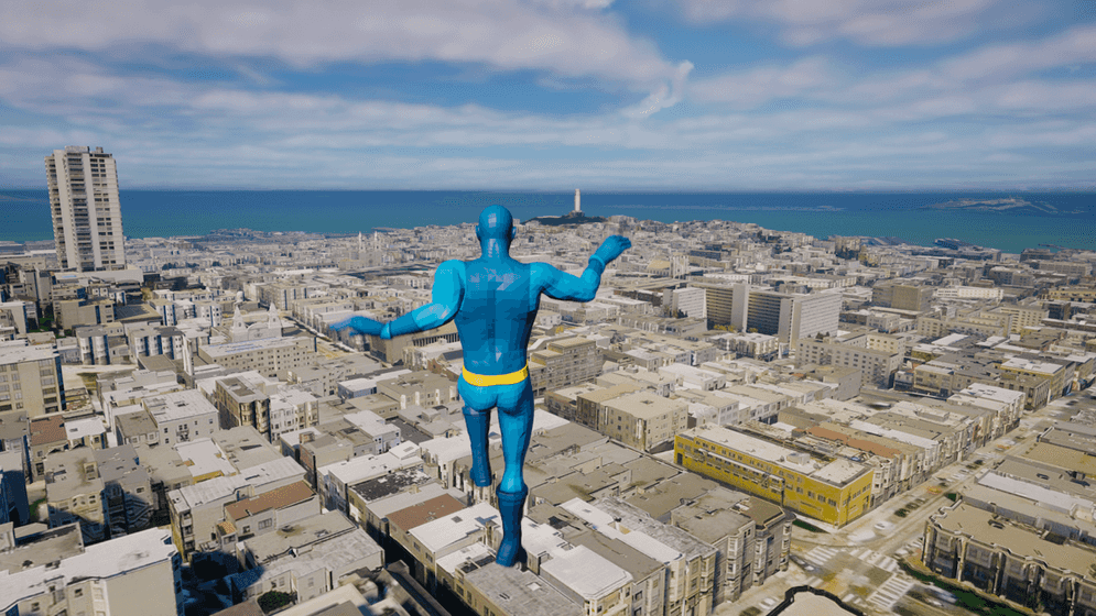
Allows users to explore a city/map from the perspective of a third-person character. This sample contains both a C++ and blueprint version with identical functionality.
How to use the sample
- Open the ThirdPerson or ThirdPersonBluePrintOnly level.
- Click on the ArcGISMapActor in the Outliner panel.
- Set your API key under the Authentication section in the Details panel.
- Click play and move the character by using the WASD keys and the right mouse button. Jump with the space key.
Note: The terrain needs to be loaded before the Third Person Character falls on the ground. Adjust the Z Location value of the BP_ThirdPersonCharacter (or ThirdPersonCharacterBluePrintVersion if you are using the blueprint sample) in order to gain more time for the terrain to be loaded if it's necessary.
How it works
- Set up ArcGIS Map for the exploration area.
- Create a Third Person Character with its control and attach the ArcGIS Camera Component to the Character Mesh.
- Add the Third Person Character to the level.
- Mesh colliders need to be enabled in the ArcGIS Map Component.
- If you want to place the character in a specific location, attach the ArcGIS Location Component to specify it.
- Adjust the
ZLocation value of the character to have enough time to load the terrain.
About the data
Building models for San Francisco are loaded from a 3D object scene layer hosted by Esri.
Elevation data is loaded from the Terrain 3D elevation layer hosted by Esri.
Tags
exploration, third person perspective, third person controller, blueprints