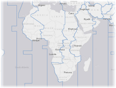
This example shows how a single layer from an ArcGIS Map service can be used in the web map as an operational layer. In this case, the operational layer shows time zone boundaries.
When a map service is used in this way, the features are retrieved using a query and are drawn by the web browser. The map author can configure pop-up windows for the layer. In this example map, a pop-up window shows the offset from Coordinated Universal Time (UTC) for each time zone.
In the map service, this time zone layer is symbolized using a gray outline. A layer definition has been applied to this web map, overriding the default style with a blue outline.
The server administrator may have limited the number of features that can be retrieved through the query. The default limit for ArcGIS Server map services is 1,000 features, therefore, this time zone map runs no risk of reaching the limit.
