Use transactions to manage how changes are committed to a geodatabase.
Use case
Transactions allow you to control how changes are added to a database. This is useful to ensure that when multiple changes are made to a database, they all succeed or fail at once. For example, you could have a business rule that both parent/guardian and student must be added to a database used for calculating school bus routes. You can use transactions to avoid breaking the business rule if you lose power while between the steps of adding the student and parent/guardian.
How to use the sample
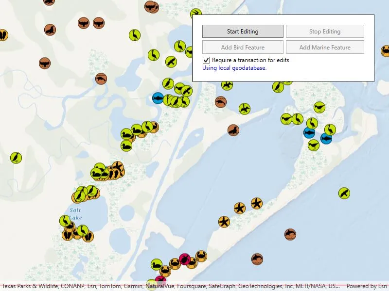
Tap on the map to add multiple types of features. To apply edits directly, uncheck the “Requires Transaction”. When using transactions, use the buttons to start editing and stop editing. When you stop editing, you can choose to commit the changes or roll them back.
How it works
- Create a
Geodatabaseusing the mobile geodatabase file location. - Display the
Geodatabase.FeatureTablesin feature layers. - If a transaction is required, begin one using
Geodatabase.BeginTransaction(). - Add one or more features to the feature table(s).
- When ready, either commit the transaction to the geodatabase with
Geodatabase.CommitTransaction()or roll back the transaction withGeodatabase.RollbackTransaction().
Relevant API
- Geodatabase
- Geodatabase.BeginTransaction
- Geodatabase.CommitTransaction
- Geodatabase.IsInTransaction
- Geodatabase.RollbackTransaction
- GeometryEditor
Offline data
This sample downloads the Save The Bay Geodatabase item from ArcGIS Online.
About the data
The mobile geodatabase contains a collection schema for wildlife sightings around Christmas Bay, TX, USA. It was created using data from the Save The Bay Feature Service.
Tags
commit, database, geodatabase, geometry editor, transact, transactions
Sample code
// Copyright 2017 Esri.//// Licensed under the Apache License, Version 2.0 (the "License"); you may not use this file except in compliance with the License.// You may obtain a copy of the License at: http://www.apache.org/licenses/LICENSE-2.0//// Unless required by applicable law or agreed to in writing, software distributed under the License is distributed on an// "AS IS" BASIS, WITHOUT WARRANTIES OR CONDITIONS OF ANY KIND, either express or implied. See the License for the specific// Language governing permissions and limitations under the License.
using ArcGIS.Samples.Managers;using Esri.ArcGISRuntime;using Esri.ArcGISRuntime.Data;using Esri.ArcGISRuntime.Geometry;using Esri.ArcGISRuntime.Mapping;using Esri.ArcGISRuntime.Symbology;using Esri.ArcGISRuntime.UI;using Esri.ArcGISRuntime.UI.Editing;using System;using System.Drawing;using System.IO;using System.Threading.Tasks;using System.Windows;using System.Windows.Controls;
namespace ArcGIS.WPF.Samples.GeodatabaseTransactions{    [ArcGIS.Samples.Shared.Attributes.Sample(        name: "Geodatabase transactions",        category: "Data",        description: "Use transactions to manage how changes are committed to a geodatabase.",        instructions: "Tap on the map to add multiple types of features. To apply edits directly, uncheck the \"Requires Transaction\". When using transactions, use the buttons to start editing and stop editing. When you stop editing, you can choose to commit the changes or roll them back.",        tags: new[] { "commit", "database", "geodatabase", "geometry editor", "transact", "transactions" })]    [ArcGIS.Samples.Shared.Attributes.OfflineData("43809fd639f242fd8045ecbafd61a579")]    public partial class GeodatabaseTransactions    {        // Work in a small extent south of Galveston, TX.        private readonly Envelope _extent = new Envelope(-95.3035, 29.0100, -95.1053, 29.1298, SpatialReferences.Wgs84);
        // Store the local geodatabase to edit.        private Geodatabase _localGeodatabase;
        // Store references to the Birds and Marine points tables.        private GeodatabaseFeatureTable _birdTable;        private GeodatabaseFeatureTable _marineTable;
        // Store a reference to the table to be edited.        private GeodatabaseFeatureTable _editTable;
        public GeodatabaseTransactions()        {            InitializeComponent();
            Initialize();        }
        private void Initialize()        {            // When the map view loads, add a new map.            MyMapView.Loaded += (s, e) =>            {                // Create a new map with the oceans basemap and add it to the map view.                MyMapView.Map = new Map(BasemapStyle.ArcGISOceans);            };
            // When the spatial reference changes (the map loads) add the local geodatabase tables as feature layers.            MyMapView.SpatialReferenceChanged += async (s, e) =>            {                // Call a function (and await it) to get the local geodatabase (or generate it from the feature service).                await GetLocalGeodatabase();
                // Once the local geodatabase is available, load the tables as layers to the map.                _ = LoadLocalGeodatabaseTables();            };
            // Create a graphic for the extent of the geodatabase and add it to the map view.            ShowExtent();        }
        private void ShowExtent()        {            // Create a graphic for the geodatabase extent.            var lineSymbol = new SimpleLineSymbol(SimpleLineSymbolStyle.Solid, Color.Red, 2);            var extentGraphic = new Graphic(_extent, lineSymbol);
            // Create a graphics overlay for the extent graphic and apply a renderer.            var extentOverlay = new GraphicsOverlay            {                Graphics = { extentGraphic },                Renderer = new SimpleRenderer(lineSymbol)            };
            // Add graphics overlay to the map view.            MyMapView.GraphicsOverlays.Add(extentOverlay);        }
        private async Task GetLocalGeodatabase()        {            // Get the path to the local geodatabase for this platform (temp directory, for example).            string localGeodatabasePath = DataManager.GetDataFolder("43809fd639f242fd8045ecbafd61a579", "SaveTheBay.geodatabase");
            try            {                // See if the geodatabase file is already present.                if (File.Exists(localGeodatabasePath))                {                    // If the geodatabase is already available, open it, hide the progress control, and update the message.                    _localGeodatabase = await Geodatabase.OpenAsync(localGeodatabasePath);                    LoadingProgressBar.Visibility = Visibility.Collapsed;                    MessageTextBlock.Text = "Using local geodatabase.";                }                else                {                    MessageTextBlock.Text = "Missing local geodatabase.";                }            }            catch (Exception ex)            {                // Show a message for the exception encountered.                MessageTextBlock.Text = ex.Message;            }        }
        // Function that loads the two point tables from the local geodatabase and displays them as feature layers.        private async Task LoadLocalGeodatabaseTables()        {            // Read the geodatabase tables and add them as layers.            foreach (GeodatabaseFeatureTable table in _localGeodatabase.GeodatabaseFeatureTables)            {                try                {                    // Load the table so the TableName can be read.                    await table.LoadAsync();
                    // Store a reference to the Birds table.                    if (table.TableName.ToLower().Contains("birds"))                    {                        _birdTable = table;                    }
                    // Store a reference to the Marine table.                    if (table.TableName.ToLower().Contains("marine"))                    {                        _marineTable = table;                    }
                    // Create a new feature layer to show the table in the map.                    var layer = new FeatureLayer(table);                    Dispatcher.Invoke(() => MyMapView.Map?.OperationalLayers.Add(layer));                }                catch (Exception ex)                {                    MessageTextBlock.Text = ex.Message;                }            }
            // Handle the transaction status changed event.            _localGeodatabase.TransactionStatusChanged += GdbTransactionStatusChanged;
            // Zoom the map view to the extent of the generated local datasets.            Dispatcher.Invoke(() =>            {                MyMapView.SetViewpoint(new Viewpoint(_marineTable.Extent));                StartEditingButton.IsEnabled = true;            });        }
        private void GdbTransactionStatusChanged(object sender, TransactionStatusChangedEventArgs e)        {            // Update UI controls based on whether the geodatabase has a current transaction.            Dispatcher.Invoke(() =>            {                // These buttons should be enabled when there IS a transaction.                AddBirdButton.IsEnabled = e.IsInTransaction;                AddMarineButton.IsEnabled = e.IsInTransaction;                StopEditingButton.IsEnabled = e.IsInTransaction;
                // This button should be enabled when there is NOT a transaction.                StartEditingButton.IsEnabled = !e.IsInTransaction;            });        }
        private void BeginTransaction(object sender, RoutedEventArgs e)        {            // See if there is a transaction active for the geodatabase.            if (!_localGeodatabase.IsInTransaction)            {                // If not, begin a transaction.                _localGeodatabase.BeginTransaction();                MessageTextBlock.Text = "Transaction started.";            }        }
        private void AddNewFeature(object sender, RoutedEventArgs args)        {            // See if it was the "Birds" or "Marine" button that was clicked.            Button addFeatureButton = (Button)sender;
            try            {                // Store the correct table to edit (for the button clicked).                if (addFeatureButton == AddBirdButton)                {                    _editTable = _birdTable;                }                else                {                    _editTable = _marineTable;                }
                // Inform the user which table is being edited.                MessageTextBlock.Text = "Click the map to add a new feature to the geodatabase table '" + _editTable.TableName + "'.";
                if (!MyMapView.GeometryEditor.IsStarted)                {                    // Use the geometry editor to allow the user to draw a point on the map.                    MyMapView.GeometryEditor.Start(GeometryType.Point);
                    MyMapView.GeometryEditor.PropertyChanged += GeometryEditor_PropertyChanged;                }            }            catch (Exception ex)            {                // Report other exception messages.                MessageTextBlock.Text = ex.Message;            }        }
        private async void GeometryEditor_PropertyChanged(object sender, System.ComponentModel.PropertyChangedEventArgs e)        {            // Check if the user finished drawing a point on the map.            if (e.PropertyName == nameof(GeometryEditor.Geometry) && MyMapView.GeometryEditor.Geometry?.IsEmpty == false)            {                // Disconnect event handler to prevent multiple calls.                MyMapView.GeometryEditor.PropertyChanged -= GeometryEditor_PropertyChanged;
                // Get the active geometry.                Geometry geometry = MyMapView.GeometryEditor.Stop();
                // Create a new feature (row) in the selected table.                Feature newFeature = _editTable.CreateFeature();
                // Create a random value for the 'type' attribute (integer between 1 and 7).                var random = new Random(DateTime.Now.Millisecond);                int featureType = random.Next(1, 7);
                // Set the geometry with the point the user clicked and the 'type' with the random integer.                newFeature.Geometry = geometry;                newFeature.SetAttributeValue("type", featureType);
                // Add the new feature to the table.                string message = string.Empty;                try                {                    await _editTable.AddFeatureAsync(newFeature);                    MessageTextBlock.Text = "New feature added to the '" + _editTable.TableName + "' table.";                }                catch (ArcGISException ex)                {                    // Report the exception message.                    MessageTextBlock.Text = ex.Message;                }            }        }
        private void StopEditTransaction(object sender, RoutedEventArgs e)        {            // Ensure the geometry editor is stopped and property changed event is unsubscribed since user is leaving editing mode.            // Handles case where user stops transaction while geometry editor is active.            MyMapView.GeometryEditor.PropertyChanged -= GeometryEditor_PropertyChanged;            MyMapView.GeometryEditor.Stop();
            // Ask the user if they want to commit or rollback the transaction (or cancel to keep working in the transaction).            MessageBoxResult commitAnswer = MessageBox.Show("Commit your edits to the local geodatabase?", "Stop Editing", MessageBoxButton.YesNoCancel);
            if (commitAnswer == MessageBoxResult.Yes)            {                // Commit the transaction to store the edits (this will also end the transaction).                _localGeodatabase.CommitTransaction();                MessageTextBlock.Text = _localGeodatabase.HasLocalEdits() ?                        "Edits were committed to the local geodatabase." : "No edits committed.";            }            else if (commitAnswer == MessageBoxResult.No)            {                // Rollback the transaction to discard the edits (this will also end the transaction).                _localGeodatabase.RollbackTransaction();                MessageTextBlock.Text = _localGeodatabase.HasLocalEdits() ?                        "Edits were rolled back and not stored to the local geodatabase." : "No edits were rolled back.";            }            else            {                // User canceled.                MessageTextBlock.Text = "Transaction still going.";            }        }
        // Change which controls are enabled if the user chooses to require/not require transactions for edits.        private void RequireTransactionChanged(object sender, RoutedEventArgs e)        {            // If the local geodatabase isn't created yet, return.            if (_localGeodatabase == null) { return; }
            // Get the value of the "require transactions" checkbox.            bool mustHaveTransaction = RequireTransactionCheckBox.IsChecked == true;
            // Warn the user if disabling transactions while a transaction is active.            if (!mustHaveTransaction && _localGeodatabase.IsInTransaction)            {                MessageBox.Show("Stop editing to end the current transaction.", "Current Transaction");                RequireTransactionCheckBox.IsChecked = true;                return;            }
// Enable or disable controls according to the checkbox value. StartEditingButton.IsEnabled = mustHaveTransaction; StopEditingButton.IsEnabled = mustHaveTransaction && _localGeodatabase.IsInTransaction; AddBirdButton.IsEnabled = !mustHaveTransaction; AddMarineButton.IsEnabled = !mustHaveTransaction; } }}<UserControl x:Class="ArcGIS.WPF.Samples.GeodatabaseTransactions.GeodatabaseTransactions" xmlns="http://schemas.microsoft.com/winfx/2006/xaml/presentation" xmlns:x="http://schemas.microsoft.com/winfx/2006/xaml" xmlns:esri="http://schemas.esri.com/arcgis/runtime/2013"> <UserControl.Resources> <Style TargetType="Button" BasedOn="{StaticResource CalciteButtonBaseStyle}"> <Setter Property="Padding" Value="5,5,5,5" /> <Setter Property="Margin" Value="5,0,0,5" /> </Style> </UserControl.Resources> <Grid> <esri:MapView x:Name="MyMapView" /> <Border Style="{StaticResource BorderStyle}"> <StackPanel Orientation="Vertical"> <Grid> <Grid.ColumnDefinitions> <ColumnDefinition Width="*" /> <ColumnDefinition Width="*" /> </Grid.ColumnDefinitions> <Grid.RowDefinitions> <RowDefinition Height="*" /> <RowDefinition Height="*" /> </Grid.RowDefinitions> <Button x:Name="StartEditingButton" Grid.Column="0" Margin="0,0,0,5" Click="BeginTransaction" Content="Start Editing" IsEnabled="False" /> <Button x:Name="StopEditingButton" Grid.Column="1" Click="StopEditTransaction" Content="Stop Editing" IsEnabled="False" /> <Button x:Name="AddBirdButton" Grid.Row="1" Grid.Column="0" Margin="0,0,0,5" Click="AddNewFeature" Content="Add Bird Feature" IsEnabled="False" /> <Button x:Name="AddMarineButton" Grid.Row="1" Grid.Column="1" Click="AddNewFeature" Content="Add Marine Feature" IsEnabled="False" /> </Grid> <CheckBox x:Name="RequireTransactionCheckBox" Click="RequireTransactionChanged" Content="Require a transaction for edits" IsChecked="True" /> <ProgressBar x:Name="LoadingProgressBar" Height="15" Margin="0,5,0,5" IsIndeterminate="True" /> <TextBlock x:Name="MessageTextBlock" Foreground="Blue" Text="Generating local geodatabase ..." TextWrapping="Wrap" /> </StackPanel> </Border> </Grid></UserControl>