Follow these steps to get started with the spatial analysis service.
1. Sign up for an account
Get access to a portal
ArcGIS Location Platform
- Get an ArcGIS Location Platform account
An ArcGIS Location Platform account, formerly known as an ArcGIS Developer account, is an identity associated with an ArcGIS Location Platform subscription. with access to a single-user organizationAn organization a list of members from the same business, association, or entity who can sign in, access tools and applications, and collaborate with other members in a portal. All members have an ArcGIS account and are approved by an administrator to access the same portal. . - Get access to a portal
ArcGIS portal, also known as a portal, is a website with applications and tools that can be used to create, manage, access, and share geospatial content and data. It supports security and authentication, developer credentials, content and data service management, user and group management, and site administration. A portal can be hosted in Esri's infrastructure or your own infrastructure. with tools to create developer credentialsDeveloper credentials are a type of item in a portal that contains parameters for authentication. There are two types of developer credentials: API key credentials and OAuth credentials. , contentContent is a collection of items in a portal that belong to a user, group, or organization. , and data servicesData services, also known as hosted data services, are services created dynamically to store and provide access to your data in ArcGIS. Examples are feature services, vector tile services, map tile services, image services, and scene services. . - Use location services
ArcGIS Location Services, also referred to as Location Services, are services hosted by Esri that provide geospatial functionality for developing mapping applications. They include the ArcGIS Basemap Styles service, ArcGIS Static Basemap Tiles service, ArcGIS Static Maps service, ArcGIS Places service, ArcGIS Geocoding service, ArcGIS Routing service, ArcGIS GeoEnrichment service, and ArcGIS Elevation service. An ArcGIS Location Platform or ArcGIS Online account is required to use the services. and spatial analysis servicesSpatial analysis services are services that perform geometry and statistical analyses on feature and raster data. . - Common use case: Build public applications
A public application is an application that allows anonymous access without requiring users to sign in with an ArcGIS account. It supports API key or app authentication. that don't require users to sign in with an ArcGIS accountAn ArcGIS account is an identity with a user type and set of privileges that can access specific ArcGIS products, tools, APIs, services, and resources. The main account types that can be used for development are an ArcGIS Location Platform account, ArcGIS Online account, and ArcGIS Enterprise account. ArcGIS Location Platform and ArcGIS Online accounts are also associated with a subscription. .
ArcGIS Online
- Get an ArcGIS Online account
An ArcGIS Online account, also known as an ArcGIS Organization account, is an identity associated with an ArcGIS Online subscription. It can be used to access ArcGIS tools and develop applications with ArcGIS location services for an organization. with access to a multi-user organizationAn organization a list of members from the same business, association, or entity who can sign in, access tools and applications, and collaborate with other members in a portal. All members have an ArcGIS account and are approved by an administrator to access the same portal. . - Get access to a portal
ArcGIS portal, also known as a portal, is a website with applications and tools that can be used to create, manage, access, and share geospatial content and data. It supports security and authentication, developer credentials, content and data service management, user and group management, and site administration. A portal can be hosted in Esri's infrastructure or your own infrastructure. with tools to create developer credentialsDeveloper credentials are a type of item in a portal that contains parameters for authentication. There are two types of developer credentials: API key credentials and OAuth credentials. , contentContent is a collection of items in a portal that belong to a user, group, or organization. , and data servicesData services, also known as hosted data services, are services created dynamically to store and provide access to your data in ArcGIS. Examples are feature services, vector tile services, map tile services, image services, and scene services. . - Use location services
ArcGIS Location Services, also referred to as Location Services, are services hosted by Esri that provide geospatial functionality for developing mapping applications. They include the ArcGIS Basemap Styles service, ArcGIS Static Basemap Tiles service, ArcGIS Static Maps service, ArcGIS Places service, ArcGIS Geocoding service, ArcGIS Routing service, ArcGIS GeoEnrichment service, and ArcGIS Elevation service. An ArcGIS Location Platform or ArcGIS Online account is required to use the services. , spatial analysis servicesSpatial analysis services are services that perform geometry and statistical analyses on feature and raster data. , and additional ArcGIS services. - Common use cases:
- Build low-code/no-code applications with app builders
App builder is an ArcGIS product that is used to create, configure, and deploy web applications using user interfaces, templates, and predefined software components. . - Build private applications
A private application is an application that requires users to sign in with an ArcGIS account. It supports user authentication. for your organization that requires users to authenticate with an ArcGIS accountAn ArcGIS account is an identity with a user type and set of privileges that can access specific ArcGIS products, tools, APIs, services, and resources. The main account types that can be used for development are an ArcGIS Location Platform account, ArcGIS Online account, and ArcGIS Enterprise account. ArcGIS Location Platform and ArcGIS Online accounts are also associated with a subscription. . - Build public applications
A public application is an application that allows anonymous access without requiring users to sign in with an ArcGIS account. It supports API key or app authentication. that don't require users to sign in.
- Build low-code/no-code applications with app builders
ArcGIS Enterprise
- Get an ArcGIS Online account
An ArcGIS Online account, also known as an ArcGIS Organization account, is an identity associated with an ArcGIS Online subscription. It can be used to access ArcGIS tools and develop applications with ArcGIS location services for an organization. with access to a multi-user organizationAn organization a list of members from the same business, association, or entity who can sign in, access tools and applications, and collaborate with other members in a portal. All members have an ArcGIS account and are approved by an administrator to access the same portal. . - Get access to a portal
ArcGIS portal, also known as a portal, is a website with applications and tools that can be used to create, manage, access, and share geospatial content and data. It supports security and authentication, developer credentials, content and data service management, user and group management, and site administration. A portal can be hosted in Esri's infrastructure or your own infrastructure. hosted in your infrastructure with tools to create developer credentialsDeveloper credentials are a type of item in a portal that contains parameters for authentication. There are two types of developer credentials: API key credentials and OAuth credentials. , contentContent is a collection of items in a portal that belong to a user, group, or organization. , and data servicesData services, also known as hosted data services, are services created dynamically to store and provide access to your data in ArcGIS. Examples are feature services, vector tile services, map tile services, image services, and scene services. . - Use ArcGIS Enterprise services.
- Common use cases:
- Build low-code/no-code applications with app builders
App builder is an ArcGIS product that is used to create, configure, and deploy web applications using user interfaces, templates, and predefined software components. . - Build private applications
A private application is an application that requires users to sign in with an ArcGIS account. It supports user authentication. for your organization that requires users to authenticate with an ArcGIS accountAn ArcGIS account is an identity with a user type and set of privileges that can access specific ArcGIS products, tools, APIs, services, and resources. The main account types that can be used for development are an ArcGIS Location Platform account, ArcGIS Online account, and ArcGIS Enterprise account. ArcGIS Location Platform and ArcGIS Online accounts are also associated with a subscription. . - Build public applications
A public application is an application that allows anonymous access without requiring users to sign in with an ArcGIS account. It supports API key or app authentication. that don't require users to sign in.
- Build low-code/no-code applications with app builders
2. Explore analysis types
Choose an analysis type to learn how to work with geometry, feature, raster, or 3D data.

Geometry analysis
Perform client-side analyses on point, polyline, and polygon geometries.
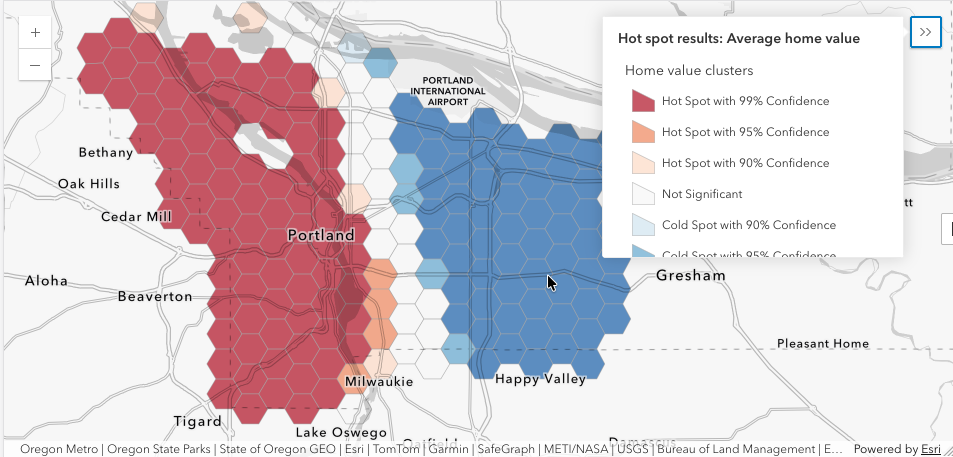
Feature analysis
Perform server-side analyses on feature data to find relationships and patterns.

Imagery and raster analysis
Perform server-side and client side analysis on raster data.

3D visual analysis
Perform client-side analysis on terrain and objects.
Want to explore more things you can do? Go to Popular topics.
3. Select a type of authentication
Create an API key
API key authentication
- Build public applications
A public application is an application that allows anonymous access without requiring users to sign in with an ArcGIS account. It supports API key or app authentication. that don't require users to sign in with an ArcGIS accountAn ArcGIS account is an identity with a user type and set of privileges that can access specific ArcGIS products, tools, APIs, services, and resources. The main account types that can be used for development are an ArcGIS Location Platform account, ArcGIS Online account, and ArcGIS Enterprise account. ArcGIS Location Platform and ArcGIS Online accounts are also associated with a subscription. . - Build personal applications
A personal application is an application used exclusively by its owner and not shared with others. It supports API key, user authentication, or app authentication. for you that are not shared with other users. - Use a long-lived API key
An API key is a long-lived access token created using API key credentials. They are valid for up to one year and are typically embedded directly into client applications. access token to authenticate service requests. - Applications can access location services
ArcGIS Location Services, also referred to as Location Services, are services hosted by Esri that provide geospatial functionality for developing mapping applications. They include the ArcGIS Basemap Styles service, ArcGIS Static Basemap Tiles service, ArcGIS Static Maps service, ArcGIS Places service, ArcGIS Geocoding service, ArcGIS Routing service, ArcGIS GeoEnrichment service, and ArcGIS Elevation service. An ArcGIS Location Platform or ArcGIS Online account is required to use the services. , spatial analysis servicesSpatial analysis services are services that perform geometry and statistical analyses on feature and raster data. , the portal serviceA portal service provides the functionality to securely create, access, and manage content, data services, users, and groups in a portal. The service can be hosted by Esri or in ArcGIS Enterprise. , and secure data servicesData services, also known as hosted data services, are services created dynamically to store and provide access to your data in ArcGIS. Examples are feature services, vector tile services, map tile services, image services, and scene services. in a portal. - Privileges
Privileges are a set of permissions assigned to ArcGIS accounts, developer credentials, and applications that grant access to secure resources and functionality in ArcGIS. and portal itemAn item, also known as a content item, is a resource stored in a portal such as a web map, hosted layer, style, script tool, file, or notebook. access are defined by the developer. - Service usage and data storage is billed to the developer.
Learn more about API key authentication
OAuth 2.0 user authentication
- Build private applications
A private application is an application that requires users to sign in with an ArcGIS account. It supports user authentication. that requires users to authenticate with an ArcGIS accountAn ArcGIS account is an identity with a user type and set of privileges that can access specific ArcGIS products, tools, APIs, services, and resources. The main account types that can be used for development are an ArcGIS Location Platform account, ArcGIS Online account, and ArcGIS Enterprise account. ArcGIS Location Platform and ArcGIS Online accounts are also associated with a subscription. . - Create OAuth 2.0 credentials
Developer credentials are a type of item in a portal that contains parameters for authentication. There are two types of developer credentials: API key credentials and OAuth credentials. and implement OAuth 2.0 flows to get an access token. - Applications can access all resources available to the signed-in user, including location services
ArcGIS Location Services, also referred to as Location Services, are services hosted by Esri that provide geospatial functionality for developing mapping applications. They include the ArcGIS Basemap Styles service, ArcGIS Static Basemap Tiles service, ArcGIS Static Maps service, ArcGIS Places service, ArcGIS Geocoding service, ArcGIS Routing service, ArcGIS GeoEnrichment service, and ArcGIS Elevation service. An ArcGIS Location Platform or ArcGIS Online account is required to use the services. , spatial analysis servicesSpatial analysis services are services that perform geometry and statistical analyses on feature and raster data. , data servicesData services, also known as hosted data services, are services created dynamically to store and provide access to your data in ArcGIS. Examples are feature services, vector tile services, map tile services, image services, and scene services. , secure itemsAn item, also known as a content item, is a resource stored in a portal such as a web map, hosted layer, style, script tool, file, or notebook. , and portalArcGIS portal, also known as a portal, is a website with applications and tools that can be used to create, manage, access, and share geospatial content and data. It supports security and authentication, developer credentials, content and data service management, user and group management, and site administration. A portal can be hosted in Esri's infrastructure or your own infrastructure. management operations. - Privileges
Privileges are a set of permissions assigned to ArcGIS accounts, developer credentials, and applications that grant access to secure resources and functionality in ArcGIS. and portal itemAn item, also known as a content item, is a resource stored in a portal such as a web map, hosted layer, style, script tool, file, or notebook. access are defined by the user's account. - Service usage and data storage is billed to the organization of the user signed into the application.
4. Perform an analysis
Try one of the tutorials to build an application to perform client-side or server-side analyses.

Find spatial relationships
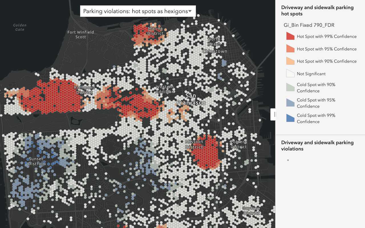
Discover patterns in data
Find patterns and trends in data using spatial analysis operations.

Display a line of sight
Perform and display a line of sight analysis in a 3D scene.
