Create and use a raster layer made from a local raster file.
Use case
Rasters can be digital aerial photographs, imagery from satellites, digital pictures, or even scanned maps. An end-user will frequently need to import raster files acquired through various data-collection methods into their map to view and analyze the data.
How to use the sample
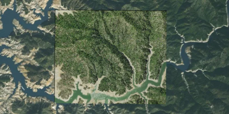
When the sample starts, a raster will be loaded from a file and displayed in the map view.
How it works
- Create a
Rasterfrom a raster file. - Create a
RasterLayerfrom the raster. - Add it as an operational layer with
map.getOperationalLayers().add(rasterLayer).
Relevant API
- Raster
- RasterLayer
Additional information
See the topic What is raster data? in the ArcMap documentation for more information about raster images.
Tags
data, image, import, layer, raster, visualization
Sample code
RasterLayerFileSample.java
/* * Copyright 2017 Esri. * * Licensed under the Apache License, Version 2.0 (the "License"); you may not * use this file except in compliance with the License. You may obtain a copy of * the License at * * http://www.apache.org/licenses/LICENSE-2.0 * * Unless required by applicable law or agreed to in writing, software * distributed under the License is distributed on an "AS IS" BASIS, WITHOUT * WARRANTIES OR CONDITIONS OF ANY KIND, either express or implied. See the * License for the specific language governing permissions and limitations under * the License. */
package com.esri.samples.raster_layer_file;
import java.io.File;
import javafx.application.Application;import javafx.scene.Scene;import javafx.scene.control.Alert;import javafx.scene.layout.StackPane;import javafx.stage.Stage;
import com.esri.arcgisruntime.ArcGISRuntimeEnvironment;import com.esri.arcgisruntime.layers.RasterLayer;import com.esri.arcgisruntime.loadable.LoadStatus;import com.esri.arcgisruntime.mapping.ArcGISMap;import com.esri.arcgisruntime.mapping.BasemapStyle;import com.esri.arcgisruntime.mapping.view.MapView;import com.esri.arcgisruntime.raster.Raster;
public class RasterLayerFileSample extends Application {
  private MapView mapView;
  @Override  public void start(Stage stage) {
    try {      // create stack pane and application scene      StackPane stackPane = new StackPane();      Scene scene = new Scene(stackPane);
      // set title, size, and add scene to stage      stage.setTitle("Raster Layer File");      stage.setWidth(800);      stage.setHeight(700);      stage.setScene(scene);      stage.show();
      // authentication with an API key or named user is required to access basemaps and other location services      String yourAPIKey = System.getProperty("apiKey");      ArcGISRuntimeEnvironment.setApiKey(yourAPIKey);
      // create a raster from a local raster file      Raster raster = new Raster(new File(System.getProperty("data.dir"), "./samples-data/raster/Shasta.tif").getAbsolutePath());
      // create a raster layer      RasterLayer rasterLayer = new RasterLayer(raster);
      // create a map with the standard imagery basemap style      ArcGISMap map = new ArcGISMap(BasemapStyle.ARCGIS_IMAGERY_STANDARD);
      // create a map view and set the map to it      mapView = new MapView();      mapView.setMap(map);
      // add the raster layer to the map's operational layers      map.getOperationalLayers().add(rasterLayer);
      // set viewpoint on the raster      rasterLayer.addDoneLoadingListener(() -> {        if (rasterLayer.getLoadStatus() == LoadStatus.LOADED) {          mapView.setViewpointGeometryAsync(rasterLayer.getFullExtent(), 150);        } else {          Alert alert = new Alert(Alert.AlertType.ERROR, "Raster Layer Failed to Load!");          alert.show();        }      });
      // add the map view to stack pane      stackPane.getChildren().addAll(mapView);    } catch (Exception e) {      // on any error, display the stack trace.      e.printStackTrace();    }  }
  /**   * Stops and releases all resources used in application.   */  @Override  public void stop() {
    if (mapView != null) {      mapView.dispose();    }  }
  /**   * Opens and runs application.   *   * @param args arguments passed to this application   */  public static void main(String[] args) {
    Application.launch(args);  }
}