Load an ArcGIS tiled layer from a URL.
Use case
An ArcGISTiledLayer consumes raster tiles provided by an ArcGIS service or a tile package (.tpk & .tpkx). Dividing a raster into tiles provides the user with relevant tiles and level of detail while panning and zooming, allowing for rapid map visualization and navigation. For example, say you wanted an application with a map containing all museums in your city so that you could share this with tourists. Since only the museums would need to support being identifiable or queryable within the app, all other contextual information required to orient and direct the tourists could be sourced from a single ArcGIS tiled layer, leading to faster performance and minimizing the time to load the map.
How to use the sample
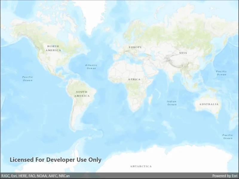
Launch the app to view the “World Topographic Map” tile layer as the basemap.
How it works
- Add an
ArcGISTiledLayerfrom an ArcGIS Online service URL to theArcGISMapas an operational layer.
Relevant API
- ArcGISTiledLayer
- Basemap
- Map
- MapView
About the data
The application utilizes the “World Topographic Map” tile layer. This presents a simple yet powerful illustration of adding visualization context to a basemap through the use of an ArcGIS tiled layer.
Additional information
An ArcGISTiledLayer can also be added to the ArcGISMap as a layer, but it’s best practice to use as a basemap since its purpose is to provide geographical context. ArcGIS tiled layers do not support reprojection, query, select, identify, or editing.
Tags
basemap, layers, raster tiles, tiled layer, visualization
Sample code
// Copyright 2022 Esri.//// Licensed under the Apache License, Version 2.0 (the "License"); you may not use this file except in compliance with the License.// You may obtain a copy of the License at: http://www.apache.org/licenses/LICENSE-2.0//// Unless required by applicable law or agreed to in writing, software distributed under the License is distributed on an// "AS IS" BASIS, WITHOUT WARRANTIES OR CONDITIONS OF ANY KIND, either express or implied. See the License for the specific// language governing permissions and limitations under the License.
using Esri.ArcGISRuntime.Mapping;
namespace ArcGIS.Samples.ArcGISTiledLayerUrl{    [ArcGIS.Samples.Shared.Attributes.Sample(        name: "ArcGIS tiled layer",        category: "Layers",        description: "Load an ArcGIS tiled layer from a URL.",        instructions: "Launch the app to view the \"World Topographic Map\" tile layer as the basemap.",        tags: new[] { "basemap", "layers", "raster tiles", "tiled layer", "visualization" })]    public partial class ArcGISTiledLayerUrl : ContentPage    {        public ArcGISTiledLayerUrl()        {            InitializeComponent();
            // Create the UI, setup the control references and execute initialization            Initialize();        }
        private void Initialize()        {            // Create new Map            Map myMap = new Map();
            // Create uri to the tiled service            Uri serviceUri = new Uri(               "https://services.arcgisonline.com/arcgis/rest/services/World_Topo_Map/MapServer");
            // Create new tiled layer from the url            ArcGISTiledLayer imageLayer = new ArcGISTiledLayer(serviceUri);
            // Add created layer to the basemaps collection            myMap.Basemap.BaseLayers.Add(imageLayer);
// Assign the map to the MapView MyMapView.Map = myMap; } }}<?xml version="1.0" encoding="utf-8" ?><ContentPage x:Class="ArcGIS.Samples.ArcGISTiledLayerUrl.ArcGISTiledLayerUrl" xmlns="http://schemas.microsoft.com/dotnet/2021/maui" xmlns:x="http://schemas.microsoft.com/winfx/2009/xaml" xmlns:esriUI="clr-namespace:Esri.ArcGISRuntime.Maui;assembly=Esri.ArcGISRuntime.Maui"> <Grid> <esriUI:MapView x:Name="MyMapView" /> </Grid></ContentPage>