Display a feature layer from a service using the no cache feature request mode.
Use case
ServiceFeatureTable supports three request modes, which define how features are requested from the service and stored in the local table. The feature request modes have different performance characteristics. Use no cache in scenarios where you always want the freshest data.
How to use the sample
Run the sample and pan and zoom around the map. With each interaction, new features will be requested from the service and displayed on the map.
How it works
- Set the
ServiceFeatureTable.FeatureRequestModeproperty of the service feature table toNO_CACHEbefore the table is loaded. - Add the table to the map using a
FeatureLayer; features will be requested for the visible extent as the user pans and zooms.
Relevant API
- FeatureLayer
- FeatureRequestMode.NoCache
- ServiceFeatureTable
- ServiceFeatureTable.PopulateFromServiceAsync
- ServiceFeatureTable.FeatureRequestMode
About the data
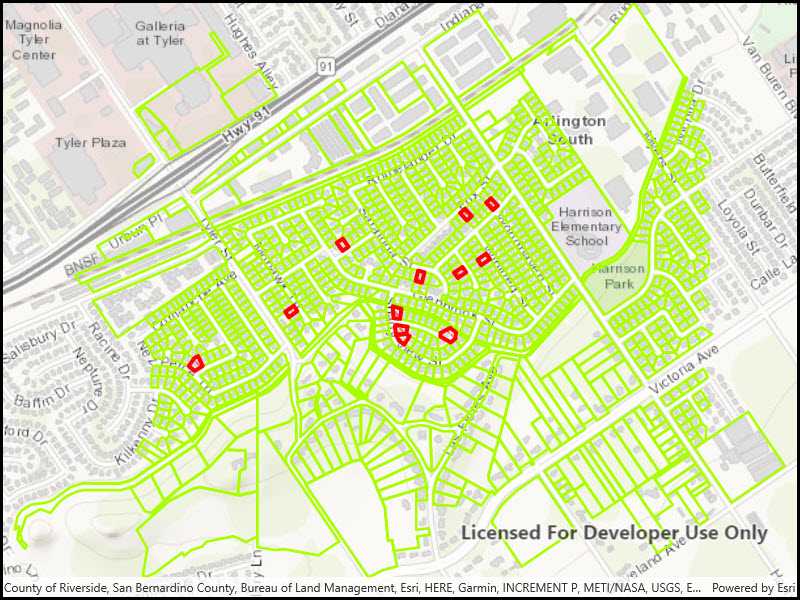
The sample uses a feature service showing pool permits for land parcels in a Riverside, CA neighborhood.
Additional information
In no cache mode, features are automatically populated from the service for the visible extent. Each time the user pans and zooms, features are downloaded for the visible extent. Features are still cached in a local geodatabase for display, but the cache will always be populated with the latest data after navigation.
NOTE: No cache does not guarantee that features won't be cached locally; feature request mode is a performance concept unrelated to data security.
Tags
cache, feature request mode, performance
Sample Code
�<UserControl
x:Class="ArcGIS.UWP.Samples.ServiceFeatureTableNoCache.ServiceFeatureTableNoCache"
xmlns="http://schemas.microsoft.com/winfx/2006/xaml/presentation"
xmlns:x="http://schemas.microsoft.com/winfx/2006/xaml"
xmlns:d="http://schemas.microsoft.com/expression/blend/2008"
xmlns:mc="http://schemas.openxmlformats.org/markup-compatibility/2006"
xmlns:esriUI="using:Esri.ArcGISRuntime.UI.Controls"
mc:Ignorable="d"
d:DesignHeight="300"
d:DesignWidth="400">
<Grid>
<esriUI:MapView x:Name="MyMapView"/>
</Grid>
</UserControl>