Restrict zooming between specific scale ranges.
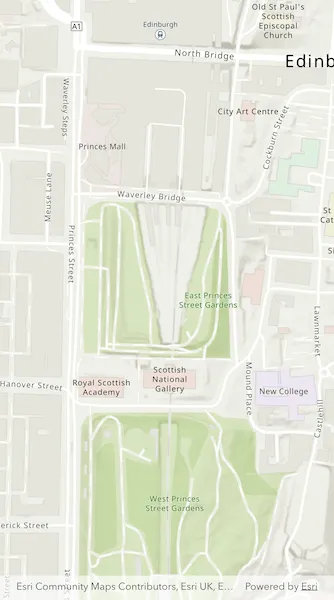
Use case
Data may only appear at a certain scale on a map, and may be visually lost if zooming too far in or out. Setting the minimum and maximum scales ensures the zoom extents are appropriately limited for the purposes of the map.
How to use the sample
Zoom in and out of the map. The zoom extents of the map are limited between the given minimum and maximum scales.
How it works
- Instantiate an
ArcGISMapobject. - Set min and max scales of map with
maxScaleandminScaleproperties ofArcGISMap. - Set the map to an
ArcGISMapViewobject.
Relevant API
- ArcGISMap
- ArcGISMapView
- Basemap
- ViewPoint
Tags
area of interest, level of detail, maximum, minimum, scale, viewpoint
Sample code
set_min_and_max_scale.dart
// Copyright 2026 Esri//// Licensed under the Apache License, Version 2.0 (the "License");// you may not use this file except in compliance with the License.// You may obtain a copy of the License at////   https://www.apache.org/licenses/LICENSE-2.0//// Unless required by applicable law or agreed to in writing, software// distributed under the License is distributed on an "AS IS" BASIS,// WITHOUT WARRANTIES OR CONDITIONS OF ANY KIND, either express or implied.// See the License for the specific language governing permissions and// limitations under the License.//
import 'package:arcgis_maps/arcgis_maps.dart';import 'package:arcgis_maps_sdk_flutter_samples/common/common.dart';import 'package:flutter/material.dart';
class SetMinAndMaxScale extends StatefulWidget {  const SetMinAndMaxScale({super.key});
  @override  State<SetMinAndMaxScale> createState() => _SetMinAndMaxScaleState();}
class _SetMinAndMaxScaleState extends State<SetMinAndMaxScale>    with SampleStateSupport {  // Create a controller for the map view.  final _mapViewController = ArcGISMapView.createController();
  @override  Widget build(BuildContext context) {    return Scaffold(      // Add a map view to the widget tree and set a controller.      body: ArcGISMapView(        controllerProvider: () => _mapViewController,        onMapViewReady: onMapViewReady,      ),    );  }
  Future<void> onMapViewReady() async {    // Create a map with a basemap style and initial viewpoint.    final map = ArcGISMap.withBasemapStyle(.arcGISTopographic);    map.initialViewpoint = Viewpoint.fromCenter(      ArcGISPoint(        x: -355453,        y: 7548720,        spatialReference: SpatialReference.webMercator,      ),      scale: 3000,    );    // Set min and max scales to the map.    map.minScale = 8000;    map.maxScale = 2000;    // Set the map to the map view controller.    _mapViewController.arcGISMap = map;  }}