Generate multiple individual buffers or a single unioned buffer around multiple points.
Use case
Creating buffers is a core concept in GIS proximity analysis that allows you to visualize and locate geographic features contained within a set distance of a feature. For example, consider an area where wind turbines are proposed. It has been determined that each turbine should be located at least 2 km away from residential premises due to noise pollution regulations, and a proximity analysis is therefore required. The first step would be to generate 2 km buffer polygons around all proposed turbines. As the buffer polygons may overlap for each turbine, unioning the result would produce a single graphic result with a neater visual output. If any premises are located within 2 km of a turbine, that turbine would be in breach of planning regulations.
How to use the sample
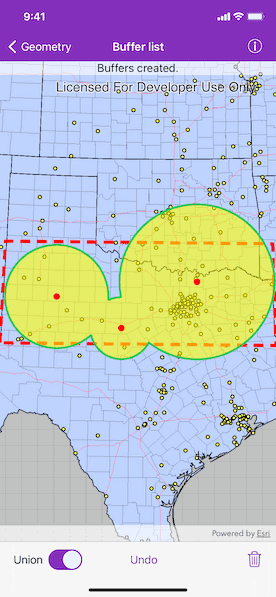
Tap on the map to add buffers. Toggle on "Union" toggle if you want the result to union (combine) the buffers. Tap the trash icon to start over. The red dashed envelope shows the area where you can expect reasonable results for planar buffer operations with the North Central Texas State Plane spatial reference.
How it works
- Use
class AGSGeometryEngine.bufferGeometries(_:distances:unionResults:)to create a list ofAGSGeometrys.- The parameter
pointsare the points to buffer around,distancesare the buffer radius distances for each point (in the unit of the geometry's spatial reference) andunionResultsis a Boolean for whether the results should be unioned.
- The parameter
- Add the resulting polygons (if not unioned) or single polygon (if unioned) to the map's
AGSGraphicsOverlayas anAGSGraphic.
Relevant API
- AGSGeometry
- AGSSpatialReference
- class AGSGeometryEngine.bufferGeometries(_:distances:unionResults:)
Additional information
The properties of the underlying projection determine the accuracy of buffer polygons in a given area. Planar buffers work well when analyzing distances around features that are concentrated in a relatively small area in a projected coordinate system. Inaccurate buffers could still be created by buffering points inside the spatial reference's envelope with distances that move it outside the envelope. On the other hand, geodesic buffers consider the curved shape of the Earth's surface and provide more accurate buffer offsets for features that are more dispersed (i.e., cover multiple UTM zones, large regions, or even the whole globe). See the "Buffer" sample for an example of a geodesic buffer.
For more information about using buffer analysis, see the topic How Buffer (Analysis) works in the ArcGIS Pro documentation.
Tags
analysis, buffer, geometry, planar
Sample Code
// Copyright 2020 Esri
//
// Licensed under the Apache License, Version 2.0 (the "License");
// you may not use this file except in compliance with the License.
// You may obtain a copy of the License at
//
// http://www.apache.org/licenses/LICENSE-2.0
//
// Unless required by applicable law or agreed to in writing, software
// distributed under the License is distributed on an "AS IS" BASIS,
// WITHOUT WARRANTIES OR CONDITIONS OF ANY KIND, either express or implied.
// See the License for the specific language governing permissions and
// limitations under the License.
import UIKit
import ArcGIS
class BufferListViewController: UIViewController {
// MARK: Storyboard views
/// The undo button.
@IBOutlet weak var undoBarButtonItem: UIBarButtonItem!
/// The clear button.
@IBOutlet weak var clearBarButtonItem: UIBarButtonItem!
/// A label to display status message.
@IBOutlet weak var statusLabel: UILabel!
/// A switch to enable "union" for buffer operation.
@IBOutlet weak var isUnionSwitch: UISwitch!
/// The map view managed by the view controller.
@IBOutlet weak var mapView: AGSMapView! {
didSet {
mapView.map = makeMap(imageLayer: mapImageLayer)
// Create and add graphics overlays.
// An overlay to display the boundary.
let boundaryGraphicsOverlay = makeBoundaryGraphicsOverlay(boundaryGeometry: boundaryPolygon)
bufferGraphicsOverlay = makeBufferGraphicsOverlay()
tappedLocationsGraphicsOverlay = makeTappedLocationsGraphicsOverlay()
mapView.graphicsOverlays.addObjects(from: [boundaryGraphicsOverlay, bufferGraphicsOverlay!, tappedLocationsGraphicsOverlay!])
mapView.touchDelegate = self
}
}
// MARK: Instance properties
/// An image layer as the base layer of the map.
let mapImageLayer = AGSArcGISMapImageLayer(url: URL(string: "https://sampleserver6.arcgisonline.com/arcgis/rest/services/USA/MapServer")!)
/// A polygon that represents the valid area of use for the spatial reference.
let boundaryPolygon: AGSPolygon = {
let boundaryPoints = [
AGSPoint(x: -103.070, y: 31.720, spatialReference: .wgs84()),
AGSPoint(x: -103.070, y: 34.580, spatialReference: .wgs84()),
AGSPoint(x: -94.000, y: 34.580, spatialReference: .wgs84()),
AGSPoint(x: -94.00, y: 31.720, spatialReference: .wgs84())
]
let polygon = AGSPolygon(points: boundaryPoints)
let statePlaneNorthCentralTexas = AGSSpatialReference(wkid: 32038)!
return AGSGeometryEngine.projectGeometry(polygon, to: statePlaneNorthCentralTexas) as! AGSPolygon
}()
/// An overlay to display buffers graphics.
var bufferGraphicsOverlay: AGSGraphicsOverlay!
/// An overlay to display tapped locations with red circle symbols.
var tappedLocationsGraphicsOverlay: AGSGraphicsOverlay!
/// An array of tapped points and buffer radii (in US feet) tuple.
var tappedPointsAndRadii = [(point: AGSPoint, radius: Double)]() {
didSet {
let newValueIsEmpty = tappedPointsAndRadii.isEmpty
if newValueIsEmpty != oldValue.isEmpty {
// Only set button states when the emptiness of the array has changed.
undoBarButtonItem.isEnabled = !newValueIsEmpty
clearBarButtonItem.isEnabled = !newValueIsEmpty
}
// Redraw the buffers.
drawBuffers()
}
}
/// A formatter for the output distance string.
let distanceFormatter: MeasurementFormatter = {
let formatter = MeasurementFormatter()
formatter.numberFormatter.maximumFractionDigits = 0
return formatter
}()
// MARK: Instance methods
/// Creates a map with an image base layer.
///
/// - Parameter imageLayer: An `AGSArcGISMapImageLayer` object as the base layer of the map.
/// - Returns: A new `AGSMap` object.
func makeMap(imageLayer: AGSArcGISMapImageLayer) -> AGSMap {
// The spatial reference for this sample.
let statePlaneNorthCentralTexas = AGSSpatialReference(wkid: 32038)!
let map = AGSMap(spatialReference: statePlaneNorthCentralTexas)
map.basemap.baseLayers.add(imageLayer)
return map
}
/// Creates a graphics overlay for the boundary polygon graphics.
///
/// - Parameter boundaryGeometry: The geometry of bounday graphics.
/// - Returns: A new `AGSGraphicsOverlay` object.
func makeBoundaryGraphicsOverlay(boundaryGeometry: AGSGeometry) -> AGSGraphicsOverlay {
let overlay = AGSGraphicsOverlay()
let lineSymbol = AGSSimpleLineSymbol(style: .dash, color: .red, width: 5)
let boundaryGraphic = AGSGraphic(geometry: boundaryGeometry, symbol: lineSymbol)
overlay.graphics.add(boundaryGraphic)
return overlay
}
/// Creates a graphics overlay for the buffer graphics.
func makeBufferGraphicsOverlay() -> AGSGraphicsOverlay {
let overlay = AGSGraphicsOverlay()
let bufferPolygonOutlineSymbol = AGSSimpleLineSymbol(style: .solid, color: .systemGreen, width: 3)
let bufferPolygonFillSymbol = AGSSimpleFillSymbol(style: .solid, color: UIColor.yellow.withAlphaComponent(0.6), outline: bufferPolygonOutlineSymbol)
overlay.renderer = AGSSimpleRenderer(symbol: bufferPolygonFillSymbol)
return overlay
}
/// Creates a graphics overlay for the tapped location graphics.
func makeTappedLocationsGraphicsOverlay() -> AGSGraphicsOverlay {
let overlay = AGSGraphicsOverlay()
let circleSymbol = AGSSimpleMarkerSymbol(style: .circle, color: .red, size: 10)
overlay.renderer = AGSSimpleRenderer(symbol: circleSymbol)
return overlay
}
// MARK: Actions
@IBAction func undoButtonTapped(_ sender: UIBarButtonItem) {
// Remove the last pair of tapped point and radius.
tappedPointsAndRadii.removeLast()
}
@IBAction func isUnionSwitchValueChanged(_ sender: UISwitch) {
// Redraw buffers when the union switch's value is changed.
drawBuffers()
}
@IBAction func clearButtonTapped(_ sender: UIBarButtonItem) {
bufferGraphicsOverlay.graphics.removeAllObjects()
tappedLocationsGraphicsOverlay.graphics.removeAllObjects()
tappedPointsAndRadii.removeAll()
}
// MARK: UI
func setStatus(message: String) {
statusLabel.text = message
}
func drawBuffers() {
// Clear existing buffers graphics before drawing.
bufferGraphicsOverlay.graphics.removeAllObjects()
tappedLocationsGraphicsOverlay.graphics.removeAllObjects()
guard !tappedPointsAndRadii.isEmpty else {
setStatus(message: "Tap on the map to add buffers.")
return
}
// Reduce the tuples into points and radii arrays.
let (points, radii) = tappedPointsAndRadii.reduce(into: ([AGSPoint](), [NSNumber]())) { (result, pointAndRadius) in
result.0.append(pointAndRadius.point)
result.1.append(pointAndRadius.radius as NSNumber)
}
// Create the buffers.
// Notice: the radius distances has the same unit of the map's spatial reference's unit.
// In this case, the statePlaneNorthCentralTexas spatial reference uses US feet.
if let bufferPolygon = AGSGeometryEngine.bufferGeometries(points, distances: radii, unionResults: isUnionSwitch.isOn) {
// Add graphics symbolizing the tap point.
tappedLocationsGraphicsOverlay.graphics.addObjects(from: points.map { AGSGraphic(geometry: $0, symbol: nil) })
// Add graphics of the buffer polygons.
bufferGraphicsOverlay.graphics.addObjects(from: bufferPolygon.map { AGSGraphic(geometry: $0, symbol: nil) })
setStatus(message: "Buffers created.")
}
}
// MARK: UIViewController
override func viewDidLoad() {
super.viewDidLoad()
// Add the source code button item to the right of navigation bar.
(navigationItem.rightBarButtonItem as? SourceCodeBarButtonItem)?.filenames = ["BufferListViewController"]
// Load the map image layer.
mapImageLayer.load { [weak self] (error) in
guard let self = self else { return }
if let error = error {
self.presentAlert(error: error)
self.setStatus(message: "Failed to load basemap.")
} else {
self.mapView.setViewpoint(AGSViewpoint(targetExtent: self.boundaryPolygon.extent), completion: nil)
self.setStatus(message: "Tap on the map to add buffers.")
}
}
}
}
// MARK: - AGSGeoViewTouchDelegate
extension BufferListViewController: AGSGeoViewTouchDelegate {
func geoView(_ geoView: AGSGeoView, didTapAtScreenPoint screenPoint: CGPoint, mapPoint: AGSPoint) {
// Only proceed when the tapped point is within the boundary.
guard AGSGeometryEngine.geometry(boundaryPolygon, contains: mapPoint) else {
setStatus(message: "Tap within the boundary to add buffer.")
return
}
// Use an alert to get radius input from user.
let alert = UIAlertController(title: "Provide a buffer radius between 0 and 300 \(distanceFormatter.string(from: UnitLength.miles)).", message: nil, preferredStyle: .alert)
// Create an object to observe changes from the textfield.
var textFieldObserver: NSObjectProtocol!
// Add a textfield to get user input.
alert.addTextField { textField in
textField.keyboardType = .numberPad
textField.placeholder = "100"
}
let doneAction = UIAlertAction(title: "Done", style: .default) { [weak self, unowned alert, mapPoint = mapPoint] _ in
// Remove the observer after editing is complete.
NotificationCenter.default.removeObserver(textFieldObserver!)
guard let self = self,
let text = alert.textFields?.first?.text,
let radius = self.distanceFormatter.numberFormatter.number(from: text)
else { return }
// Update the buffer radius with the text value.
let radiusInMiles = Measurement(value: radius.doubleValue, unit: UnitLength.miles)
// The spatial reference in this sample uses US feet as its unit.
let radiusInFeet = radiusInMiles.converted(to: .feet).value
// Keep track of tapped points and their radii.
self.tappedPointsAndRadii.append((point: mapPoint, radius: radiusInFeet))
}
// Add an observer to ensure the user input is valid.
textFieldObserver = NotificationCenter.default.addObserver(forName: UITextField.textDidChangeNotification, object: nil, queue: .main, using: { [weak self, weak alert, unowned doneAction] _ in
// Ensure the buffer radius input is valid, and is within the range.
if let text = alert?.textFields?.first?.text,
!text.isEmpty,
let radius = self?.distanceFormatter.numberFormatter.number(from: text),
radius.doubleValue > 0,
radius.doubleValue < 300 {
doneAction.isEnabled = true
} else {
doneAction.isEnabled = false
}
})
// Disable done button by default.
doneAction.isEnabled = false
alert.addAction(doneAction)
let cancelAction = UIAlertAction(title: "Cancel", style: .cancel) { _ in
// Remove the observer when canceled.
NotificationCenter.default.removeObserver(textFieldObserver!)
}
alert.addAction(cancelAction)
alert.preferredAction = doneAction
present(alert, animated: true)
}
}