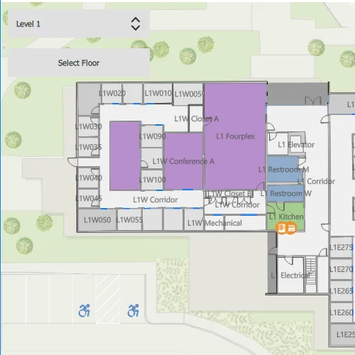
Display and browse through building floors from a floor-aware web map.
Use case
Having map data to aid indoor navigation in buildings with multiple floors such as airports, museums, or offices can be incredibly useful. For example, you may wish to browse through all available floor maps for an office in order to find the location of an upcoming meeting in advance.
How to use the sample
Use the dropdown menu to browse different floor levels in the facility. Only the selected floor will be displayed.
How it works
- Create a
PortalItemusing the identifier of a floor-aware web map. - Create a map using the portal item.
- Create a map view and assign the map to it.
- Wait for the map to load and retrieve the map’s
FloorManager. - Wait for the floor manager to load and get its list of
FloorLevels. - Set the
isVisibleproperty to false for all floor levels. - Set only the selected
FloorLevelto visible using theisVisibleproperty of the floor level.
- Note: Manually set the default floor level to the first floor.
Relevant API
- FloorLevel
- FloorManager
About the data
This sample uses a floor-aware web map that displays the floors of Building L on the Esri Redlands campus.
Additional information
The FloorManager API also supports browsing different sites and facilities in addition to building floors.
Tags
building, facility, floor, floor-aware, floors, ground floor, indoor, level, site, story
Sample code
// [WriteFile Name=BrowseBuildingFloors, Category=Maps]// [Legal]// Copyright 2022 Esri.//// Licensed under the Apache License, Version 2.0 (the "License");// you may not use this file except in compliance with the License.// You may obtain a copy of the License at// http://www.apache.org/licenses/LICENSE-2.0//// Unless required by applicable law or agreed to in writing, software// distributed under the License is distributed on an "AS IS" BASIS,// WITHOUT WARRANTIES OR CONDITIONS OF ANY KIND, either express or implied.// See the License for the specific language governing permissions and// limitations under the License.// [Legal]
#ifdef PCH_BUILD#include "pch.hpp"#endif // PCH_BUILD
// sample headers#include "BrowseBuildingFloors.h"
// ArcGIS Maps SDK headers#include "Error.h"#include "FloorLevel.h"#include "FloorManager.h"#include "Map.h"#include "MapQuickView.h"#include "MapTypes.h"#include "Portal.h"#include "PortalItem.h"
using namespace Esri::ArcGISRuntime;
BrowseBuildingFloors::BrowseBuildingFloors(QObject* parent /* = nullptr */):  QObject(parent){  Portal* portal = new Portal(QUrl("https://www.arcgis.com/"), this);  PortalItem* portalItem = new PortalItem(portal, "f133a698536f44c8884ad81f80b6cfc7", this);
  // Create a map object using the portalItem  m_map = new Map(portalItem, this);
  connect(m_map, &Map::doneLoading, this, [this]()  {    if (m_map->loadStatus() == LoadStatus::Loaded)    {      m_floorManager = m_map->floorManager();    }
    connect(m_floorManager, &FloorManager::doneLoading, this, [this]()    {      if (m_floorManager && m_floorManager->loadStatus() == LoadStatus::Loaded)      {        for (FloorLevel* level : m_floorManager->levels())        {          level->setVisible(false);        }
        // Manually set the default floor level to the first floor        m_floorManager->levels().at(0)->setVisible(true);      }    });    m_floorManager->load();  });}
BrowseBuildingFloors::~BrowseBuildingFloors() = default;
void BrowseBuildingFloors::init(){  // Register the map view for QML  qmlRegisterType<MapQuickView>("Esri.Samples", 1, 0, "MapView");  qmlRegisterType<BrowseBuildingFloors>("Esri.Samples", 1, 0, "BrowseBuildingFloorsSample");}
MapQuickView* BrowseBuildingFloors::mapView() const{  return m_mapView;}
// Set the view (created in QML)void BrowseBuildingFloors::setMapView(MapQuickView* mapView){  if (!mapView || mapView == m_mapView)    return;
  m_mapView = mapView;  m_mapView->setMap(m_map);
  emit mapViewChanged();}
void BrowseBuildingFloors::selectFloor(const QString& floor_number){  if (m_floorManager && m_floorManager->loadStatus() == LoadStatus::Loaded)  {    if (floor_number.compare("Level 1") == 0)    {      m_floorManager->levels().at(0)->setVisible(true);
      //Make the other floors invisible      m_floorManager->levels().at(1)->setVisible(false);      m_floorManager->levels().at(2)->setVisible(false);    }
    if (floor_number.compare("Level 2") == 0)    {      m_floorManager->levels().at(1)->setVisible(true);
      //Make the other floors invisible      m_floorManager->levels().at(0)->setVisible(false);      m_floorManager->levels().at(2)->setVisible(false);    }
    if (floor_number.compare("Level 3") == 0)    {      m_floorManager->levels().at(2)->setVisible(true);
      //Make the other floors invisible      m_floorManager->levels().at(0)->setVisible(false);      m_floorManager->levels().at(1)->setVisible(false);    }  }
}
// [WriteFile Name=BrowseBuildingFloors, Category=Maps]// [Legal]// Copyright 2022 Esri.//// Licensed under the Apache License, Version 2.0 (the "License");// you may not use this file except in compliance with the License.// You may obtain a copy of the License at// http://www.apache.org/licenses/LICENSE-2.0//// Unless required by applicable law or agreed to in writing, software// distributed under the License is distributed on an "AS IS" BASIS,// WITHOUT WARRANTIES OR CONDITIONS OF ANY KIND, either express or implied.// See the License for the specific language governing permissions and// limitations under the License.// [Legal]
#ifndef BROWSEBUILDINGFLOORS_H#define BROWSEBUILDINGFLOORS_H
// Qt headers#include <QObject>
namespace Esri::ArcGISRuntime{class Map;class MapQuickView;class FloorManager;class FloorLevel;}
Q_MOC_INCLUDE("MapQuickView.h")
class BrowseBuildingFloors : public QObject{ Q_OBJECT
Q_PROPERTY(Esri::ArcGISRuntime::MapQuickView* mapView READ mapView WRITE setMapView NOTIFY mapViewChanged)
public: explicit BrowseBuildingFloors(QObject* parent = nullptr); ~BrowseBuildingFloors();
static void init(); Q_INVOKABLE void selectFloor(const QString& floor_number);
signals: void mapViewChanged();
private: Esri::ArcGISRuntime::MapQuickView* mapView() const; void setMapView(Esri::ArcGISRuntime::MapQuickView* mapView);
Esri::ArcGISRuntime::Map* m_map = nullptr; Esri::ArcGISRuntime::MapQuickView* m_mapView = nullptr; Esri::ArcGISRuntime::FloorManager* m_floorManager = nullptr;};
#endif // BROWSEBUILDINGFLOORS_H// [WriteFile Name=BrowseBuildingFloors, Category=Maps]// [Legal]// Copyright 2022 Esri.//// Licensed under the Apache License, Version 2.0 (the "License");// you may not use this file except in compliance with the License.// You may obtain a copy of the License at// http://www.apache.org/licenses/LICENSE-2.0//// Unless required by applicable law or agreed to in writing, software// distributed under the License is distributed on an "AS IS" BASIS,// WITHOUT WARRANTIES OR CONDITIONS OF ANY KIND, either express or implied.// See the License for the specific language governing permissions and// limitations under the License.// [Legal]
import QtQuickimport QtQuick.Controlsimport Esri.Samples
Item {
// add a mapView component MapView { id: view anchors.fill: parent }
// Declare the C++ instance which creates the map etc. and supply the view BrowseBuildingFloorsSample { id: model mapView: view }
// Add a background to the column Rectangle { anchors.fill: col radius: 10 border.width: 1 }
Column { id: col spacing: 15 padding: 10
ComboBox { id: floor_level width: 200 model: ["Level 1", "Level 2", "Level 3"] }
Button { id: select_floor width: 200 anchors.horizontalCenter: parent.horizontalCenter text: "Select Floor" onClicked: { model.selectFloor(floor_level.currentText); } } }}