Load ArcGIS vector tiled layers using custom styles.
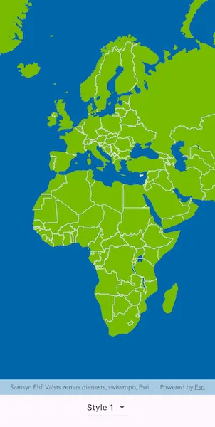
Use case
Vector tile basemaps can be created in ArcGIS Pro and published as offline packages or online services. You can create a custom style tailored to your needs and easily apply it to your map. ArcGISVectorTiledLayer has many advantages over traditional raster-based basemaps (ArcGISTiledLayer), including smooth scaling between different screen DPIs, smaller package sizes, and the ability to rotate symbols and labels dynamically.
How to use the sample
Pan and zoom to explore the vector tile basemap. Select a theme to see it applied to the vector tile basemap.
How it works
- Create an
ArcGISVectorTiledLayerfrom an ArcGIS Online custom style item. - Alternatively, create an
ArcGISVectorTiledLayerby taking a style item offline and applying it to a local vector tile package:- Create a
PortalItemfor the selected style. - Create an
ExportVectorTilesTaskwith thatPortalItem. - Create and run an
ExportVectorTilesJobusingExportVectorTilesTask.exportStyleResourceCache. - Create a
VectorTileCachefrom the local.vtpkfile. - Create an
ArcGISVectorTiledLayerwithArcGISVectorTiledLayer.withVectorTileCache, passing theItemResourceCachefrom the job result.
- Create a
- Create a
Basemapfrom the layer and assign it to the map’sbasemap.
Relevant API
- ArcGISMap
- ArcGISVectorTiledLayer
- ExportVectorTilesTask
- ItemResourceCache
- VectorTileCache
Offline data
This sample uses the Dodge City OSM vector tile package. It is downloaded from ArcGIS Online automatically.
Tags
tiles, vector, vector basemap, vector tile package, vector tiled layer, vector tiles, vtpk
Sample code
// Copyright 2026 Esri//// Licensed under the Apache License, Version 2.0 (the "License");// you may not use this file except in compliance with the License.// You may obtain a copy of the License at////   https://www.apache.org/licenses/LICENSE-2.0//// Unless required by applicable law or agreed to in writing, software// distributed under the License is distributed on an "AS IS" BASIS,// WITHOUT WARRANTIES OR CONDITIONS OF ANY KIND, either express or implied.// See the License for the specific language governing permissions and// limitations under the License.//
import 'dart:io';
import 'package:arcgis_maps/arcgis_maps.dart';import 'package:arcgis_maps_sdk_flutter_samples/common/common.dart';import 'package:flutter/material.dart';import 'package:go_router/go_router.dart';
class AddVectorTiledLayerFromCustomStyle extends StatefulWidget {  const AddVectorTiledLayerFromCustomStyle({super.key});
  @override  State<AddVectorTiledLayerFromCustomStyle> createState() =>      _AddVectorTiledLayerFromCustomStyleState();}
class _AddVectorTiledLayerFromCustomStyleState    extends State<AddVectorTiledLayerFromCustomStyle>    with SampleStateSupport {  // Keep the online style labels and associated ArcGIS Online item IDs.  static const _onlineStyles = {    'Default': '1349bfa0ed08485d8a92c442a3850b06',    'Style 1': 'bd8ac41667014d98b933e97713ba8377',    'Style 2': '02f85ec376084c508b9c8e5a311724fa',    'Style 3': '1bf0cc4a4380468fbbff107e100f65a5',  };
  // Keep the offline style labels and associated ArcGIS Online item IDs.  static const _offlineStyles = {    'Light': 'e01262ef2a4f4d91897d9bbd3a9b1075',    'Dark': 'ce8a34e5d4ca4fa193a097511daa8855',  };
  // Create a controller for the map view.  final _mapViewController = ArcGISMapView.createController();
  // Track the selected style label.  var _selectedStyleLabel = 'Default';
  // Cache style layers to avoid recreating them for repeated selections.  final _vectorTiledLayers = <String, ArcGISVectorTiledLayer>{};
  // The URI of the downloaded local vector tile package.  late Uri _vtpkUri;
  // Keep a temporary folder for exported style resources.  late Uri _temporaryDirectoryUri;
  // A flag for when the map view is ready and controls can be used.  var _ready = false;
  @override  void initState() {    // Resolve the local vector tile package from downloadable resources.    final listPaths = GoRouter.of(context).state.extra! as List<String>;    _vtpkUri = Uri.file(listPaths.first);
    // Create a temporary directory for exported style resources.    final temporaryDirectory = Directory.systemTemp.createTempSync(      'add_vector_tiled_layer_from_custom_style_',    );    _temporaryDirectoryUri = temporaryDirectory.uri;
    super.initState();  }
  @override  void dispose() {    // Remove temporary exported resources when the sample is disposed.    final directory = Directory.fromUri(_temporaryDirectoryUri);    if (directory.existsSync()) {      directory.deleteSync(recursive: true);    }
    super.dispose();  }
  @override  Widget build(BuildContext context) {    return Scaffold(      body: SafeArea(        top: false,        left: false,        right: false,        child: Stack(          children: [            Column(              children: [                Expanded(                  // Add a map view to the widget tree and set a controller.                  child: ArcGISMapView(                    controllerProvider: () => _mapViewController,                    onMapViewReady: onMapViewReady,                  ),                ),                // Add a style picker to switch between online and offline styles.                Center(                  child: DropdownButton(                    value: _selectedStyleLabel,                    onChanged: (value) {                      if (value == null || value == _selectedStyleLabel) {                        return;                      }                      _applyStyleSelection(value).ignore();                    },                    items: [..._onlineStyles.keys, ..._offlineStyles.keys].map((                      label,                    ) {                      return DropdownMenuItem(value: label, child: Text(label));                    }).toList(),                  ),                ),              ],            ),            // Display a progress indicator and prevent interaction until state is ready.            LoadingIndicator(visible: !_ready),          ],        ),      ),    );  }
  Future<void> onMapViewReady() async {    // Create an empty map and set it on the map view.    _mapViewController.arcGISMap = ArcGISMap();
    // Apply the default style.    await _applyStyleSelection(_selectedStyleLabel);
    // Mark setup complete so the style picker can be used.    setState(() => _ready = true);  }
  Future<void> _applyStyleSelection(String styleLabel) async {    // Block interactions while loading the selected style.    setState(() {      _ready = false;      _selectedStyleLabel = styleLabel;    });
    try {      // Get the layer for the selected style.      final layer = await _getVectorTiledLayer(styleLabel);
      // Create and apply a basemap from the selected vector tiled layer.      final basemap = Basemap.withBaseLayer(layer);      _mapViewController.arcGISMap!.basemap = basemap;
      // Apply a viewpoint that matches the selected style type.      if (_offlineStyles.containsKey(styleLabel)) {        // Offline - use a viewpoint over Dodge City, KS.        _mapViewController.setViewpoint(          Viewpoint.withLatLongScale(            latitude: 37.76528,            longitude: -100.01766,            scale: 40000,          ),        );      } else {        // Online - use a viewpoint over Europe and Africa.        _mapViewController.setViewpoint(          Viewpoint.withLatLongScale(            latitude: 28.53345,            longitude: 17.56488,            scale: 100000000,          ),        );      }    } on ArcGISException catch (e) {      // Show ArcGIS runtime failures.      showMessageDialog(e.message, title: 'ArcGIS Error');    } on Exception catch (e) {      // Show non-ArcGIS failures.      showMessageDialog(e.toString(), title: 'Error');    } finally {      // Re-enable interactions after style work completes.      setState(() => _ready = true);    }  }
  Future<ArcGISVectorTiledLayer> _getVectorTiledLayer(String styleLabel) async {    // Check if the layer is already cached and return it if available.    if (_vectorTiledLayers.containsKey(styleLabel)) {      return _vectorTiledLayers[styleLabel]!;    }
    // Resolve the layer source using online or offline style item IDs.    final ArcGISVectorTiledLayer layer;    if (_onlineStyles.containsKey(styleLabel)) {      layer = _createOnlineVectorTiledLayer(_onlineStyles[styleLabel]!);    } else {      layer = await _createOfflineVectorTiledLayer(_offlineStyles[styleLabel]!);    }
    // Load the layer before assigning it to the map.    await layer.load();
    // Cache the layer for later reuse.    _vectorTiledLayers[styleLabel] = layer;    return layer;  }
  ArcGISVectorTiledLayer _createOnlineVectorTiledLayer(String itemId) {    // Create a portal item for an ArcGIS Online vector style.    final portalItem = PortalItem.withPortalAndItemId(      portal: Portal.arcGISOnline(),      itemId: itemId,    );
    // Create a vector tiled layer from the online style item.    return ArcGISVectorTiledLayer.withItem(portalItem);  }
  Future<ArcGISVectorTiledLayer> _createOfflineVectorTiledLayer(    String itemId,  ) async {    // Create a portal item and export task for the selected style item.    final portalItem = PortalItem.withPortalAndItemId(      portal: Portal.arcGISOnline(),      itemId: itemId,    );    final exportTask = ExportVectorTilesTask.withPortalItem(portalItem);
    // Export only style resources into a per-style temporary folder.    final styleFolder = Directory.fromUri(      _temporaryDirectoryUri.resolve('$itemId/'),    )..createSync(recursive: true);    final job = exportTask.exportStyleResourceCache(      itemResourceCacheUri: styleFolder.uri,    );    final result = await job.run();    final itemResourceCache = result.itemResourceCache;    if (itemResourceCache == null) {      throw Exception(        'Failed to export style resources for style item $itemId.',      );    }
    // Create a vector tile cache from the downloaded local package.    final vectorTileCache = VectorTileCache(fileUri: _vtpkUri);
    // Create a vector tiled layer from tile and style caches.    return ArcGISVectorTiledLayer.withVectorTileCache(      vectorTileCache,      itemResourceCache: itemResourceCache,    );  }}