Control the behavior of the camera in a scene.
Use case
The globe camera controller (the default camera controller in all new scenes) allows a user to explore the scene freely by zooming in/out and panning around the globe. The orbit camera controllers fix the camera to look at a target location or geoelement. A primary use case is for following moving objects like cars and planes.
How to use the sample
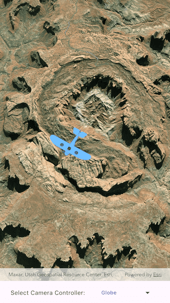
The application loads with the default globe camera controller. To rotate and fix the scene around the plane, exit globe mode by choosing the "Orbit plane" option (i.e. camera will now be fixed to the plane). Choose the "Orbit crater" option to rotate and center the scene around the location of the Upheaval Dome crater structure, or choose the "Globe" option to return to default free navigation.
How it works
- Create an instance of a class extending
CameraController:GlobeCameraController,OrbitLocationCameraController,OrbitGeoElementCameraController. - Set the scene view's camera controller by setting the
ArcGISSceneViewController.cameraControllerproperty.
Relevant API
- ArcGISScene
- ArcGISSceneViewController
- Camera
- GlobeCameraController
- OrbitGeoElementCameraController
- OrbitLocationCameraController
Tags
3D, camera controller, orbit, tracking
Sample Code
// Copyright 2025 Esri
//
// Licensed under the Apache License, Version 2.0 (the "License");
// you may not use this file except in compliance with the License.
// You may obtain a copy of the License at
//
// https://www.apache.org/licenses/LICENSE-2.0
//
// Unless required by applicable law or agreed to in writing, software
// distributed under the License is distributed on an "AS IS" BASIS,
// WITHOUT WARRANTIES OR CONDITIONS OF ANY KIND, either express or implied.
// See the License for the specific language governing permissions and
// limitations under the License.
//
import 'dart:io';
import 'package:arcgis_maps/arcgis_maps.dart';
import 'package:arcgis_maps_sdk_flutter_samples/common/common.dart';
import 'package:flutter/material.dart';
import 'package:path_provider/path_provider.dart';
class ChangeCameraController extends StatefulWidget {
const ChangeCameraController({super.key});
@override
State<ChangeCameraController> createState() => _ChangeCameraControllerState();
}
class _ChangeCameraControllerState extends State<ChangeCameraController>
with SampleStateSupport {
// Create a controller for the scene view.
final _sceneViewController = ArcGISSceneView.createController();
// A flag for when the scene view is ready and controls can be used.
var _ready = false;
// The graphic for the plane.
Graphic? _planeGraphic;
// The type of CameraController currently being used.
var _selectedCameraControllerKind = CameraControllerKind.globe;
// List of entries for the dropdown menu.
final _cameraControllerDropdownEntries =
<DropdownMenuEntry<CameraControllerKind>>[];
@override
void initState() {
super.initState();
// Build up the dropdown menu entries.
_cameraControllerDropdownEntries.addAll([
const DropdownMenuEntry(
value: CameraControllerKind.globe,
label: 'Globe',
),
const DropdownMenuEntry(
value: CameraControllerKind.orbitLocation,
label: 'Orbit crater',
),
const DropdownMenuEntry(
value: CameraControllerKind.orbitGeoElement,
label: 'Orbit plane',
),
]);
}
@override
Widget build(BuildContext context) {
return Scaffold(
body: SafeArea(
top: false,
left: false,
right: false,
child: Stack(
children: [
Column(
children: [
Expanded(
// Add a scene view to the widget tree and set a controller.
child: ArcGISSceneView(
controllerProvider: () => _sceneViewController,
onSceneViewReady: onSceneViewReady,
),
),
Row(
mainAxisAlignment: MainAxisAlignment.center,
children: [
const Text('Select Camera Controller:'),
// Create a dropdown menu to select a feature layer source.
DropdownMenu(
dropdownMenuEntries: _cameraControllerDropdownEntries,
trailingIcon: const Icon(Icons.arrow_drop_down),
textAlign: TextAlign.center,
textStyle: Theme.of(context).textTheme.labelMedium,
hintText: 'Select a camera controller',
onSelected: handleCameraControllerSelection,
initialSelection: _selectedCameraControllerKind,
),
],
),
],
),
// Display a progress indicator and prevent interaction until state is ready.
LoadingIndicator(visible: !_ready),
],
),
),
);
}
Future<void> onSceneViewReady() async {
// Add the scene to the view controller.
final scene = _setupScene();
_sceneViewController.arcGISScene = scene;
// Graphics overlay for the plane
final graphicsOverlay = GraphicsOverlay();
_planeGraphic = await _setupPlaneGraphic();
graphicsOverlay.graphics.add(_planeGraphic!);
graphicsOverlay.sceneProperties.surfacePlacement =
SurfacePlacement.absolute;
_sceneViewController.graphicsOverlays.add(graphicsOverlay);
// Set the ready state variable to true to enable the sample UI.
setState(() => _ready = true);
}
// Function to handle when the user selects a camera controller from the
// dropdown menu.
void handleCameraControllerSelection(
CameraControllerKind? cameraControllerKind,
) {
if (cameraControllerKind == null || _planeGraphic == null) return;
// Set the appropriate camera controller based on the user's selection.
switch (cameraControllerKind) {
case CameraControllerKind.globe:
_sceneViewController.cameraController = GlobeCameraController();
case CameraControllerKind.orbitGeoElement:
final cameraController = OrbitGeoElementCameraController(
targetGeoElement: _planeGraphic!,
distance: 1700,
);
cameraController.cameraPitchOffset = 3;
cameraController.cameraHeadingOffset = 150;
_sceneViewController.cameraController = cameraController;
case CameraControllerKind.orbitLocation:
final cameraController =
OrbitLocationCameraController.withTargetPositionAndCameraDistance(
targetLocation: ArcGISPoint(
x: -109.929589,
y: 38.437304,
z: 1700,
spatialReference: SpatialReference.wgs84,
),
distance: 10000,
);
cameraController.cameraPitchOffset = 3;
cameraController.cameraHeadingOffset = 150;
_sceneViewController.cameraController = cameraController;
}
setState(() {
_selectedCameraControllerKind = cameraControllerKind;
});
}
ArcGISScene _setupScene() {
// Create a scene with an imagery basemap style.
final scene = ArcGISScene.withBasemapStyle(BasemapStyle.arcGISImagery);
// Set the scene's initial viewpoint.
scene.initialViewpoint = Viewpoint.withPointScaleCamera(
center: ArcGISPoint(x: 0, y: 0),
scale: 1,
camera: Camera.withLookAtPoint(
lookAtPoint: ArcGISPoint(
x: -109.92845172437961,
y: 38.440455578104029,
spatialReference: SpatialReference.wgs84,
),
distance: 10000,
heading: 150,
pitch: 20,
roll: 0,
),
);
// Add surface elevation to the scene.
final worldElevationService = Uri.parse(
'https://elevation3d.arcgis.com/arcgis/rest/services/WorldElevation3D/Terrain3D/ImageServer',
);
final elevationSource = ArcGISTiledElevationSource.withUri(
worldElevationService,
);
scene.baseSurface.elevationSources.add(elevationSource);
return scene;
}
Future<Graphic> _setupPlaneGraphic() async {
const downloadFileName = 'Bristol';
final appDir = await getApplicationDocumentsDirectory();
final zipFile = File('${appDir.absolute.path}/$downloadFileName.zip');
final bristolFile = File(
'${appDir.absolute.path}/$downloadFileName/$downloadFileName.dae',
);
// Download the plane model files.
if (!zipFile.existsSync()) {
await downloadSampleDataWithProgress(
itemIds: ['681d6f7694644709a7c830ec57a2d72b'],
destinationFiles: [zipFile],
);
}
// Define the plane's position.
final planePosition = ArcGISPoint(
x: -109.937516,
y: 38.456714,
z: 5000,
spatialReference: SpatialReference.wgs84,
);
// Define the plane symbol.
final planeSymbol = ModelSceneSymbol.withUri(
uri: Uri.parse(bristolFile.path),
scale: 50,
);
// Create the plane's graphic with the location and symbol.
final planeGraphic = Graphic(geometry: planePosition, symbol: planeSymbol);
return planeGraphic;
}
}
// Enumeration listing the kinds of camera controllers available in this sample.
enum CameraControllerKind { globe, orbitLocation, orbitGeoElement }