Load an ArcGIS tiled layer from a URL.
Use case
An ArcGISTiledLayer consumes raster tiles provided by an ArcGIS service or a tile package (.tpk & .tpkx). Dividing a raster into tiles provides the user with relevant tiles and level of detail while panning and zooming, allowing for rapid map visualization and navigation. For example, say you wanted an application with a map containing all museums in your city so that you could share this with tourists. Since only the museums would need to support being identifiable or queryable within the app, all other contextual information required to orient and direct the tourists could be sourced from a single ArcGIS tiled layer, leading to faster performance and minimizing the time to load the map.
How to use the sample
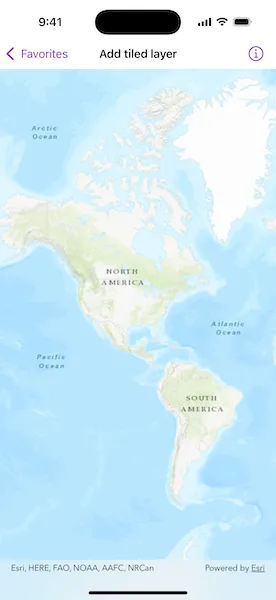
Open the sample to view the “World Topographic Map” tile layer as the basemap.
How it works
- Create an
ArcGISTiledLayerobject from a URL. - Create a
Basemap, passing in the tiled layer. - Create a
Mapwith the basemap. - Set the map on the
MapView.
Relevant API
- ArcGISTiledLayer
- Basemap
- Map
- MapView
About the data
The application utilizes the “World Topographic Map” tile layer. This presents a simple yet powerful illustration of adding visualization context to a basemap through the use of an ArcGIS tiled layer.
Additional information
An ArcGIS tiled layer can also be added to a map as a layer, but it’s best practice to use it as a basemap since its purpose is to provide geographical context. ArcGIS tiled layers do not support reprojection, query, select, identify, or editing.
Tags
basemap, layers, raster tiles, tiled layer, visualization
Sample code
// Copyright 2024 Esri//// Licensed under the Apache License, Version 2.0 (the "License");// you may not use this file except in compliance with the License.// You may obtain a copy of the License at////   https://www.apache.org/licenses/LICENSE-2.0//// Unless required by applicable law or agreed to in writing, software// distributed under the License is distributed on an "AS IS" BASIS,// WITHOUT WARRANTIES OR CONDITIONS OF ANY KIND, either express or implied.// See the License for the specific language governing permissions and// limitations under the License.
import ArcGISimport SwiftUI
struct AddTiledLayerView: View {    /// A map with a "World Topographic Map" tiled layer.    @State private var map: Map = {        // A web URL to the "World_Topo_Map" map server on ArcGIS Online.        let worldTopographicMap = URL(            string: "https://services.arcgisonline.com/arcgis/rest/services/World_Topo_Map/MapServer"        )!
        // Creates a tiled layer using the URL.        let tiledLayer = ArcGISTiledLayer(url: worldTopographicMap)
        // Creates a basemap using the layer.        let basemap = Basemap(baseLayer: tiledLayer)
        // Creates a map using the basemap.        let map = Map(basemap: basemap)
        // Sets the initial viewpoint on the map to zoom in on the layer.        let extent = Envelope(            xRange: -18546390...(-1833410),            yRange: -10740120...18985720,            spatialReference: .webMercator        )        map.initialViewpoint = Viewpoint(boundingGeometry: extent)
        return map    }()
    var body: some View {        // Displays the map using a map view.        MapView(map: map)    }}
#Preview {    AddTiledLayerView()}