Display and customize coordinate system grids including Latitude/Longitude, MGRS, UTM and USNG on a map view or scene view.
Use case
Grids are often used on printed maps, but can also be helpful on digital 2D maps or 3D scenes, to identify locations.
How to use the sample
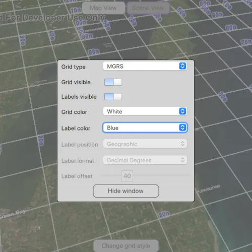
Tap on the Change Grid button in the toolbar to open a settings view. You can change the view from 2D or 3D, select the type of grid from Grid Type (LatLong, MGRS, UTM, and USNG) and modify its properties like label visibility, grid line color, grid label color, label formatting, and label offset.
How it works
- Create an instance of one of the
Gridtypes. - Grid lines and labels can be styled per grid level with
setLineSymbol(gridLevel, lineSymbol)andsetTextSymbol(gridLevel, textSymbol)methods on the grid. - The label position can be set with
setLabelPosition(labelPosition)method on the grid.- Note that as of 200.6, MGRS, UTM, and USNG grids in a SceneView only support the
Geographiclabel position.
- Note that as of 200.6, MGRS, UTM, and USNG grids in a SceneView only support the
- For the
LatitudeLongitudeGridtype, you can specify a label format ofDECIMAL_DEGREESorDEGREES_MINUTES_SECONDS. - For all screen-aligned label placement strategies, you can set the labels’ offset in device-independent pixels (DIPs) from the screen edge with
setLabelOffset(offset). - To set the grid, use the
setGrid(grid)method on the map view or scene view.
Relevant API
- ArcGISGrid
- LatitudeLongitudeGrid
- MapView
- MGRSGrid
- SceneView
- SimpleLineSymbol
- TextSymbol
- USNGGrid
- UTMGrid
Tags
coordinates, degrees, graticule, grid, latitude, longitude, MGRS, minutes, seconds, USNG, UTM
Sample code
// [WriteFile Name=ShowGrid, Category=DisplayInformation]// [Legal]// Copyright 2024 Esri.
// Licensed under the Apache License, Version 2.0 (the "License");// you may not use this file except in compliance with the License.// You may obtain a copy of the License at// http://www.apache.org/licenses/LICENSE-2.0
// Unless required by applicable law or agreed to in writing, software// distributed under the License is distributed on an "AS IS" BASIS,// WITHOUT WARRANTIES OR CONDITIONS OF ANY KIND, either express or implied.// See the License for the specific language governing permissions and// limitations under the License.// [Legal]
#ifdef PCH_BUILD#include "pch.hpp"#endif // PCH_BUILD
#include "ShowGrid.h"
#include "ArcGISTiledElevationSource.h"#include "ElevationSourceListModel.h"#include "LatitudeLongitudeGrid.h"#include "Map.h"#include "MapTypes.h"#include "MapQuickView.h"#include "MapViewTypes.h"#include "MGRSGrid.h"#include "Point.h"#include "Scene.h"#include "SceneQuickView.h"#include "SimpleLineSymbol.h"#include "SpatialReference.h"#include "Surface.h"#include "TextSymbol.h"#include "USNGGrid.h"#include "UTMGrid.h"#include "Viewpoint.h"
#include <QFuture>
using namespace Esri::ArcGISRuntime;
ShowGrid::ShowGrid(QObject* parent /* = nullptr */):  QObject(parent),  m_map(new Map(BasemapStyle::ArcGISImagery, this)),  m_scene(new Scene(BasemapStyle::ArcGISImagery, this)){  // create a new elevation source from Terrain3D REST service  ArcGISTiledElevationSource* elevationSource = new ArcGISTiledElevationSource(        QUrl("https://elevation3d.arcgis.com/arcgis/rest/services/WorldElevation3D/Terrain3D/ImageServer"), this);
  // add the elevation source to the scene to display elevation  m_scene->baseSurface()->elevationSources()->append(elevationSource);
  // Set the sample's initial GeoView type to MapView  m_currentViewType = s_mapView;
  // Set the initial viewpoint of the map  constexpr double targetScale = 6450785;  m_map->setInitialViewpoint(Viewpoint(Point(-10336141.70018318, 5418213.05332071, SpatialReference::webMercator()), targetScale));
  // Set the initial grid to LatitudeLongitudeGrid  m_grid = new LatitudeLongitudeGrid(this);
  // Most values are populated from the UI, but we need to set some initial values  m_currentLabelOffset = m_grid->labelOffset();}
ShowGrid::~ShowGrid() = default;
void ShowGrid::init(){  // Register classes for QML  qmlRegisterType<MapQuickView>("Esri.Samples", 1, 0, "MapView");  qmlRegisterType<SceneQuickView>("Esri.Samples", 1, 0, "SceneView");  qmlRegisterType<ShowGrid>("Esri.Samples", 1, 0, "ShowGridSample");}
MapQuickView* ShowGrid::mapView() const{  return m_mapView;}
// Set the view (created in QML)void ShowGrid::setMapView(MapQuickView* mapView){  if (!mapView || mapView == m_mapView)    return;
  m_mapView = mapView;  m_mapView->setMap(m_map);
  m_mapView->setGrid(m_grid);
  emit mapViewChanged();}
SceneQuickView* ShowGrid::sceneView() const{  return m_sceneView;}
// Set the view (created in QML)void ShowGrid::setSceneView(SceneQuickView* sceneView){  if (!sceneView || sceneView == m_sceneView)    return;
  m_sceneView = sceneView;  m_sceneView->setArcGISScene(m_scene);
  // Set the SceneView initially to be invisible  m_sceneView->setVisible(false);
  emit sceneViewChanged();}

void ShowGrid::setViewType(const QString& viewType){  if (m_currentViewType == viewType)    return;
  m_currentViewType = viewType;
  // MapView and SceneView share the same inherited class GeoView  GeoView* newGeoView = viewType == s_mapView ? dynamic_cast<GeoView*>(m_mapView) : dynamic_cast<GeoView*>(m_sceneView);  GeoView* oldGeoView = viewType != s_mapView ? dynamic_cast<GeoView*>(m_mapView) : dynamic_cast<GeoView*>(m_sceneView);
  // Set the viewpoint of the new view to the current viewpoint of the old view  newGeoView->setViewpointAsync(oldGeoView->currentViewpoint(ViewpointType::BoundingGeometry), 0);
  // The Grid cannot be shared between a MapView and a SceneView so we need to unset it first  oldGeoView->setGrid(nullptr);  newGeoView->setGrid(m_grid);
  emit viewTypeChanged();}
void ShowGrid::setGridType(const QString& gridType){  if (m_currentGridType == gridType)    return;
  m_currentGridType = gridType;
  if (m_grid)  {    delete m_grid;    m_grid = nullptr;  }
  // Create a new Grid of the selected type  if (gridType == s_latLong)    m_grid = new LatitudeLongitudeGrid(this);  else if (gridType == s_mgrs)    m_grid = new MGRSGrid(this);  else if (gridType == s_utm)    m_grid = new UTMGrid(this);  else if (gridType == s_usng)    m_grid = new USNGGrid(this);
  // Set the grid on the current view  if (m_currentViewType == s_mapView)    m_mapView->setGrid(m_grid);  else    m_sceneView->setGrid(m_grid);
  // Set properties from current UI values  setGridVisible(m_gridVisible);  setLabelsVisible(m_labelsVisible);  setLineColor(m_currentLineColor);  setLabelColor(m_currentLabelColor);  setLabelPosition(m_currentLabelPosition);  setLabelFormat(m_currentLabelFormat);  setLabelOffset(m_currentLabelOffset);
  emit gridTypeChanged();}
void ShowGrid::setGridVisible(bool visible){  if (m_grid->isVisible() == visible)    return;
  m_gridVisible = visible;  m_grid->setVisible(visible);
  emit gridVisibleChanged();}
void ShowGrid::setLabelsVisible(bool visible){  if (m_grid->isLabelsVisible() == visible)    return;
  m_labelsVisible = visible;  m_grid->setLabelsVisible(visible);
  emit labelsVisibleChanged();}
void ShowGrid::setLineColor(const QString& lineColor){  m_currentLineColor = lineColor;
  SimpleLineSymbol* lineSymbol = static_cast<SimpleLineSymbol*>(m_grid->lineSymbol(0));  lineSymbol->setColor(lineColor.toLower());
  // Some grids have multiple levels, in this sample we set the same symbol for all levels  for (int level = 0; level < m_grid->levelCount(); ++level)    m_grid->setLineSymbol(level, lineSymbol);
  emit lineColorChanged();}
void ShowGrid::setLabelColor(const QString& labelColor){  m_currentLabelColor = labelColor;
  TextSymbol* labelSymbol = static_cast<TextSymbol*>(m_grid->textSymbol(0));  labelSymbol->setColor(labelColor.toLower());
  // Some grids have multiple levels, in this sample we set the same symbol for all levels  for (int level = 0; level < m_grid->levelCount(); ++level)    m_grid->setTextSymbol(level, labelSymbol);
  emit labelColorChanged();}
void ShowGrid::setLabelPosition(const QString& labelPosition){  m_currentLabelPosition = labelPosition;
  if (labelPosition == s_geographic)    m_grid->setLabelPosition(GridLabelPosition::Geographic);  else if (labelPosition == s_bottomLeft)    m_grid->setLabelPosition(GridLabelPosition::BottomLeft);  else if (labelPosition == s_bottomRight)    m_grid->setLabelPosition(GridLabelPosition::BottomRight);  else if (labelPosition == s_topLeft)    m_grid->setLabelPosition(GridLabelPosition::TopLeft);  else if (labelPosition == s_topRight)    m_grid->setLabelPosition(GridLabelPosition::TopRight);  else if (labelPosition == s_center)    m_grid->setLabelPosition(GridLabelPosition::Center);  else if (labelPosition == s_allSides)    m_grid->setLabelPosition(GridLabelPosition::AllSides);
  emit labelPositionChanged();}
void ShowGrid::setLabelFormat(const QString& labelFormat){  m_currentLabelFormat = labelFormat;
  // Only LatitudeLongitudeGrid supports label formats  if (m_grid->gridType() != GridType::LatitudeLongitudeGrid)    return;
  if (labelFormat == s_decimalDegrees)    static_cast<LatitudeLongitudeGrid*>(m_grid)->setLabelFormat(LatitudeLongitudeGridLabelFormat::DecimalDegrees);  else if (labelFormat == s_degreesMinutesSeconds)    static_cast<LatitudeLongitudeGrid*>(m_grid)->setLabelFormat(LatitudeLongitudeGridLabelFormat::DegreesMinutesSeconds);
  emit labelFormatChanged();}
void ShowGrid::setLabelOffset(double offset){  m_currentLabelOffset = offset;  m_grid->setLabelOffset(offset);  emit labelOffsetChanged();}
// [WriteFile Name=ShowGrid, Category=DisplayInformation]// [Legal]// Copyright 2024 Esri.
// Licensed under the Apache License, Version 2.0 (the "License");// you may not use this file except in compliance with the License.// You may obtain a copy of the License at// http://www.apache.org/licenses/LICENSE-2.0
// Unless required by applicable law or agreed to in writing, software// distributed under the License is distributed on an "AS IS" BASIS,// WITHOUT WARRANTIES OR CONDITIONS OF ANY KIND, either express or implied.// See the License for the specific language governing permissions and// limitations under the License.// [Legal]
#ifndef SHOWGRID_H#define SHOWGRID_H
#include <QObject>
namespace Esri::ArcGISRuntime{class Grid;class Map;class MapQuickView;class Scene;class SceneQuickView;class SimpleLineSymbol;class TextSymbol;}
Q_MOC_INCLUDE("MapQuickView.h");Q_MOC_INCLUDE("SceneQuickView.h");
class ShowGrid : public QObject{ Q_OBJECT
Q_PROPERTY(Esri::ArcGISRuntime::MapQuickView* mapView READ mapView WRITE setMapView NOTIFY mapViewChanged) Q_PROPERTY(Esri::ArcGISRuntime::SceneQuickView* sceneView READ sceneView WRITE setSceneView NOTIFY sceneViewChanged) Q_PROPERTY(QString currentViewType MEMBER m_currentViewType NOTIFY viewTypeChanged) Q_PROPERTY(QStringList viewTypes MEMBER m_viewTypes CONSTANT) Q_PROPERTY(QString currentGridType MEMBER m_currentGridType NOTIFY gridTypeChanged) Q_PROPERTY(QStringList gridTypes MEMBER m_gridTypes CONSTANT) Q_PROPERTY(bool gridVisible MEMBER m_gridVisible NOTIFY gridVisibleChanged) Q_PROPERTY(bool labelsVisible MEMBER m_labelsVisible NOTIFY labelsVisibleChanged) Q_PROPERTY(QString currentLineColor MEMBER m_currentLineColor NOTIFY lineColorChanged) Q_PROPERTY(QStringList lineColors MEMBER m_lineColors CONSTANT) Q_PROPERTY(QString currentLabelColor MEMBER m_currentLabelColor NOTIFY labelColorChanged) Q_PROPERTY(QStringList labelColors MEMBER m_labelColors CONSTANT) Q_PROPERTY(QString currentLabelPosition MEMBER m_currentLabelPosition NOTIFY labelPositionChanged) Q_PROPERTY(QStringList labelFormats MEMBER m_labelFormats CONSTANT) Q_PROPERTY(QString currentLabelFormat MEMBER m_currentLabelFormat NOTIFY labelFormatChanged) Q_PROPERTY(QStringList labelPositions MEMBER m_labelPositions CONSTANT) Q_PROPERTY(double currentLabelOffset MEMBER m_currentLabelOffset NOTIFY labelOffsetChanged)
public: explicit ShowGrid(QObject* parent = nullptr); ~ShowGrid() override;
static void init();
Q_INVOKABLE void setGridVisible(bool visible); Q_INVOKABLE void setLabelsVisible(bool visible); Q_INVOKABLE void setViewType(const QString& viewType); Q_INVOKABLE void setGridType(const QString& gridType); Q_INVOKABLE void setLineColor(const QString& lineColor); Q_INVOKABLE void setLabelColor(const QString& labelColor); Q_INVOKABLE void setLabelPosition(const QString& labelPosition); Q_INVOKABLE void setLabelFormat(const QString& labelFormat); Q_INVOKABLE void setLabelOffset(double offset);
signals: void mapViewChanged(); void sceneViewChanged(); void viewTypeChanged(); void gridTypeChanged(); void gridVisibleChanged(); void labelsVisibleChanged(); void lineColorChanged(); void labelColorChanged(); void labelPositionChanged(); void labelFormatChanged(); void labelOffsetChanged();
private: // Declare private methods Esri::ArcGISRuntime::MapQuickView* mapView() const; void setMapView(Esri::ArcGISRuntime::MapQuickView* mapView); Esri::ArcGISRuntime::SceneQuickView* sceneView() const; void setSceneView(Esri::ArcGISRuntime::SceneQuickView* sceneView);
// Declare private members Esri::ArcGISRuntime::Grid* m_grid = nullptr; Esri::ArcGISRuntime::Map* m_map = nullptr; Esri::ArcGISRuntime::MapQuickView* m_mapView = nullptr; Esri::ArcGISRuntime::Scene* m_scene = nullptr; Esri::ArcGISRuntime::SceneQuickView* m_sceneView = nullptr;
// Properties QString m_currentViewType; QString m_currentGridType; bool m_gridVisible = true; bool m_labelsVisible = true; QString m_currentLineColor; QString m_currentLabelColor; QString m_currentLabelPosition; QString m_currentLabelFormat; double m_currentLabelOffset = 0.0;
// Constants const QString s_mapView = QStringLiteral("MapView"); const QString s_sceneView = QStringLiteral("SceneView"); const QStringList m_viewTypes = {s_mapView, s_sceneView};
const QString s_latLong = QStringLiteral("LatLong"); const QString s_mgrs = QStringLiteral("MGRS"); const QString s_utm = QStringLiteral("UTM"); const QString s_usng = QStringLiteral("USNG"); const QStringList m_gridTypes = {s_latLong, s_mgrs, s_utm, s_usng};
const QString s_white = QStringLiteral("White"); const QString s_red = QStringLiteral("Red"); const QString s_blue = QStringLiteral("Blue"); const QString s_black = QStringLiteral("Black"); const QStringList m_lineColors = {s_white, s_red, s_blue}; const QStringList m_labelColors = {s_black, s_red, s_blue};
const QString s_geographic = QStringLiteral("Geographic"); const QString s_topLeft = QStringLiteral("Top Left"); const QString s_topRight = QStringLiteral("Top Right"); const QString s_bottomLeft = QStringLiteral("Bottom Left"); const QString s_bottomRight = QStringLiteral("Bottom Right"); const QString s_center = QStringLiteral("Center"); const QString s_allSides = QStringLiteral("All sides"); const QStringList m_labelPositions = {s_geographic, s_topLeft, s_topRight, s_bottomLeft, s_bottomRight, s_center, s_allSides};
const QString s_decimalDegrees = QStringLiteral("Decimal Degrees"); const QString s_degreesMinutesSeconds = QStringLiteral("Degrees Minutes Seconds"); const QStringList m_labelFormats = {s_decimalDegrees, s_degreesMinutesSeconds};};
#endif // SHOWGRID_H// [WriteFile Name=ShowGrid, Category=DisplayInformation]// [Legal]// Copyright 2024 Esri.//// Licensed under the Apache License, Version 2.0 (the "License");// you may not use this file except in compliance with the License.// You may obtain a copy of the License at// http://www.apache.org/licenses/LICENSE-2.0//// Unless required by applicable law or agreed to in writing, software// distributed under the License is distributed on an "AS IS" BASIS,// WITHOUT WARRANTIES OR CONDITIONS OF ANY KIND, either express or implied.// See the License for the specific language governing permissions and// limitations under the License.// [Legal]
import QtQuickimport QtQuick.Controlsimport QtQuick.Layoutsimport Esri.Samples
Item { id: root property real centerWindowY: (root.height / 2) - (styleWindow.height / 2)
MapView { id: mapQuickView anchors.fill: parent visible: gridSample.currentViewType == "MapView" Component.onCompleted: { // Set and keep the focus on SceneView to enable keyboard navigation forceActiveFocus(); } }
SceneView { id: sceneQuickView anchors.fill: parent visible: gridSample.currentViewType == "SceneView" }
// Declare the C++ instance which creates the map, scene etc. and supply the views ShowGridSample { id: gridSample mapView: mapQuickView sceneView: sceneQuickView
onCurrentViewTypeChanged: { if (gridSample.currentViewType === "MapView") mapQuickView.forceActiveFocus(); else sceneQuickView.forceActiveFocus(); } }
Row { id: viewButtonsRow anchors { top: parent.top horizontalCenter: parent.horizontalCenter topMargin: 5 }
spacing: 2
Rectangle { id: mapViewButton property bool selected: gridSample.currentViewType === "MapView"
width: 100 height: 30
color: selected ? "#959595" : "#D6D6D6" radius: 8 border { color: selected ? "#7938b6" : "#585858" width: selected ? 2 : 1 }
Text { anchors.centerIn: parent text: "Map View" font.pixelSize: 14 color: "#474747" }
MouseArea { anchors.fill: parent onClicked: { gridSample.setViewType("MapView"); positionCombo.enabled = true; } } }
Rectangle { id: sceneViewButton property bool selected: gridSample.currentViewType === "SceneView"
width: 100 height: 30
color: selected ? "#959595" : "#D6D6D6" radius: 8 border { color: selected ? "#7938b6" : "#585858" width: selected ? 2 : 1 }
Text { anchors.centerIn: parent text: "Scene View" font.pixelSize: 14 color: "#474747" }
MouseArea { anchors.fill: parent onClicked: { gridSample.setViewType("SceneView"); if (gridTypeComboBox.currentText !== "LatLong") { positionCombo.currentIndex = 0; positionCombo.enabled = false; } else { positionCombo.enabled = true; } } } } }
// Button to view the styling window Rectangle { id: styleButton property bool pressed: false anchors { horizontalCenter: parent.horizontalCenter bottom: parent.bottom bottomMargin: 23 }
width: 150 height: 30 color: pressed ? "#959595" : "#D6D6D6" radius: 8 border { color: "#585858" width: 1 }
Text { anchors.centerIn: parent text: "Change grid style" font.pixelSize: 14 color: "#474747" }
MouseArea { anchors.fill: parent onPressed: styleButton.pressed = true onReleased: styleButton.pressed = false onClicked: { background.visible = true; showAnimation.restart() } } }
// background fade rectangle Rectangle { id: background anchors.fill: parent color: "gray" opacity: 0.7 visible: false border { width: 0.5 color: "black" }
MouseArea { anchors.fill: parent onClicked: mouse => mouse.accepted = true; } }
Rectangle { id: styleWindow anchors { horizontalCenter: parent.horizontalCenter } y: parent.height // initially display below the page height: childrenRect.height width: childrenRect.width
color: "lightgray" radius: 4 border { color: "black" width: 1 }
SequentialAnimation { id: showAnimation NumberAnimation { target: styleWindow; property: "y"; to: centerWindowY; duration: 200 } }
SequentialAnimation { id: hideAnimation NumberAnimation { target: styleWindow; property: "y"; to: root.height; duration: 200 } }
GridLayout { id: grid columns: 2
Text { Layout.leftMargin: 10 text: "Grid type" }
ComboBox { id: gridTypeComboBox property int modelWidth: 0 Layout.minimumWidth: modelWidth + leftPadding + rightPadding + (indicator ? indicator.width : 10) Layout.rightMargin: 10 Layout.fillWidth: true model: gridSample.gridTypes onCurrentTextChanged: { gridSample.setGridType(currentText) if (currentText !== "LatLong" && gridSample.currentViewType === "SceneView") { positionCombo.currentIndex = 0; positionCombo.enabled = false; } else { positionCombo.enabled = true; } } Component.onCompleted : { for (let i = 0; i < model.length; ++i) { metricsGridTypeComboBox.text = model[i]; modelWidth = Math.max(modelWidth, metricsGridTypeComboBox.width); } } TextMetrics { id: metricsGridTypeComboBox font: gridTypeComboBox.font } }
Text { Layout.leftMargin: 10 text: "Grid visible" }
Switch { id: gridVisibleSwitch Layout.rightMargin: 10 checked: gridSample.gridVisible onCheckedChanged: gridSample.setGridVisible(checked); }
Text { text: "Labels visible" Layout.leftMargin: 10 enabled: gridVisibleSwitch.checked color: enabled ? "black" : "gray" }
Switch { id: labelVisibleSwitch Layout.rightMargin: 10 checked: gridSample.labelsVisible enabled: gridVisibleSwitch.checked onCheckedChanged: gridSample.setLabelsVisible(checked); }
Text { Layout.leftMargin: 10 text: "Grid color" }
ComboBox { id: colorCombo property int modelWidth: 0 Layout.minimumWidth: modelWidth + leftPadding + rightPadding + (indicator ? indicator.width : 10) Layout.rightMargin: 10 Layout.fillWidth: true model: gridSample.lineColors onCurrentTextChanged: gridSample.setLineColor(currentText); Component.onCompleted : { for (let i = 0; i < model.length; ++i) { colorComboMetrics.text = model[i]; modelWidth = Math.max(modelWidth, colorComboMetrics.width); } } TextMetrics { id: colorComboMetrics font: colorCombo.font } }
Text { Layout.leftMargin: 10 text: "Label color" }
ComboBox { id: colorCombo2 property int modelWidth: 0 Layout.minimumWidth: modelWidth + leftPadding + rightPadding + (indicator ? indicator.width : 10) Layout.rightMargin: 10 Layout.fillWidth: true model: gridSample.labelColors onCurrentTextChanged: gridSample.setLabelColor(currentText); Component.onCompleted : { for (let i = 0; i < model.length; ++i) { colorCombo2Metrics.text = model[i]; modelWidth = Math.max(modelWidth, colorCombo2Metrics.width); } } TextMetrics { id: colorCombo2Metrics font: colorCombo2.font } }
Text { Layout.leftMargin: 10 text: "Label position" enabled: positionCombo.enabled color: enabled ? "black" : "gray" }
ComboBox { id: positionCombo property int modelWidth: 0 Layout.minimumWidth: modelWidth + leftPadding + rightPadding + (indicator ? indicator.width : 10) Layout.rightMargin: 10 Layout.fillWidth: true model: gridSample.labelPositions onCurrentTextChanged: gridSample.setLabelPosition(currentText); Component.onCompleted : { for (let i = 0; i < model.length; ++i) { positionComboMetrics.text = model[i]; modelWidth = Math.max(modelWidth, positionComboMetrics.width); } } TextMetrics { id: positionComboMetrics font: positionCombo.font } }
Text { Layout.leftMargin: 10 text: "Label format" enabled: formatCombo.enabled color: enabled ? "black" : "gray" }
ComboBox { id: formatCombo property int modelWidth: 0 Layout.minimumWidth: modelWidth + leftPadding + rightPadding + (indicator ? indicator.width : 10) Layout.rightMargin: 10 Layout.fillWidth: true model: gridSample.labelFormats enabled: gridSample.currentGridType === "LatLong" onCurrentTextChanged: gridSample.setLabelFormat(currentText); Component.onCompleted : { for (let i = 0; i < model.length; ++i) { formatComboMetrics.text = model[i]; modelWidth = Math.max(modelWidth, formatComboMetrics.width); } } TextMetrics { id: formatComboMetrics font: formatCombo.font } }
Text { Layout.leftMargin: 10 text: "Label offset" enabled: offsetSlider.enabled color: enabled ? "black" : "gray" }
Slider { id: offsetSlider Layout.minimumWidth: leftPadding + rightPadding Layout.rightMargin: 10 Layout.fillWidth: true from: 0 to: 150 value: gridSample.currentLabelOffset enabled: (gridSample.currentLabelPosition !== "Geographic" && gridSample.currentLabelPosition !== "Center") onValueChanged: { if (value !== gridSample.currentLabelOffset) gridSample.setLabelOffset(value); }
handle: Rectangle { x: offsetSlider.leftPadding + offsetSlider.visualPosition * (offsetSlider.availableWidth - width) y: offsetSlider.topPadding + offsetSlider.availableHeight / 2 - height / 2 implicitWidth: 26 implicitHeight: 26
color: offsetSlider.enabled ? "white" : "lightgrey" border.color: "gray" Text { anchors.centerIn: parent text: offsetSlider.value.toFixed(0) font.pixelSize: 14 color: offsetSlider.enabled ? "black" : "gray" onWidthChanged: { parent.width = Math.max(width + 10, 26) } } } }
// Button to hide the styling window Rectangle { id: hideButton property bool pressed: false Layout.alignment: Qt.AlignHCenter Layout.columnSpan: 2 Layout.bottomMargin: 5
width: 150 height: 30 color: pressed ? "#959595" : "#D6D6D6" radius: 8 border { color: "#585858" width: 1 }
Text { anchors.centerIn: parent text: "Hide window" font.pixelSize: 14 color: "#474747" }
MouseArea { anchors.fill: parent onPressed: hideButton.pressed = true onReleased: hideButton.pressed = false onClicked: { background.visible = false; hideAnimation.restart(); } } } } }}