Open a shapefile stored on the device and display it as a feature layer with default symbology.
Use case
Shapefiles store location, shape and attributes of geospatial vector data. Shapefiles can be loaded directly into ArcGIS Maps SDKs for Native Apps.
How to use the sample
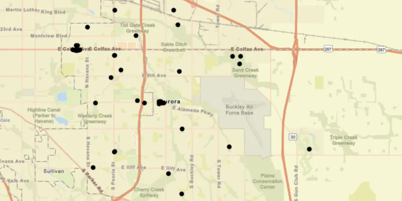
Pan and zoom around the map. View the data loaded from the shapefile.
How it works
- Create a
ShapefileFeatureTablepassing in the URL of a shapefile. - Create a
FeatureLayerusing the shapefile feature table. - Add the layer to the map’s operation layers.
Relevant API
- FeatureLayer
- ShapefileFeatureTable
Tags
Layers, shapefile, shp, vector
Sample code
FeatureLayerShapefileSample.java
/* * Copyright 2018 Esri. * * Licensed under the Apache License, Version 2.0 (the "License"); you may not * use this file except in compliance with the License. You may obtain a copy of * the License at * * http://www.apache.org/licenses/LICENSE-2.0 * * Unless required by applicable law or agreed to in writing, software * distributed under the License is distributed on an "AS IS" BASIS, WITHOUT * WARRANTIES OR CONDITIONS OF ANY KIND, either express or implied. See the * License for the specific language governing permissions and limitations under * the License. */
package com.esri.samples.feature_layer_shapefile;
import java.io.File;
import javafx.application.Application;import javafx.scene.Scene;import javafx.scene.control.Alert;import javafx.scene.layout.StackPane;import javafx.stage.Stage;
import com.esri.arcgisruntime.ArcGISRuntimeEnvironment;import com.esri.arcgisruntime.data.ShapefileFeatureTable;import com.esri.arcgisruntime.layers.FeatureLayer;import com.esri.arcgisruntime.loadable.LoadStatus;import com.esri.arcgisruntime.mapping.ArcGISMap;import com.esri.arcgisruntime.mapping.BasemapStyle;import com.esri.arcgisruntime.mapping.view.MapView;
public class FeatureLayerShapefileSample extends Application {
  private MapView mapView;  private FeatureLayer featureLayer; // keep loadable in scope to avoid garbage collection
  @Override  public void start(Stage stage) {
    try {      // create stack pane and application scene      StackPane stackPane = new StackPane();      Scene scene = new Scene(stackPane);
      // set title, size, and add scene to stage      stage.setTitle("Feature Layer Shapefile Sample");      stage.setWidth(800);      stage.setHeight(700);      stage.setScene(scene);      stage.show();
      // authentication with an API key or named user is required to access basemaps and other location services      String yourAPIKey = System.getProperty("apiKey");      ArcGISRuntimeEnvironment.setApiKey(yourAPIKey);
      // create a map with the streets basemap style      ArcGISMap map = new ArcGISMap(BasemapStyle.ARCGIS_STREETS);
      // create a map view and set the map to it      mapView = new MapView();      mapView.setMap(map);
      // create a shapefile feature table from the local file      File shapefile = new File(System.getProperty("data.dir"), "./samples-data/auroraCO/Public_Art.shp");      ShapefileFeatureTable shapefileFeatureTable = new ShapefileFeatureTable(shapefile.getAbsolutePath());
      // use the shapefile feature table to create a feature layer      featureLayer = new FeatureLayer(shapefileFeatureTable);      featureLayer.addDoneLoadingListener(() -> {        if (featureLayer.getLoadStatus() == LoadStatus.LOADED) {          // zoom to the area containing the layer's features          mapView.setViewpointGeometryAsync(featureLayer.getFullExtent());        } else {          Alert alert = new Alert(Alert.AlertType.ERROR, featureLayer.getLoadError().getMessage());          alert.show();        }      });
      // add the feature layer to the map      map.getOperationalLayers().add(featureLayer);
      // add the map view to the stack pane      stackPane.getChildren().add(mapView);    } catch (Exception e) {      // on any error, display the stack trace.      e.printStackTrace();    }  }
  /**   * Stops and releases all resources used in application.   */  @Override  public void stop() {
    if (mapView != null) {      mapView.dispose();    }  }
  /**   * Opens and runs application.   *   * @param args arguments passed to this application   */  public static void main(String[] args) {
    Application.launch(args);  }
}