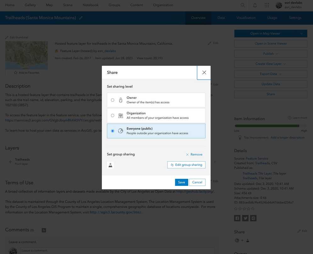
The Share setting for a hosted vector tile layer (item) allows you to manage the sharing level of the item and the corresponding vector tile service. Restricting the sharing level is how you secure both the item in a portal and the underlying data in the data service.
You can use the share setting to:
- Change the discoverability of a hosted layer (item) in a portal.
- Make an item and a data service private or public.
- Give specific groups of users or an organization access to an item and a data service.
- Require data services to be accessed with an access token.
How to set the sharing level
When you create a new data service, the hosted layer (item) and data service sharing level (privacy setting) is set to Owner. The item and data service are only available to you. This setting requires that applications provide a valid access token to authenticate requests to view the item or access the data service.
The steps to change the sharing properties are:
-
Log in to a data management tool with your ArcGIS account:
- ArcGIS.com (ArcGIS Platform or ArcGIS Online)
- ArcGIS Enterprise portal (ArcGIS Enterprise)
- Find the item.
- Use the item page to change the sharing setting.
Types of sharing levels
The following is a list of the sharing levels available for the different types of ArcGIS products:
- Owner (private): Only the owner has access. The hosted layer (item) and data service are private and will not be visible or accessible to others. A valid access token or scoped API key is required. Learn more about scoping items to an API key in API keys.
- Owner (private): Only the owner has access. The hosted layer (item) and data service are private and will not be visible to others who have access to the portal. A valid access token is required.
- Organization: All members of your organization can access the hosted layer (item) and data service. A valid access token is required.
- Group: All members of a group can access the hosted layer (item) and data service. A valid access token is required.
- Everyone (public): Anyone can view the hosted layer (item) and access the data service.
Code examples
You can use data management tools to set the sharing level of a vector tile layer (item) or you can use the ArcGIS REST APIs. The following examples illustrate how to programmatically set the sharing level a hosted vector tile layer (item).
Set sharing to private
Restrict the hosted layer (item) and data service access to the owner only. An access token is required to access the service.
POST https://{host}/sharing/rest/content/users/{organizationId}/items/{itemId}/share HTTP/1.1
Content-Type: application/x-www-form-urlencoded
everyone=false
&org=false
&groups=
&token={access_token}POST https://{host}/sharing/rest/content/users/{organizationId}/items/{itemId}/share HTTP/1.1
Content-Type: application/x-www-form-urlencoded
everyone=false
&org=false
&groups=
&token={access_token}POST https://{host}/{webadaptor}/sharing/rest/content/users/{username}/items/{itemid}/share HTTP/1.1
Content-Type: application/x-www-form-urlencoded
everyone=false
&org=false
&groups=
&token={access_token}Set sharing to group
Restrict the hosted layer (item) and data service access to private or public groups in the organization. An access token is required to access the service.
This sharing level is not available.
POST https://{host}/sharing/rest/content/users/{organizationId}/items/{itemId}/share HTTP/1.1
Content-Type: application/x-www-form-urlencoded
everyone=false
&org=false
&groups={groupId}
&token={access_token}POST https://{host}/{webadaptor}/sharing/rest/content/users/{username}/items/{itemid}/share HTTP/1.1
Content-Type: application/x-www-form-urlencoded
everyone=false
&org=false
&groups={groupId}
&token={access_token}Set sharing to organization
Restrict the hosted layer (item) and data service access to members of the organization. An access token is required to access the service.
This sharing level is not available.
POST https://{host}/sharing/rest/content/users/{organizationId}/items/{itemId}/share HTTP/1.1
Content-Type: application/x-www-form-urlencoded
everyone=false
&org=true
&groups=
&token={access_token}POST https://{host}/{webadaptor}/sharing/rest/content/users/{username}/items/{itemid}/share HTTP/1.1
Content-Type: application/x-www-form-urlencoded
everyone=false
&org=true
&groups=
&token={access_token}Set sharing to public
Allow unrestricted access to the hosted layer (item) and data service. An access token is not required to access the service.
This sharing level is not available.
POST https://{host}/sharing/rest/content/users/{organizationId}/items/{itemId}/share HTTP/1.1
Content-Type: application/x-www-form-urlencoded
everyone=true
&token={access_token}POST https://{host}/{webadaptor}/sharing/rest/content/users/{username}/items/{itemid}/share HTTP/1.1
Content-Type: application/x-www-form-urlencoded
everyone=true
&token={access_token}Tutorials
Import data to create a feature layer
Use data management tools to import files and create a feature layer in a feature service.
Define a new feature layer
Use data management tools to define and create a new empty feature layer in a feature service.
Manage a feature layer
Use a hosted feature layer item to set the properties and settings of a feature layer in a feature service.
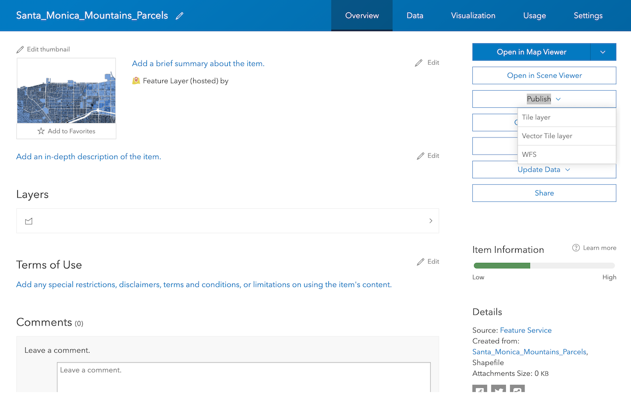
Create a vector tile service
Use data management tools to create a new vector tile service from a feature service.
Create a map tile service
Use ArcGIS Online or scripting APIs to publish a map tile service.
Workflows
Create a feature service for an app
Learn how to import parcel data, create and style a feature layer, and then access the features in an app.
Create a feature layer view for an editor app
Learn how to import parcel data, create and style a feature layer view, and then access the features in an editing app.
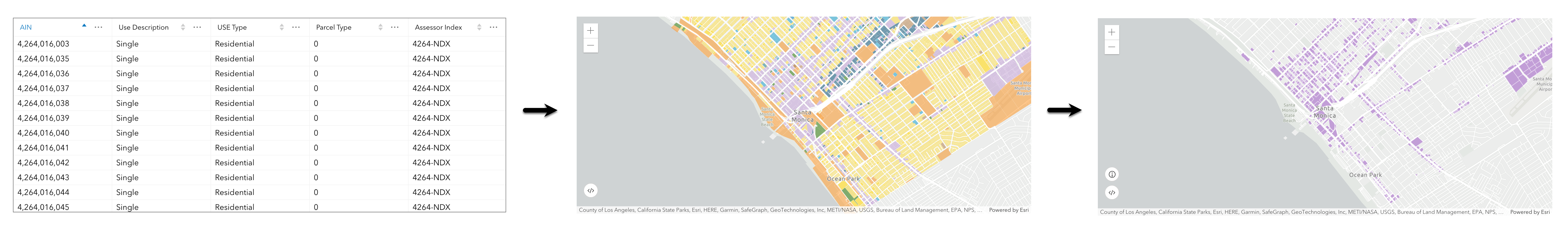
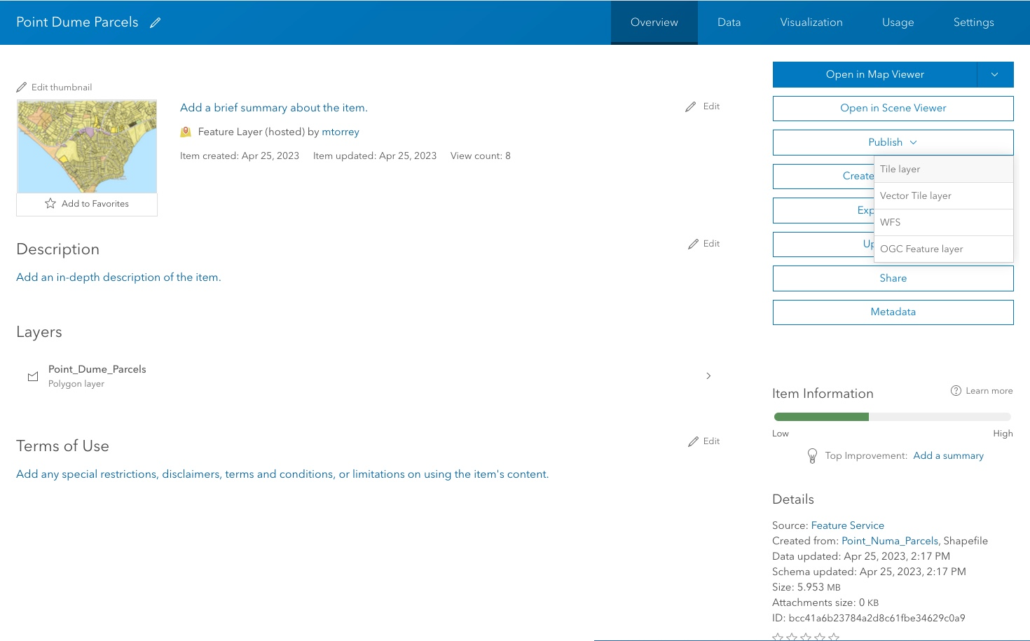
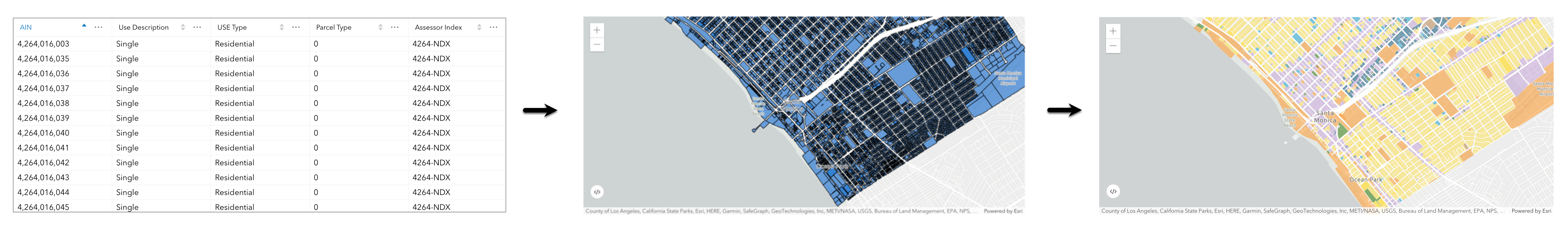
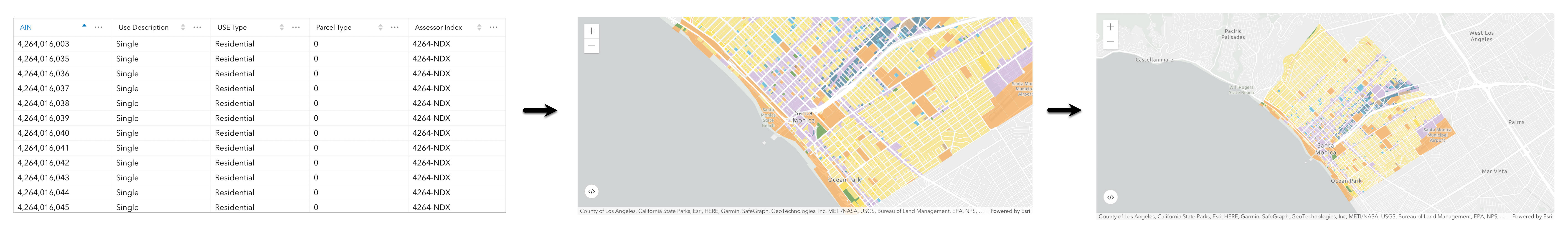
Create a vector tile service for an app
Learn how to import parcel data, style a feature layer, and then create a vector tile service for an app.
Create a map tile service for an app
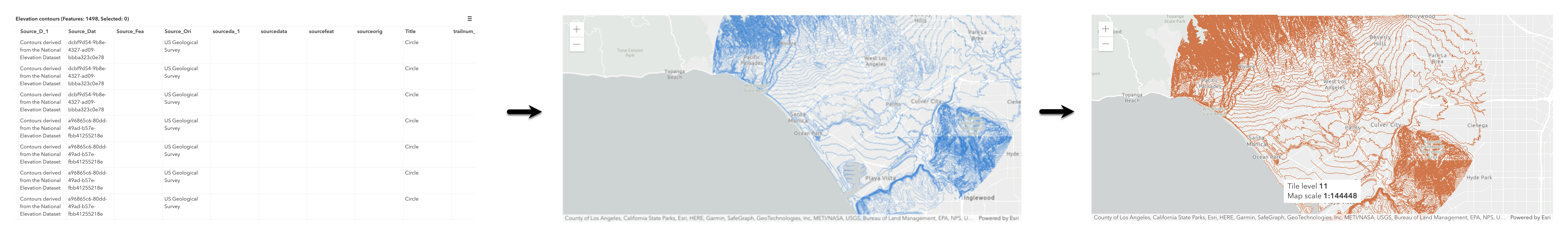
Learn how to import contour data, style a feature layer, and create a map tile service for an app.
Services
Feature service
Add, update, delete, and query feature data.
Vector tile service
Store and access vector tile data.
Map tile service
Store and access map tile data.
API support
Use Client APIs to create, manage, and access data services. The table below outlines the level of support for each API.
- 1. Use portal class and direct REST API requests
- 2. Access via ArcGIS REST JS
- 3. Requires manually setting styles for renderers