What is geometry analysis?
Geometry analysis is the process of using a client-side API to perform one or more operations on a point, polyline, or polygon to solve a geometric problem. You can use geometry operations to determine the spatial relationship between geometries, perform calculations such as creating a buffer, measure distance and area, and project geometries. The operation you use depends on the type of problem you are trying to solve.
Types of geometry operations
Geometry operations are grouped based on the type of calculation they perform and value returned.
To learn more, click on the categories below:
| Category | Description | Operations | Result | Example |
|---|---|---|---|---|
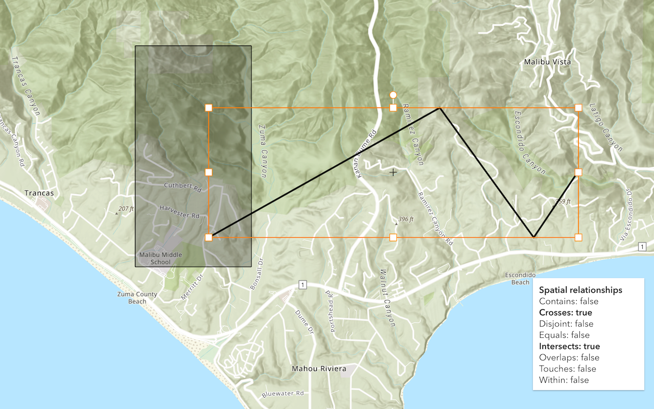
| Spatial relationship | Determine the relationship between geometries. | contains, disjoint, intersects, overlaps, touches, within | boolean |  Determine the intersection of two geometries with intersects. |
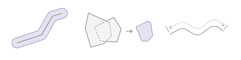
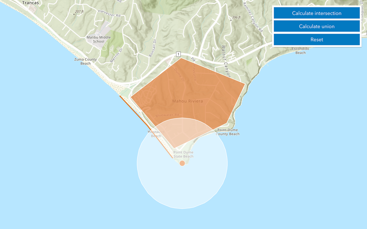
| Geometric calculation | Calculate and create new geometries from an existing geometries. | boundary, buffer, clip, convex, cut, densify, difference, extent, generalize, intersect, nearest, nearest, offset, relate, reshape, simplify, trim, union | geometry |  Buffer a line at 10 meters with buffer. |
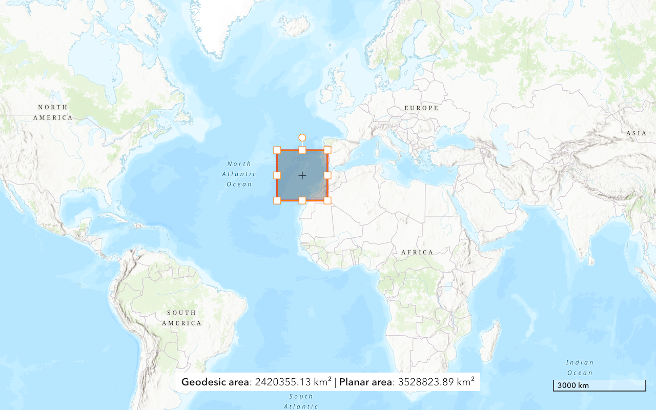
| Length and area | Measure length, area, or distance. | area, distance, length | number |  Calculate the geodesic length of a line with length. |
| Projection | Project to a new spatial reference. | project | geometry |  Project a geometry to a new spatial reference with project. |
Tutorials
Find spatial relationships
Determine the spatial relationship between two geometries.
Calculate geometries
Perform buffer, intersect, union, and other geometric operations.
Find length and area
Get the length of a line and the area of a polygon.
Display projected geometries
Project geometries to a new spatial reference in a map.
API support
| Spatial relationship | Geometric calculation | Length and area | Projection | |
|---|---|---|---|---|
| ArcGIS Maps SDK for JavaScript | ||||
| ArcGIS Maps SDK for .NET | ||||
| ArcGIS Maps SDK for Kotlin | ||||
| ArcGIS Maps SDK for Swift | ||||
| ArcGIS Maps SDK for Java | ||||
| ArcGIS Maps SDK for Qt | ||||
| ArcGIS API for Python | ||||
| ArcGIS REST JS | ||||
| Esri Leaflet | ||||
| MapBox GL JS | ||||
| OpenLayers |