Learn how to use developer tools, APIs, and SDKs to access services and build applications.
Geometry analysis
Learn how to use the ArcGIS Maps SDKs to perform viewshed, line of sight and measurement 3D visual analysis. Learn more in Introduction to geometry analysis.

Find spatial relationships


Feature analysis
Data preparation
Learn how use tools and ArcGIS APIs to find, prepare, and enrich data for use in spatial analysis. Learn more in How to perform feature analysis.

Find data sources
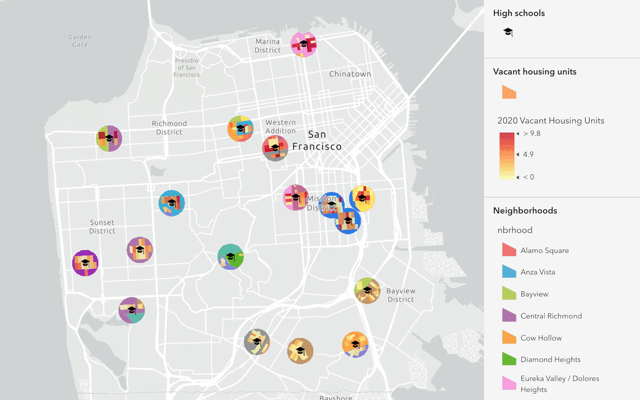
Discover data in ArcGIS that you can use for feature analysis.


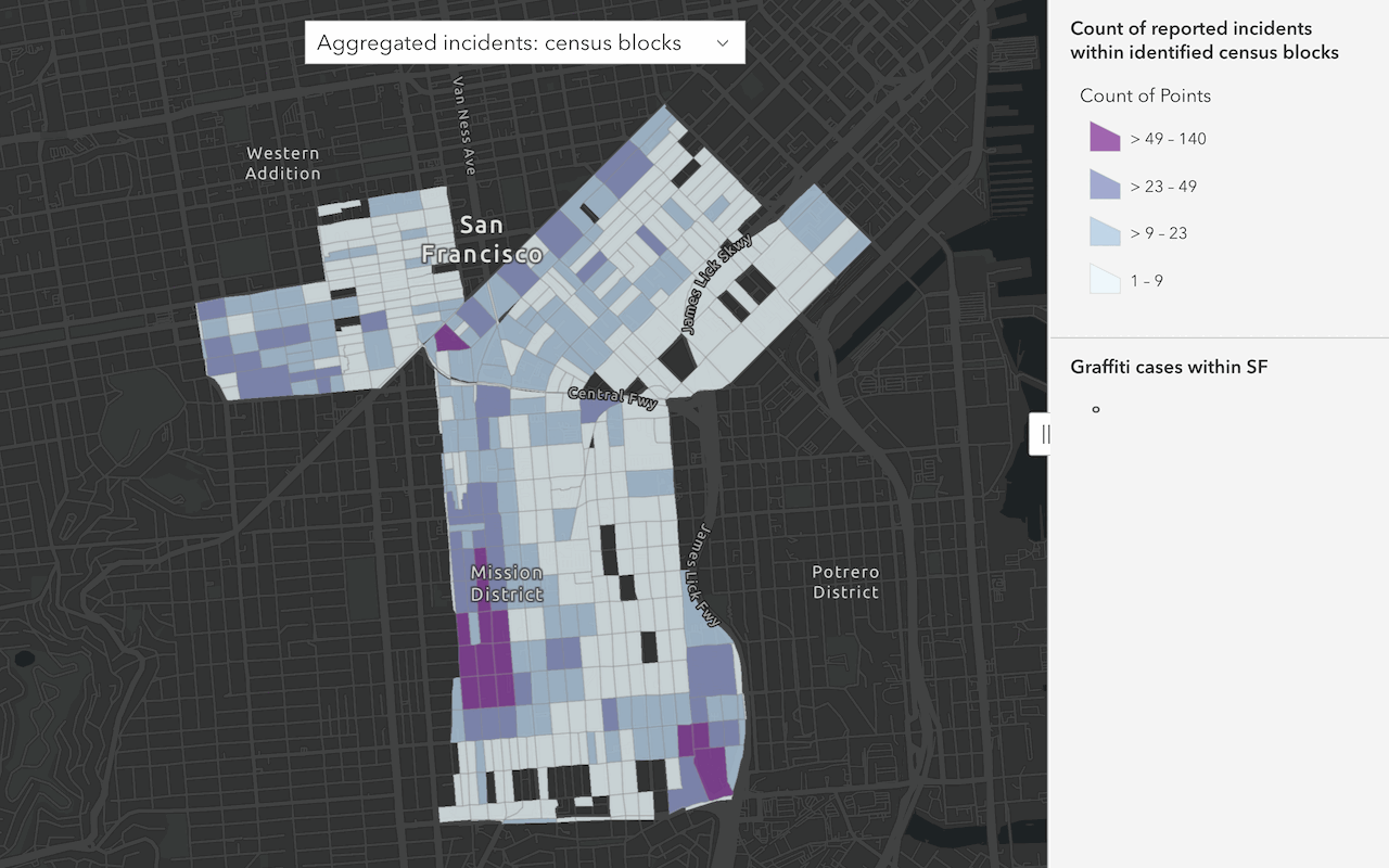
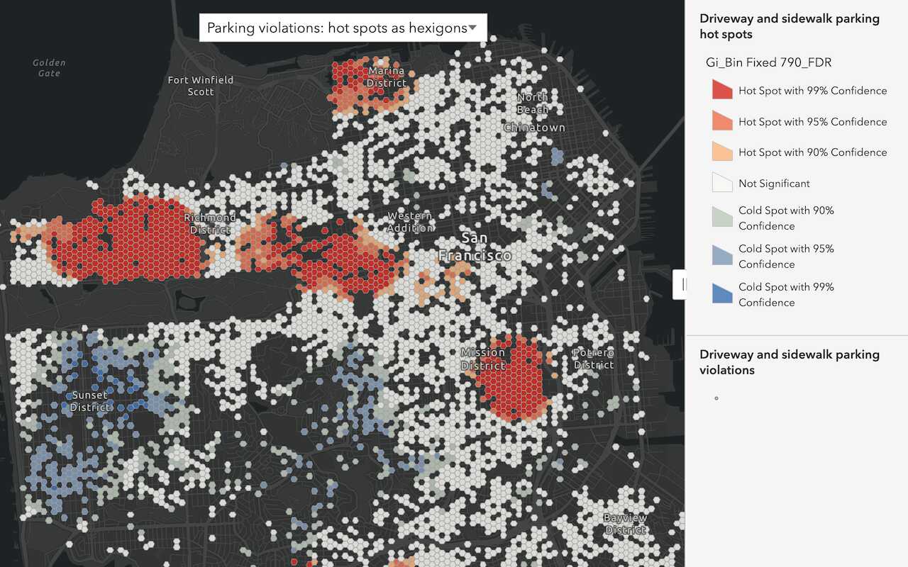
Perform feature analysis
Learn how to use tools and ArcGIS APIs to perform server-side analysis with the spatial analysis service. Learn more in How to perform feature analysis.
Find and extract data
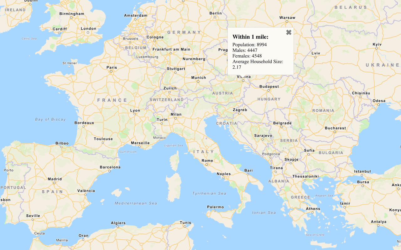
Find data with attribute and spatial queries using find analysis operations.


Raster analysis
Learn how to use tools and ArcGIS APIs to perform server-side analysis with the raster analysis service. Learn more in Introduction to raster analysis.

Perform an analysis using raster operations

3D visual analysis
Learn how to use the ArcGIS Maps SDKs to perform viewshed, line of sight, and 3D measurement visual analysis. Learn more in How to perform 3D visual analysis.

Display a viewshed
Perform and display a viewshed analysis in a 3D scene.

