Get the draw status of your map view or scene view to know when all layers in the map or scene have finished drawing.
Use case
You may want to display a loading indicator while layers are loading, which could then be removed on DrawStatus.COMPLETED.
How to use the sample
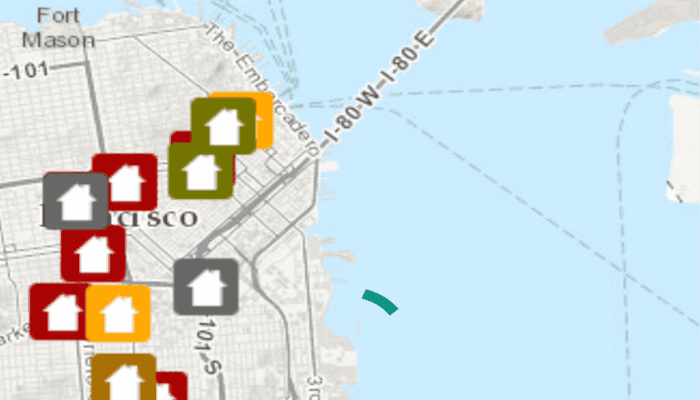
Pan and zoom around the map. Observe how the status bar changes from a loading animation to invisible, indicating that drawing has completed.
How it works
- Create a
MapViewand add aDrawStatusChangedListenerto it. - Use
getDrawStatuson theDrawStatusChangedEventto determine draw status.
Relevant API
- ArcGISMap
- DrawStatus
- DrawStatusChangedEvent
- DrawStatusChangedListener
- MapView
Tags
draw, loading, map, render
Sample Code
MainActivity.java
/* Copyright 2016 Esri
*
* Licensed under the Apache License, Version 2.0 (the "License");
* you may not use this file except in compliance with the License.
* You may obtain a copy of the License at
*
* http://www.apache.org/licenses/LICENSE-2.0
*
* Unless required by applicable law or agreed to in writing, software
* distributed under the License is distributed on an "AS IS" BASIS,
* WITHOUT WARRANTIES OR CONDITIONS OF ANY KIND, either express or implied.
* See the License for the specific language governing permissions and
* limitations under the License.
*
*/
package com.esri.arcgisruntime.sample.displaydrawingstatus;
import android.os.Bundle;
import android.view.View;
import android.widget.ProgressBar;
import androidx.appcompat.app.AppCompatActivity;
import com.esri.arcgisruntime.ArcGISRuntimeEnvironment;
import com.esri.arcgisruntime.data.ServiceFeatureTable;
import com.esri.arcgisruntime.geometry.Envelope;
import com.esri.arcgisruntime.geometry.SpatialReferences;
import com.esri.arcgisruntime.layers.FeatureLayer;
import com.esri.arcgisruntime.mapping.ArcGISMap;
import com.esri.arcgisruntime.mapping.BasemapStyle;
import com.esri.arcgisruntime.mapping.Viewpoint;
import com.esri.arcgisruntime.mapping.view.DrawStatus;
import com.esri.arcgisruntime.mapping.view.MapView;
public class MainActivity extends AppCompatActivity {
private MapView mMapView;
@Override
protected void onCreate(Bundle savedInstanceState) {
super.onCreate(savedInstanceState);
setContentView(R.layout.activity_main);
// authentication with an API key or named user is required to access basemaps and other
// location services
ArcGISRuntimeEnvironment.setApiKey(BuildConfig.API_KEY);
final ProgressBar progressBar = findViewById(R.id.progressBar);
// inflate MapView from layout
mMapView = findViewById(R.id.mapView);
// create a map with the Basemap Style topographic
ArcGISMap map = new ArcGISMap(BasemapStyle.ARCGIS_TOPOGRAPHIC);
// create a feature table from a service url
ServiceFeatureTable svcFeaturetable = new ServiceFeatureTable(getString(R.string.service_feature_table_url));
// create a feature layer
FeatureLayer featureLayer = new FeatureLayer(svcFeaturetable);
// add feature layer to map
map.getOperationalLayers().add(featureLayer);
// set the map to be displayed in this view
mMapView.setMap(map);
// create an envelope
Envelope targetExtent = new Envelope(-13639984.0, 4537387.0, -13606734.0, 4558866.0,
SpatialReferences.getWebMercator());
// use envelope to set initial viewpoint
Viewpoint initViewpoint = new Viewpoint(targetExtent);
// set the initial viewpoint in the map
mMapView.setViewpoint(initViewpoint);
//[DocRef: Name=Monitor map drawing, Category=Work with maps, Topic=Display a map]
mMapView.addDrawStatusChangedListener(drawStatusChangedEvent -> {
if (drawStatusChangedEvent.getDrawStatus() == DrawStatus.IN_PROGRESS) {
progressBar.setVisibility(View.VISIBLE);
} else if (drawStatusChangedEvent.getDrawStatus() == DrawStatus.COMPLETED) {
progressBar.setVisibility(View.INVISIBLE);
}
});
//[DocRef: END]
}
@Override
protected void onPause() {
super.onPause();
mMapView.pause();
}
@Override
protected void onResume() {
super.onResume();
mMapView.resume();
}
@Override
protected void onDestroy() {
super.onDestroy();
mMapView.dispose();
}
}