View a point scene layer from a scene service.
Use case
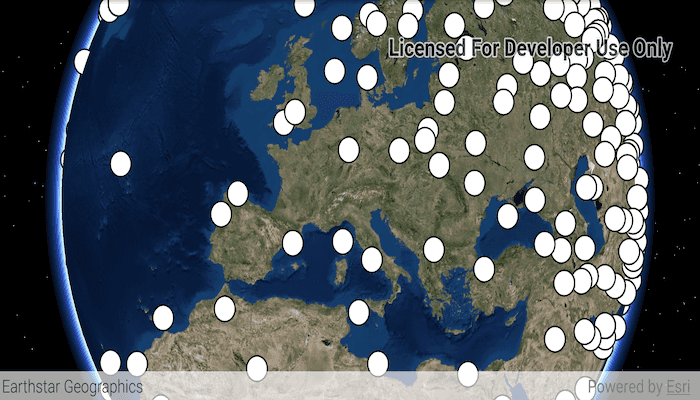
Point scene layers can efficiently display large amounts of point features. While point cloud layers can only display simple symbols, point scene layers can display any type of billboard symbol or even 3D models, as long as the location of the symbol can be described by a point. Points are cached and automatically thinned when zoomed out to improve performance.
How to use the sample
Pan around the scene and zoom in. Notice how many thousands of additional features appear at each successive zoom scale.
How it works
- Create a scene.
- Create an
ArcGISSceneLayerwith the URL to a point scene layer service. - Add the layer to the scene's operational layers collection.
Relevant API
- ArcGISSceneLayer
About the data
This dataset contains more than 40,000 points representing world airports. Points are retrieved on demand by the scene layer as the user navigates the scene.
Additional information
Point scene layers can also be retrieved from scene layer packages (.slpk) and mobile scene packages (.mspk).
Tags
3D, layers, point scene layer
Sample Code
/*
* Copyright 2019 Esri
*
* Licensed under the Apache License, Version 2.0 (the "License");
* you may not use this file except in compliance with the License.
* You may obtain a copy of the License at
*
* http://www.apache.org/licenses/LICENSE-2.0
*
* Unless required by applicable law or agreed to in writing, software
* distributed under the License is distributed on an "AS IS" BASIS,
* WITHOUT WARRANTIES OR CONDITIONS OF ANY KIND, either express or implied.
* See the License for the specific language governing permissions and
* limitations under the License.
*/
package com.esri.arcgisruntime.sample.addpointscenelayer;
import android.os.Bundle;
import androidx.appcompat.app.AppCompatActivity;
import com.esri.arcgisruntime.ArcGISRuntimeEnvironment;
import com.esri.arcgisruntime.layers.ArcGISSceneLayer;
import com.esri.arcgisruntime.mapping.ArcGISScene;
import com.esri.arcgisruntime.mapping.ArcGISTiledElevationSource;
import com.esri.arcgisruntime.mapping.Basemap;
import com.esri.arcgisruntime.mapping.BasemapStyle;
import com.esri.arcgisruntime.mapping.Surface;
import com.esri.arcgisruntime.mapping.view.SceneView;
public class MainActivity extends AppCompatActivity {
private SceneView mSceneView;
@Override
protected void onCreate(Bundle savedInstanceState) {
super.onCreate(savedInstanceState);
setContentView(R.layout.activity_main);
// authentication with an API key or named user is required to access basemaps and other
// location services
ArcGISRuntimeEnvironment.setApiKey(BuildConfig.API_KEY);
mSceneView = findViewById(R.id.sceneView);
// create a scene with a basemap and add it to the scene view
ArcGISScene scene = new ArcGISScene(BasemapStyle.ARCGIS_IMAGERY);
mSceneView.setScene(scene);
// set the base surface with world elevation
Surface surface = new Surface();
surface.getElevationSources().add(new ArcGISTiledElevationSource(getString(R.string.elevation_image_service)));
scene.setBaseSurface(surface);
// add a point scene layer with points at world airport locations
ArcGISSceneLayer pointSceneLayer = new ArcGISSceneLayer(getString(R.string.world_airports_scene_layer));
scene.getOperationalLayers().add(pointSceneLayer);
}
@Override
protected void onPause() {
mSceneView.pause();
super.onPause();
}
@Override
protected void onResume() {
super.onResume();
mSceneView.resume();
}
@Override
protected void onDestroy() {
mSceneView.dispose();
super.onDestroy();
}
}